Places to go and things to see by Gypsy Bev

Archive for the ‘Desert Highway’ Category

Get Ready to Rope

Bev Hachita 001
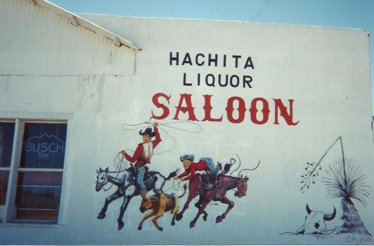
A short true adventure

Cowboys began roping as part of ranch work to brand or medicate their calves. It became a contest to see which cowboy could do it the quickest. Their goal was to throw a lasso around a calf’s head, jump off their horse, tie three of the calf’s legs together, and finish the trick as fast as possible. This led to roping contests at rodeos and fairs.

   Recently, a new type of roping sprang up. My first experience with this happened in a small town of about thirty people called Hachita, New Mexico. The only disturbance in this small town might be a dust devil coming down the street or a Border Patrol helicopter flying overhead.

   One week in 1996, they decided to try this new kind of roping…a chicken roping. Yes, chickens, with feathers flying and beaks crowing. One roper told those watching, “If it has legs, it can be roped.”

   Bev Chicken Roping 001   
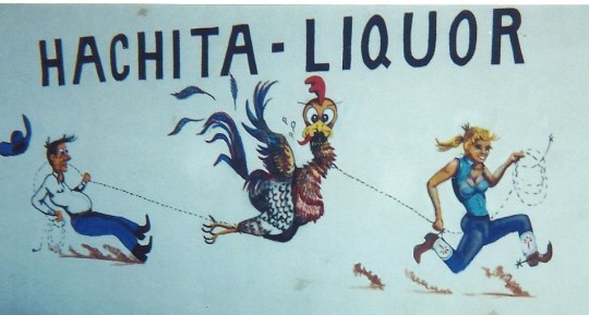
Now this kind of roping would not be done from a horse and would require a different kind of lasso. Just a heavy piece of string is used, so they don’t choke the chicken.

   Just like in the world of cattle, the chickens they roped all had names. The meaner the animal, the meaner its name. Names like Jalapeno Joe, Cholulu Chuy or Red Hot Flame were typical.

   A large crowd of over fifty people gathered to witness the chicken roping. The chicken would be let out of a box and the cowboy would be timed to see how fast he could rope it. The one who roped it the fastest won a Chicken Roping Belt Buckle with a turquoise stone found in the Little Hatchet Mountains nearby.

   Small towns often have fun in unusual ways. A mural of the Chicken Roping was painted by a traveling artist on the outside of the bar there. Inside on the wall were pictures of the winners. It soon became an annual event with even larger crowds.

   And afterward? What else, but a good old-fashioned chicken BBQ.

Hachita Liquor Saloon was no longer in operation on my last trip west. The paintings on the building were done by an old friend, C.M. Scott, a cowboy artist.

Advertisement

Casinos and Ancient Petroglyphs Make an Unusual Combination in Laughlin, Nevada

Colorado Belle CasinoMountains on the river…a spot to relax! On the banks of the beautiful Colorado River at the very southern tip of Nevada sits a lovely little town called Laughlin. Casinos are the main business in town, so many visitors try their luck at the slots or gaming tables. The Colorado Belle Casino, a 600′ replica of a 19th century Mississippi paddle-wheel riverboat, is certain to catch everyone’s attention.  However, gambling isn’t necessary to enjoy a stay in Laughlin.

When Don Laughlin, for whom the town is named, purchased the land in 1964, he opened a small casino, Riverside Resort, which had just twelve slot machines and two gaming tables. On the other side of the river in Arizona, the town of Bullhead City ran shuttle boats to the casinos as the number of them grew in Laughlin. Finally, in 1987 Don Laughlin himself provided the $3.5 million needed to build a bridge to span the river between the towns. Then business really picked up. Today, this little town is a popular gaming destination and family vacation center since it is located on the banks of the river with desert and mountains in view.  The casino strip isn’t very long with ten major casinos, but it has all the glitter of Las Vegas. The actual town of Laughlin is situated on the other side of the mountains, away from the casino activity.

Ramada ExpressA stay at the Ramada Express, now the Tropicana Express, was always a pleasant experience. Express being its name, trains were its theme, having a pool shaped like a locomotive – with a spa in the wheel, and a train that ran around the entire hotel with several stops for less walking. Their patriotic museum honored all veterans from WWII through Desert Storm and regularly showed a four, large screen tribute, “On the Wings of Eagles.”

A stop at the little Colorado River Museum displayed information about the growth of the surrounding area. An evening ride down the Colorado River on the Celebration riverboat became a shimmering experience as the lights of Laughlin casinos reflected off the water. The captain was full of information about the river’s edge and talked a hundred miles an hour.  If riverboats are not to your liking, enjoy the river’s edge on a beautiful boardwalk that is a relaxing stroll day and night.

Debbie Reynolds at RiversideNo stay in a casino town would be complete without heading to at least one show. Debbie Reynolds, a star I admired as a child, was performing at Don Laughlin’s Riverside so decided to see if I could get a ticket.  As luck would have it, they had one seat available, and it was in the front row! Afterwards, I went backstage and got an autograph and picture with Ms Reynolds.

But the Laughlin area was more than casinos.  Accessed by a well maintained dirt road, nearby Spirit Mountain took one on a walk into the past. Petroglyphs on the mountain walls and rocks gave a glimpse into the Indian heritage that ePetroglyphs near Laughlinxisted in this area many years ago.  This remote granite mountain gave one a sense of tranquility, perhaps because the ancestors of the Indians reside there to this day.

Only seven miles west of Laughlin in Christmas Tree Pass, visitors will find over 700 petroglyphs. Estimates on the original time of the glyphs have been placed from 1100-1500 AD at a time when the Mojave Indians roamed this area. While their meaning is not positively known, one possibility is that they tell the Mojave story of how the Colorado River came into existence. This is one of those places where a bottle of water and a sunhat are recommended as temperatures in the summer soar to 120 degrees.

Christmas Tree PassA long desert-mountain walk in the Indian petroglyphs concluded this week’s stay in Laughlin.  Never had I seen so many glyphs in one place, especially at the entrance of the Christmas Tree Pass. Farther up the mountainside, you could see what appeared to be the outline of an old Indian village.  Return trip expected for further exploration!

Laughlin, Nevada can be reached from I-40 taking Exit 141 to 95 North, the Needles Highway, for 23 miles. Turn right onto Bruce Woodbury Drive and after about 3 miles turn right on Casino Drive. Visitors will be greeted by Riverside Resort and the Casino Strip.

Biosphere 2 – Earth Under Glass

Biosphere 2Want to see a rainforest and ocean in the desert? Time to  head to the barren desert hills of Arizona, or should I say mountains! Located at the foot of the Santa Catalina Mountains in Oracle, Arizona, Biosphere 2‘s striking white outline and unusually shaped, futuristic buildings catch the eye. Recently named one of the top fifty “Wonders of the World”, which must be seen, this is an informative stop.

Biosphere is defined as: the regions of the Earth’s crust and atmosphere occupied by living matter. Therefore, it seemed fitting to name this man-made earth model Biosphere 2. Here is the world’s largest glass covered ecological laboratory located on forty acres. Back in 1984, Edward Bass, an environmentalist, contributed $150 million to build John Allen’s invention – Biosphere 2.

Originally built to experiment with self-contained settlement, those first eight ecologists, four men and four women,  signed up for a two year term, then sealed themselves away.  They began raising their own food and recycling air and water. Their goal was to be able to sustain all their needs from the five different ecological regions that were located inside the domes. These early designers were interested in space colonization and were looking for a way to build a similar system on Mars or perhaps the Moon.

The experiment, however, basically failed after almost two years due to the build up of noxious gases, and lack of oxygen.  While some of the four thousand species survived,  water and crops failed. However, much was learned scientifically as well as socially where disagreements caused lack of co-operation.  Columbia University operated it up until just recently, but today it is maintained and used for experimentation by the University of Arizona.

Biosphere 2 RainforestNot only is it an experiment station, but also a unique spot where visitors can view, on an inside tour, five different ecosystems: rainforest, grasslands,  desert, wetlands and ocean floor.  The rainforest is the largest and tallest biome represented.  It contains a number of different habitats, including a lowland forest, a flood plain, and a cloud forest on top of a sandstone mountain.

Savanna Grasslands is naturally dominated by various types of grasses, but there is a quartzite slope in the area where the stream waterfall is located. The Thornscrub section is the wilderness area. Most of the plants in this region are from the Sonoran area. Vegetation consists mainly of short trees and shrubs with many of them being thorny.

Biosphere 2 DesertThe desert biome has over 125 species of plants and was originally designed to replicate a coastal fog desert such as those found along the western coasts of Baja, California.  This allows the Biosphere 2 desert to co-exist with the other, more moist biomes.

The Marsh biome begins with a fresh water lake with a transitional marsh leading to the Mangrove wetlands.  Here over five hundred large mangrove trees dominate the wetlands, which is colonized by many marsh creatures such as crawfish, snails, sponges, and shrimp.

Biosphere 2 OceanThe ocean biome, designed to simulate a Caribbean reef, contains a coral reef and over one million gallons of salt water. A forty foot cliff overlooks the tropical ocean where waves, temperature and chemical balance are all carefully monitored and controlled by innovative technology. This allows scientists to conduct groundbreaking research. But the ocean biome is very efficient at recycling nutrients, so mainly mechanical means will be used in the future to attempt to control the environment here.

Today their largest project is the Landscape Evolution Observatory where they     are exploring the secrets of earth’s landscape and how it changes due to climate and water movement, as well as modifications through biological systems. Edward Bass continues to be a major supporter and last year donated another $20 million to support operations and research. This is the premiere place for learning about Earth and its place in the Universe…now and in the future. Biosphere 2 is where science lives.

Getting there depends on where you are beginning! If you are in Phoenix, find your way to Biosphere 2 off I-35 exit 185. Continue East of 187 toward Florence where you will turn right or south on Arizona 79.  Turn left on Arizona 77 until you arrive at Oriocle Junction where you turn left on Biosphere Road.  If you are in Tucson, take Arizona 77 north about 24 miles.

An “Old Soul” Explores Beautiful Red Rock Sedona

Sedona!  Just the word brings to mind beautiful red rock formations surrounded by a high level of spiritual awareness. For those interested in the metaphysical, Sedona, Arizona is the perfect place to explore. This New Age capital of America is nestled in the mouth of beautiful Oak Creek Canyon.

Spectacular views draw people from all over the world to this “red rock country” where they experience the majesty and peace of the natural wonders appearing around every corner of the road. The sandstone formations glow red and even orange, especially at sunrise and sunset here in Sedona.

Bell Rock captures the eye and the heart as it emits an energy that can’t be explained. This is just one of several energy vortexes in and around Sedona. For those not familiar with vortexes, they are created from a spiraling motion around a rotating center, such as water going down the drain or a dust devil in the desert. But here in Sedona, the energy vortex is created by spiraling spiritual energy making it a great place for prayer, meditation and healing. There is no real explanation, it must be experienced…and that is just what I did.

While walking around Bell Rock, which is a two hour trip – at least for me- instead of getting tired, my feet moved faster at the end than they did at the beginning. Just had to keep a piece of the red rock with me -it fell at my feet- and still have it under my car seat today.  Maybe that is how I keep going and going on my Gypsy Road Trips… like the energizer bunny.

As you can imagine, Hollywood also noticed the beauty of this area and over sixty Hollywood productions, mostly Westerns,  have been filmed here. John Ford’s production of Stagecoach rolled into Sedona in 1938 beginning the bonanza of films and stars that would become familiar to the red rock area. Classic greats such as John Wayne, Elvis, Rock Hudson, and Art Carney have enjoyed hanging out in the red rocks while starring in scenes shot here.

Just a short drive south of Sedona,  the Chapel of the Holy Cross provides a spiritual uplift to the trip as well as another gorgeous view of the surrounding area. Built back in 1956,  the chapel rises 250′ out of the red rock and its design was inspired by the Empire State Building. The front of the chapel faces sunset thus illuminating the interior naturally with sunlight.

Cathedral Rock, the landmark of Sedona, provided another relaxing place to walk, but personally didn’t feel the energy surge experienced at Bell Rock. Trails lead to the “saddle points” or gaps in the beautiful red rock configuration. While the trail is exceptionally steep, a breeze is nearly always present due to the air movement through the saddle points.

Stayed on the edge of town in the red rocks at a rustic little place called quite naturally, Red Rock Lodge. Here the owner gave me a tour of her beautiful flower garden and explained a little about the flowers of the region. Arizona Poppy, Indian Paintbrush, and Desert Primrose add beauty and a pleasing aroma to the surrounding mountains. Rates were affordable at this small comfortable lodge while the views were extraordinary.

Couldn’t leave town without getting a psychic reading at a charming place with beads hanging from the doorway, a crystal ball on the table, and cards spread to tell me that I was indeed an “old soul” who had been around for a long, long time. This old-fashioned metaphysical community is the place to immerse yourself in Reiki, acupuncture, aromatherapy, UFOs,  and much more.

Sedona has grown since my last visit, but even today there are few streetlights, no buildings reach over two stories high, and every structure must match the primary colors of the rocks. No Golden Arches for McDonald’s here – arches in Sedona are turquoise! These awe-inspiring red rocks formed in beautiful buttes, spires and canyons capture your attention; however, there is a serenity here among the beauties of nature that draws one back again and again.

The Sedona area is located off I-17 at exit 298. Proceed on Highway 179 which after about 14 miles  will lead you to the Y in the road from which you will be guided to various area attractions.  Grand Canyon is a couple hours north of Sedona, while the intriguing Sonoran Desert lies south. Not many can resist the charm, so plan to spend a day or two in this breathtaking area.

White Waves of Desert Sand

White Sand as far as the eye can see!  Beautiful waves and dunes of sand cover 275 square miles of land near Alamogordo, New Mexico. Approaching from Cloudcroft, a mountain village with an altitude of about 10,000 feet, the view of White Sands in the distance with a mountain background was spectacular.

Surrounded by military installations, White Sands National Monument, the largest gypsum sand dune field in the world, was an unusual environment to explore. White Sands Missile Range surrounds the place and was where the first atomic bomb was detonated. Holloman Air Force Base was just east of here and a few miles farther on you will find a landing site for space shuttles.A couple times a week, traffic will be stopped for a few hours as test missiles are being shot overhead. This is truly an interesting place for those interested in space travel, as in nearby Alamogordo you can find the International Space Hall of Fame.

Reaching White Sands National Monument, first stop is the Visitors Center, which was a 1938 WPA project constructed of adobe in Spanish pueblo style. Adobe bricks are usually sixteen inches long, ten inches wide, and four inches thick so this is a solid building which has stood the test of time. Two men would work all day to form about a hundred bricks. Set in a landscape of native plants, this is truly a Welcome Center to the area.

Outside it is time to explore. Don’t forget your water bottle because if the sun shines, this can be a very hot desert scene.  This is an especially unusual scene as gypsum is seldom found in the form of sand. But located here in a basin, the white gypsum  is captured, because there is no outlet to the sea. The dunes are constantly changing shapes as tiny grains of sand are blown into ripples across the vast white desert. This area, with shelters inspired by Frank Lloyd Wright, makes a great place for a rest, or to watch the antics of others on the dunes.

You will probably want to take a leisurely drive through the White Sands area, just to get the feel of things. There was a paved road for a couple of miles, and then you were on your own, to decide if you wanted to venture off driving on the gypsum highway through the hills of sand.

There were also a couple of walking trails – one mile-long path through the sand and another an actual boardwalk. Climbing to the top of one of these large dunes is a challenge and fun.  But this is one place where coming down is the hard part! Children have the right idea here as they use saucers or cardboard and slide down the dunes, resembling what a youngster would do with a sled in the snow.

Animals lived in this ocean of white sand in an evolved state as they became part of their environment and were thus camouflaged against the white desert scene. Salamanders, spiders and the Bleached Earless Lizard were white…just like the sand.

Drive, hike, walk the boardwalk, or go sledding!  So many options! But definitely an unusual place to enjoy the beauty that nature provides, including beautiful sunsets.

White Sands National Monument is in southern New Mexico along U.S. Highway 70, which can be reached off I-25 from Las Cruces or off U.S. Highway 54 from Alamogordo. Personally think the approach over the Sacramento Mountains on U.S. Highway 82 gives a great overview. Remember the roads may be closed at times for missile testing with a possible wait of several hours.

Under the Arches in Utah

Arches National Park is unique at every turn.  No matter how many times you drive or walk through this giant rock collection, you usually notice something different. Located near Moab, in Southeastern Utah, this beautiful red rock country is overflowing with unusual rock formations. This is called the High Desert as it is located between 4,000 and 5,600 feet above sea level and receives very little precipitation.

There are 36 miles of paved road going through Arches National Park, and you can see many of the formations at a distance.  But there seems to be a desire within to take a hike, and actually touch some of these famous landmarks. Over the years many arches have collapsed due to erosion of wind and water, but there is still a plentiful feast for your eyes here.

Delicate Arch was used in 1996 as a symbol in Utah’s centennial celebration and is the park’s most famous feature.  While it is a beautiful tribute to the National Park, it is not easily accessible. The opening close up view is spectacular, but you can see from the arrow in this photo how high and far it actually is located from the main road. Spring and Fall are definitely the coolest times to take the hike for an up close and personal view of Delicate Arch. You really can’t appreciate its beauty from afar.

The Windows is another popular photo spot.  Here you can see how vast the opening really is when compared to the size of the visitors.  At a double arch in The Windows area, filming of the beginning of  “Indiana Jones and the Last Crusade” took place back in 1988.

With all this rock, it might seem animals would be few and far between. However, there are many nocturnal creatures living in this desert region, including many different varieties of birds, mammals, reptiles and amphibians. Perhaps there are some snakes and rats left over from Indiana Jones!  Water is their biggest problem, and while the Colorado River runs on the park’s southern boundary, it is too far away for most of these creatures.  So they have developed various ways to adapt.

This group of rocks got its name, Garden of Eden, because early park visitors let their imaginations loose and  thought the rocks resembled Adam and Eve, holding the tempting apple.  There is even a small ten foot Serpentine Arch here to complete the Garden of Eden scenario.  This Estrada sandstone gives a special color to the area.  The view frequently changes as the sun moves in the sky casting shadows and glows in different directions.

With over 2000  natural sandstone arches and unusual rock formations, Arches National Park  gives you a new appreciation of the beauties of nature.  You’ll find nothing man-made here.   “Only God can make a tree”…or a beautiful rock formation!

Lonesome Town Near Mexican Border

Just by accident, travelers might find the little town of Hachita, New Mexico.  As you travel through the Southern part of the state, Hachita is a small town not far from the Mexican border and located in the Little Hatchet Mountains.

This is one of the few towns I have visited where all of the streets are still unpaved. During my first visit to Hachita, the town consisted of a bar, store, and post office along with about a hundred people in residence. The post office is located in the center of town and you can see the dirt road to its front door step, but the American flag is always flying. Another interesting event in years past was the Chicken Roping.  This town was filled with cowboys and Cattle Roping was a year long event there.  One year, the owner of the local bar thought that chicken roping would be an added attraction.  This was a real event and was depicted on the side of the bar by a traveling artist.

This was once a mining area so at one time was a booming and prosperous community. But that was Old Hachita, which is located down the road just a couple of miles and set back off today’s main road.  You have to have a local guide that knows the area to lead you to the remains of the Old Hachita town.

The local guide also took us back in the desert region very close to the Mexican border. We actually had a picnic of ham sandwiches and potato salad with refreshing cold drinks under a giant sycamore tree located near a rare spring.

As we headed back towards Hachita, we came across a sign posted by the Border Patrol which said: Attention!  You are in danger of dying if you do not summon help.This was one of those unusual signs that you come across off the beaten path.

Even attended a town meeting while visiting in the area.  They were discussing their new grant for water for the small town.  Currently, there is an old water tower but water is not really safe to drink.  The new project will have a safe water supply and a better water volume available.  After the meeting, nearly everyone in the town brought a covered dish and had delicious food as well as friendly town talk.

Border patrol frequent the town driving through both day and night as well as covering the surrounding area.  Most of the locals don’t even lock their doors at night as they feel well protected.  This is the place to really get away from it all.

Desolate New Mexico Highway

Appearances can be deceptive as Route 9 across the bottom of New Mexico seems to be a desolate stretch of nearly one hundred miles.  But upon closer observation, the beautiful desert scenery holds many interesting experiences especially since it is just three miles to the Mexican border.  This road is not as lonely as it first appears.

As we leave Columbus, NM and Pancho Villa State Park, the desert is filled with low growing plants and the roadway is lined with the burnt orange blossoms of the Indian Paint Brush. You might even notice a Mexican here or there hiding behind one of the mesquite bushes.

One industrious rancher added an artistic touch to this desert road. They have piled up rocks in various formations and painted them in brilliant colors to add a little interest to the lonely road. A bright yellow cross catches your eye.

Listen! Overhead you hear a Border Patrol helicopter watching for illegals crossing the border. It sounds like it is getting closer. Hope they aren’t after us! This is a new and interesting landing as they are right behind us and landing in the road. Let’s keep on going but watch behind as the Border Patrol gets out and heads to the desert on foot. Something or someone close must have been spotted from above.

Cows roam across the road as we travel on since this is Open Range territory. You will notice the absence of fences replaced by cattle guards.

Ahead a man is standing in the road beside his truck and trailer and waving his arms. Let’s slow down and see what he needs. We can see that he is dressed casually with sandals, shorts and tee shirt and he has a long white beard and ponytail. A flat tire seems to be his problem. Since there is no cell phone service in this area, he asks if we will call 911 in the next town about forty miles away and have asssistance sent.

“How about a ride?” we ask.

“No way,” he replies. “My motorcycle is in the trailer behind and I can’t leave it here unguarded.”

Just then the Border Patrol appears in their SUV and as usual give needed assistance. While the illegals try to hide from them, the Border Patrol is a real safety net for those traveling the area. As we pull away, notice the lettering on the back of his trailer: All Who Wander Are Not Lost. That has always been one of my favorite sayings!

Up ahead you see a small town called Hachita located between the Big Hatchet and Little Hatchet Mountain ranges. There is a gas pump here and a small store for essentials. If you want to get away from it all or hide away, this would be the perfect place!

Many think this is a lonely road, but as you can see it is never boring.

Tag Cloud