Willcox, Arizona “Where the Spirit of the West Begins”

Dragoon Mountain Valley
After a long, slow trip through the mountains, the town of Willcox, Arizona seemed like an oasis in the desert. Situated in a valley surrounded by the Dragoon Mountains, Willcox is the perfect place to stretch your legs on a walk through their beautiful town and even give yourself a tasty treat.
The town has been around since 1880, but at that time it was known as Maley, a whistlestop for the Southern Pacific Railroad. It was named Willcox years later after General Orlando Willcox, who arrived on the first train to stop there. Today that railroad heritage plays a big role in the town’s celebrations.

Rex Allen Museum on Railroad Street
The town is especially famous for country western signer, Rex Allen, whose statue and museum are highlights there. Rex Allen really was a cowboy, and became the last of the singing cowboys of movie fame. The Rex Allen “Arizona Cowboy” Museum holds memorabilia of his rodeo, record, movie and television activities. This hero of the wildwest always wore a white Stetson hat while joking around with his sidekick played by Buddy Ebsen and later Slim Pickens. The Willcox Cowboy Hall of Fame is also located inside the museum.
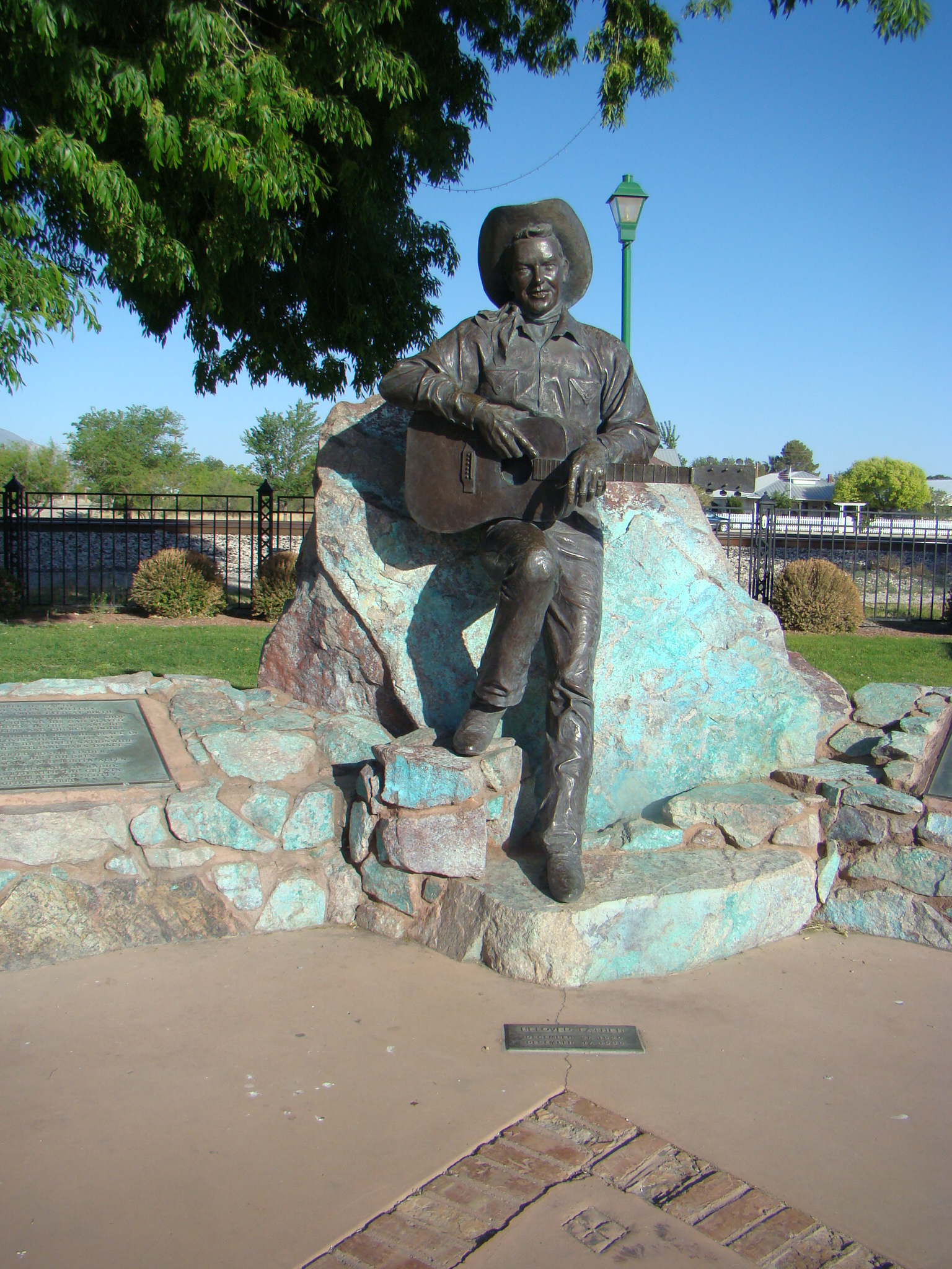
Rex Allen Statue
Rex Allen’s statue across the road has hidden meaning. Inside that statue is a bronze heart complete with arteries symbolizing that Rex Allen’s heart will always remain in the Willcox area. At the foot of his statue, the ashes of Rex’s horse, Koko, are buried, while Rex’s ashes were scattered around the base of the statue. Koko was billed as “the most beautiful horse in the world” after appearing in 30 movies with Rex Allen. They traveled together over a half million miles in the US and Canada. So it is fitting that Koko rest nearby in the green grass of Horse Heaven.
Stop by Willcox Commercial, the oldest continually operating store in Arizona. Having been in operation since 1880, one of its earlier customers was Geronima, who had a sweet tooth and often stopped by for a pound of sugar. Rex Allen and Tanya Tucker, who also grew up in Willcox, shopped here as well.

Old Chinese Elm Tree in Railroad Park
Two giant Chinese Elm trees stand in the vicinity of Rex Allen’s statue. These trees were planted back in 1928 when dirt was brought in to fill in a spot where water gathered every time it rained. They became the center piece of Willcox’s first city park – now called Railroad Park. A friend in New Mexico uses this small park area as a relaxation stop in their travels. Sitting under one of these giant trees while peering up through their branches at the great open sky, gives one a peaceful feeling.

Motherlode Antiques and Espresso
Down the street is an interesting Motherlode Antique Shop with Espresso and many fine treats. This was the perfect place to sit out on the porch and visit with the locals while enjoying ice cream and cookies. Right next door is The Dining Car where you can get some delicious Big Tex BBQ. Everyone was very friendly and offered suggestions of places to visit in the area…and no one seemed in a hurry.
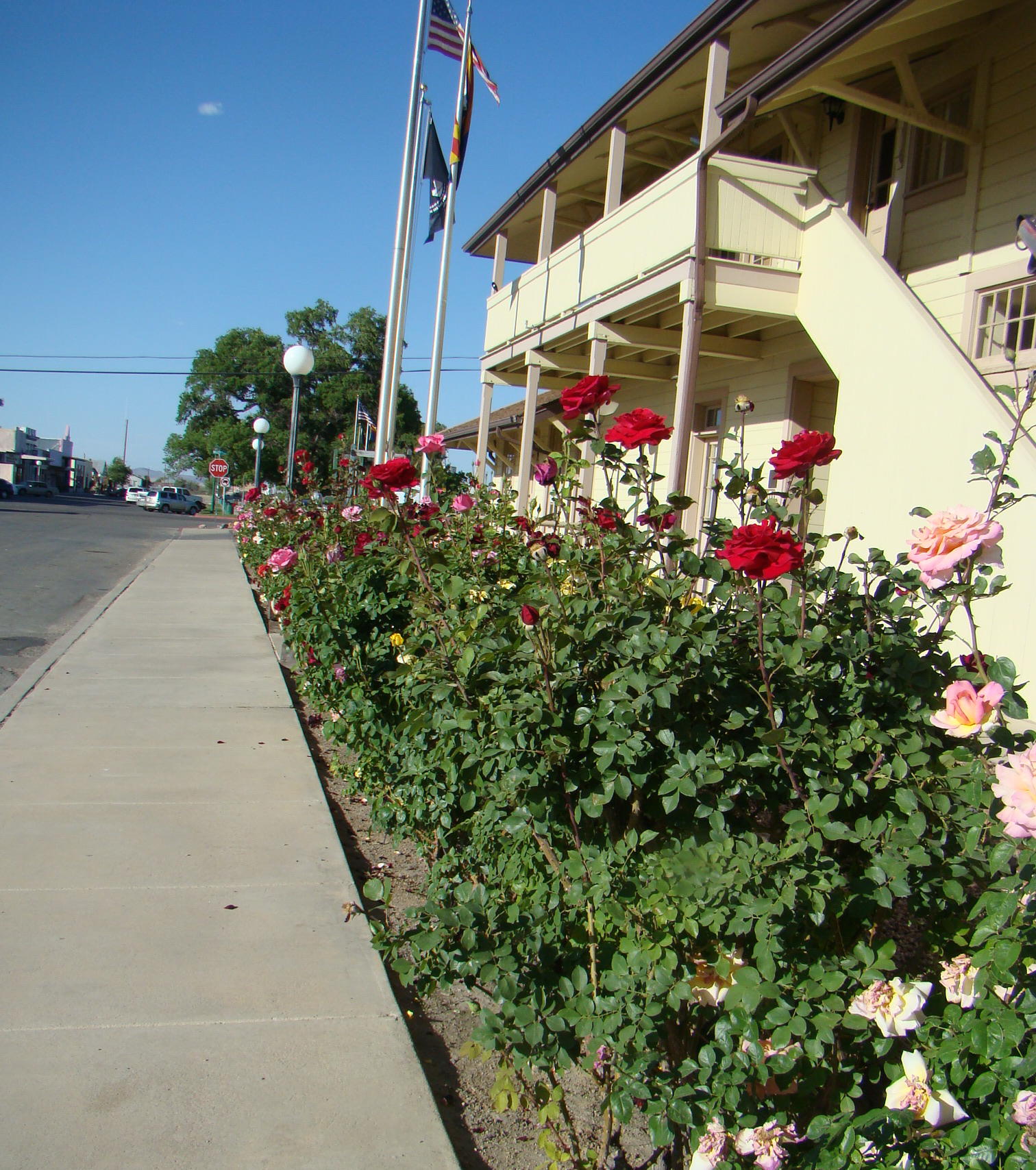
Roses line City Hall on Railroad Street
The Willcox Town Hall, a former Southern Pacific Railroad Station, features a block long row of beautiful rosebushes that make a stroll along Railroad Avenue a scenic, scented adventure. This is a great place to take a walk after that delicious ice cream cone. In Willcox, you definitely want to take time to smell the roses.
Willcox is located in southeastern Arizona just off I-10 between Bowie and Benson. Take the West Airport Exit and enjoy the spirit of the west that still exists there today.