Jackson Hole Beneath the Shadow of the Tetons

Welcome to the majestic Tetons
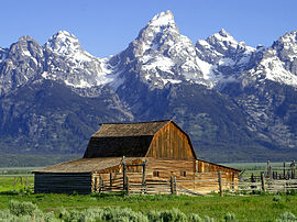
The majestic, 7000-foot-high Teton Range signals arrival in scenic Jackson Hole, Wyoming, which is located on the floor of a valley surrounded by mountains. John Colter was the first white American to view the valley and his reports were viewed with skepticism as people doubted any place could be so beautiful.
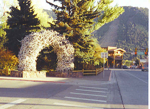
Elk Antler Arch
Town square serves as the main attraction of downtown Jackson Hole, as each corner has an arch composed of hundreds of elk antlers. Each winter, local Boy Scouts gather the antlers from the National Elk Reserve nearby. An auction is held to sell the antlers with proceeds going to the refuge. However, first of importance is maintaining repair work on the arches with any needed antlers.
Downtown hums with the sights and sounds of many gift shops and restaurants. Million Dollar Cowboy Bar featured in many Hollywood movies, Jackson Drug with its old time soda fountain, and the Victorian style Wort Hotel, home of the Silver Dollar Bar, provided interesting stops during this visit. After an exhausting day, we devoured a delicious Mexican dinner at an old established restaurant, Merry Piglets.
This area abounds with treasures to behold and even a week’s stay would not give one a chance to enjoy them all thoroughly. While the town of Jackson Hole delights many visitors, camping in the foothills of the Tetons gives an entirely different perspective.
Rustic cabin below the Cathedral Group
Snake River, which flows from its headwater at Yellowstone River, meanders along the base of the Tetons. The old Cunningham Cabin situated at the foothills of the Tetons seemed like a perfect place to live. Imagine sitting here with your morning cup of coffee or tea and watching the Snake River flow past the towering mountains.
Just outside of town can be found the largest elk preserve in North America – the National Elk Refuge. During the summer months the elk head higher in the mountains, but during the fall and winter, up to 7500 elk can be found here in the basin.
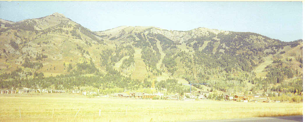
Jackson Hole Ski Resort during summer
Jackson Hole Ski Resort contains the longest ski slope in the area, although many slopes exist. The first ski slope, Snow King Ski Area, was developed way back in 1939. Makes you want to return for the winter snows.
At the Menor-Noble Historic District nearby, exploring Menor’s cabin provides a taste of life in the early 1900’s. His white washed cabin was used as a supply store while he ran a ferry across the Snake River. Cost was twenty-five cents for a horse and wagon to cross. In winter when the water was too rough, they crossed on a flat raft-like apparatus using a pulley system.

Museum of Natural History and Art
Tucked away in the foothills of the Tetons, National Museum of Wildlife Art displays spectacular paintings and statues that tell the story of Wyoming wildlife. Frequent spottings of buffalo along the road to the museum, add to the road trip’s delight. The museum also sponsors many musical and informative programs as well. On this particular day a piano duo playing jazz, Keith and Pam Phillips, entertained the crowd.
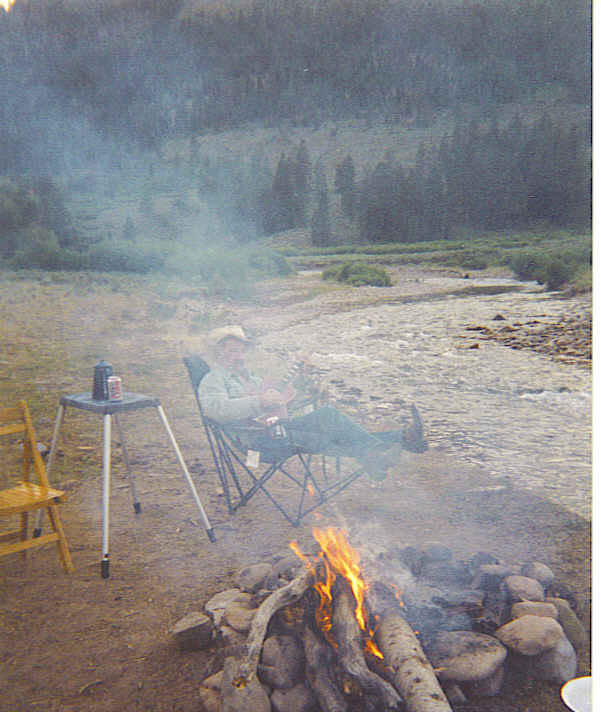
Camping along the Snake River
Leaving town, a stop at Jackson National Fish Hatchery provided viewing of trout from 2″ to 12″, ready to place in area lakes and rivers. All National Hatcheries were listed, and included was one from home – Senecaville Fish Hatchery.
Whether you stay in town at one of their many hotels, or camp in the shade of the Tetons, innumerable adventures await in the area of Jackson Hole, Wyoming. Just a short drive to the North is the bubbling Yellowstone National Park, which you won’t want to miss.
Jackson Hole, Wyoming can be found on the western border of Wyoming, very near Idaho. This is not a place of major interstate highways, but the drive is beautiful from any direction.


