Places to go and things to see by Gypsy Bev

Archive for the ‘Uncategorized’ Category

Casinos and Ancient Petroglyphs Make an Unusual Combination in Laughlin, Nevada

Colorado Belle Casino
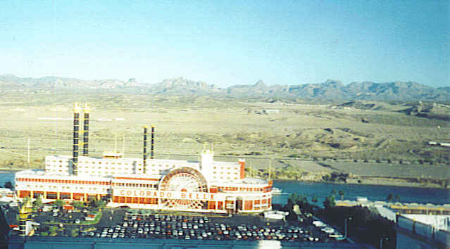
Mountains on the river…a spot to relax! On the banks of the beautiful Colorado River at the very southern tip of Nevada sits a lovely little town called Laughlin. Casinos are the main business in town, so many visitors try their luck at the slots or gaming tables. The Colorado Belle Casino, a 600′ replica of a 19th century Mississippi paddle-wheel riverboat, is certain to catch everyone’s attention.  However, gambling isn’t necessary to enjoy a stay in Laughlin.

When Don Laughlin, for whom the town is named, purchased the land in 1964, he opened a small casino, Riverside Resort, which had just twelve slot machines and two gaming tables. On the other side of the river in Arizona, the town of Bullhead City ran shuttle boats to the casinos as the number of them grew in Laughlin. Finally, in 1987 Don Laughlin himself provided the $3.5 million needed to build a bridge to span the river between the towns. Then business really picked up. Today, this little town is a popular gaming destination and family vacation center since it is located on the banks of the river with desert and mountains in view.  The casino strip isn’t very long with ten major casinos, but it has all the glitter of Las Vegas. The actual town of Laughlin is situated on the other side of the mountains, away from the casino activity.

Ramada Express
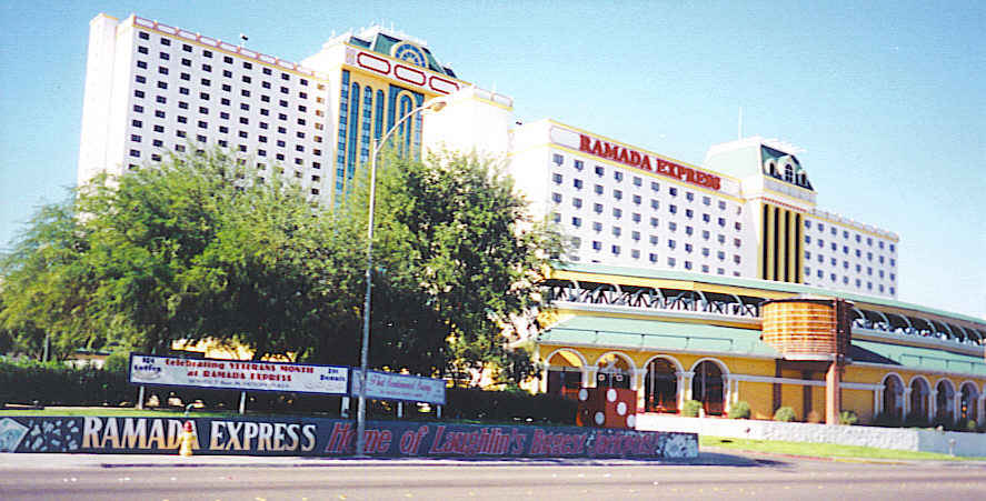
A stay at the Ramada Express, now the Tropicana Express, was always a pleasant experience. Express being its name, trains were its theme, having a pool shaped like a locomotive – with a spa in the wheel, and a train that ran around the entire hotel with several stops for less walking. Their patriotic museum honored all veterans from WWII through Desert Storm and regularly showed a four, large screen tribute, “On the Wings of Eagles.”

A stop at the little Colorado River Museum displayed information about the growth of the surrounding area. An evening ride down the Colorado River on the Celebration riverboat became a shimmering experience as the lights of Laughlin casinos reflected off the water. The captain was full of information about the river’s edge and talked a hundred miles an hour.  If riverboats are not to your liking, enjoy the river’s edge on a beautiful boardwalk that is a relaxing stroll day and night.

Debbie Reynolds at Riverside
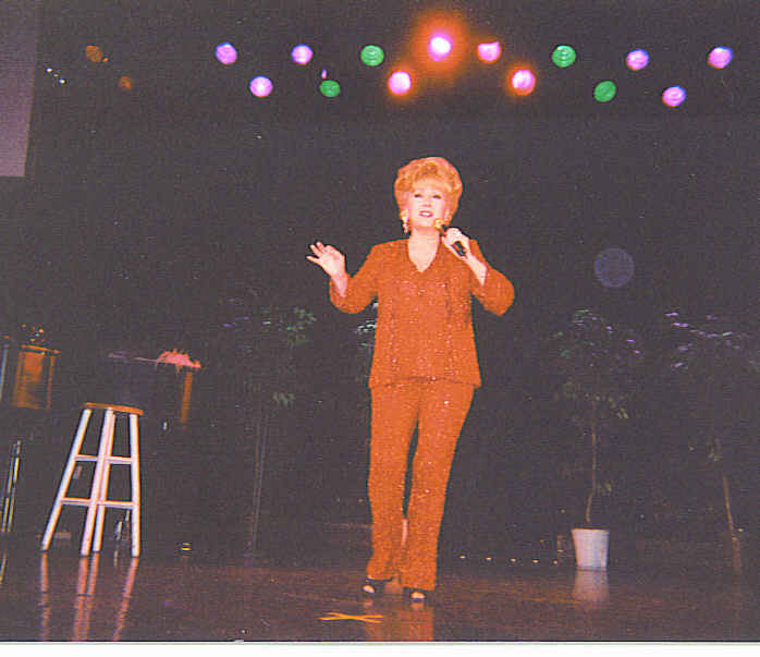
No stay in a casino town would be complete without heading to at least one show. Debbie Reynolds, a star I admired as a child, was performing at Don Laughlin’s Riverside so decided to see if I could get a ticket.  As luck would have it, they had one seat available, and it was in the front row! Afterwards, I went backstage and got an autograph and picture with Ms Reynolds.

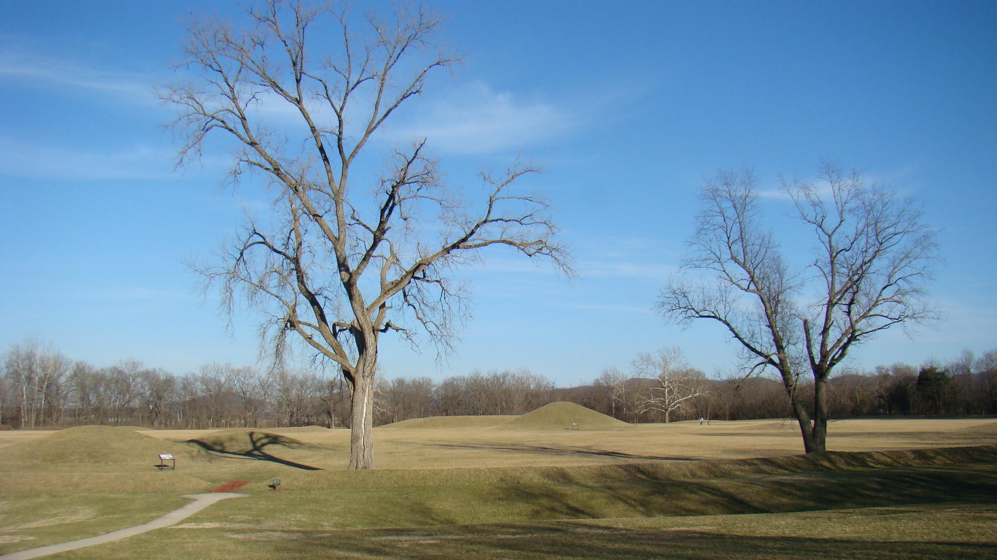
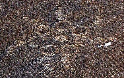
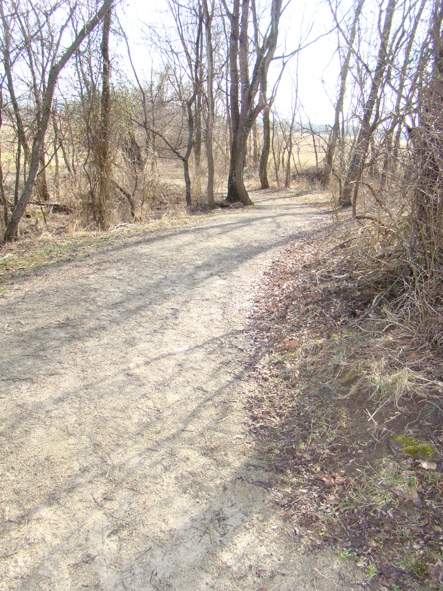
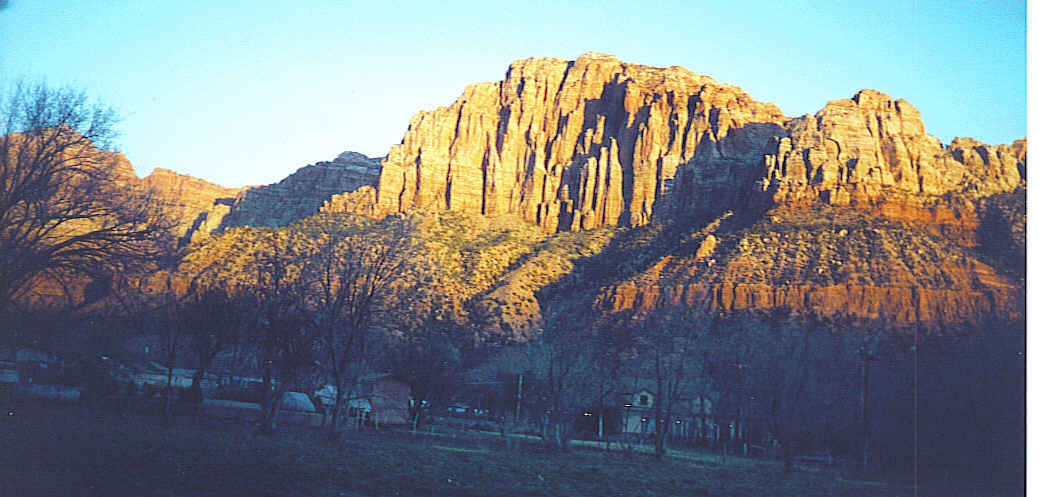
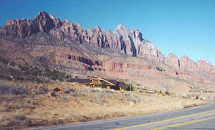
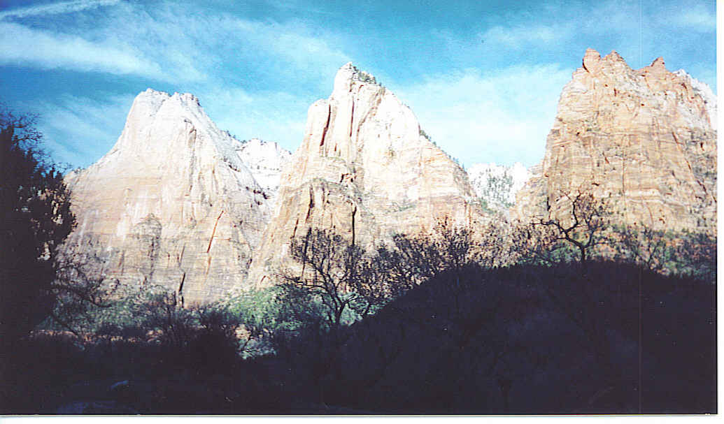
But the Laughlin area was more than casinos.  Accessed by a well maintained dirt road, nearby Spirit Mountain took one on a walk into the past. Petroglyphs on the mountain walls and rocks gave a glimpse into the Indian heritage that ePetroglyphs near Laughlin
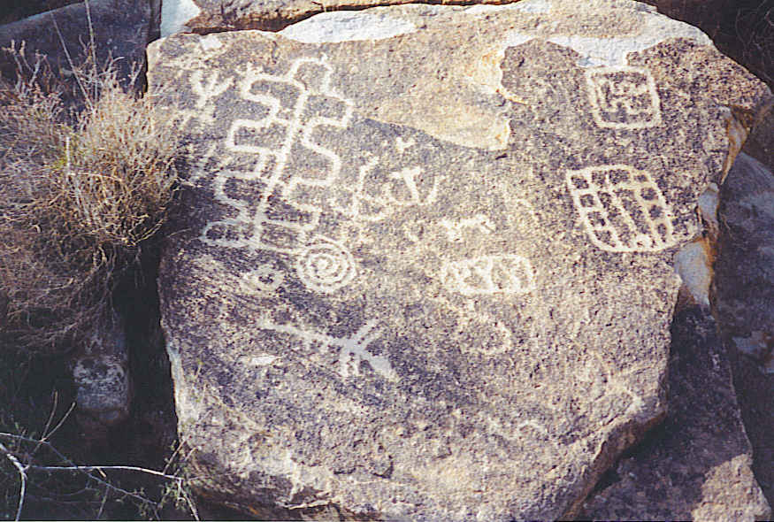
xisted in this area many years ago.  This remote granite mountain gave one a sense of tranquility, perhaps because the ancestors of the Indians reside there to this day.

Only seven miles west of Laughlin in Christmas Tree Pass, visitors will find over 700 petroglyphs. Estimates on the original time of the glyphs have been placed from 1100-1500 AD at a time when the Mojave Indians roamed this area. While their meaning is not positively known, one possibility is that they tell the Mojave story of how the Colorado River came into existence. This is one of those places where a bottle of water and a sunhat are recommended as temperatures in the summer soar to 120 degrees.

Christmas Tree Pass
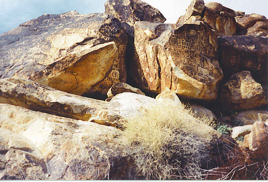
A long desert-mountain walk in the Indian petroglyphs concluded this week’s stay in Laughlin.  Never had I seen so many glyphs in one place, especially at the entrance of the Christmas Tree Pass. Farther up the mountainside, you could see what appeared to be the outline of an old Indian village.  Return trip expected for further exploration!

Laughlin, Nevada can be reached from I-40 taking Exit 141 to 95 North, the Needles Highway, for 23 miles. Turn right onto Bruce Woodbury Drive and after about 3 miles turn right on Casino Drive. Visitors will be greeted by Riverside Resort and the Casino Strip.

Snow on Aspen Mountain Creates Colorado Rocky Mountain High

ColoradoA “Colorado Rocky Mountain High” surrounds you while driving through spectacular mountains, which  open to the valley where ski resort town, Aspen, is located.  This town was first built during the late 1880”s on one of the richest silver lodes in the Rockies.  Aspen was the leading silver producer in the nation in 1891 accounting for a sixth of the silver output in the United States.  However, their boom was sort lived because in 1893, the US government returned to the gold standard, pulling the plug on the basis for their silver production.

Developing ski slopes seemed a natural, next step in this fantastic mountain region. That first ski lift acquired the name of “Boat Tow”. This very primitive lift, which was constructed partially from old silver mine parts, contained an old motor, two mini hoists, and two 10-person sleds. But that was then, and this is now!

Silver Queen GondolaToday this Rocky Mountain playground of the rich and famous is one of the world’s top ski resorts.  The mountainside aspen forests, which gave the town its name, still grow in abundance. Tourism is now where its treasure can be found. The Silver Queen Gondola gives an all-day ticket for skiers, as well as onlookers, to the top of Aspen Mountain and back down. Ski lifts being my idea of fun, several trips were made during the day.

Beginning SkiersThe ride to the top of 11,212′, about two and a half miles by ski lift, took about fifteen, breathtaking minutes. The gondola held quite a crowd and of course, many were carrying their ski gear along as well. They seemed to frown upon those going along just for the ride, so tried to stay back in a corner out of their way.

Somewhere on this mountainside a shrine has been built to John Denver, composer of “Rocky Mountain High”, which is now one of the two state songs of Colorado. Aspen was one of his favorite places to ski so it seemed natural to gather a collection of photos, posters, records and even wind chimes here on the mountainside at an undisclosed location, known and discovered by only a few.

At the top was a beautiful lodge, Sundeck, with a grand fireplace where you could sit with a cup of hot chocolate and watch the snow fly by the floor-to-ceiling windows.  Watching the skiers go down the trails through glades, bumps and steeps was great fun as well.  These trails were actually named according to their difficulty, for example, starting with the most difficult to the easiest: Sunset, Pussyfoot, One Leaf, and Slow.

Skiing through the snowflakesAt the top, snow started coming down heavily so headed back down one last time before finding a place to stay for the night. Had plans on going on east that evening, but the road had been snowed in for two months so had to backtrack just a bit.  The interstate was getting snow-covered also and the lighted sign across the road said, “Chains required 10 miles ahead.”  This was one of those nights when any motel looked like a great place to stop…no matter the price!

This snowy journey continued the following day as the interstate still called for chains. So I took a quiet, slow, snow-covered back road through the mountains. It was called “Top of the Rockies” at about 10,000′ with the peaks being about 14,000′.  Arrived the next day at the  slopes at Vail Ski Resort, which had 28″ of snow on the ground.  At Vail can be found another paradise for those who enjoy the slopes, and a great museum dedicated to skiers, Colorado Ski Museum and Ski Hall of Fame, where  “Skiing is a dance, and the mountain always leads”. These slopes fascinated me!

However, if snow is not your passion, come back in the spring for plentiful wildflowers in the alpine meadows. These mountains are beautiful any season of the year.

From I-70 in Colorado, take exit #116 south ,Colorado Highway 82. After about 40 miles, take a right on 7th Street in Aspen, then a left on Main Street.  You will definitely be able to spot the ski slopes!

Hopewell Mound Group’s Mysterious Crop Circle

Extraterrestrial, Paranormal, or Prank? Recently the Hopewell Mound Group near Chillicothe, Ohio  became a hot spot for crop circle investigation. An unusual sight of an intricately designed crop circle was noticed from an airplane flying over the area.  Therefore, this gypsy decided it was a great time to take a road trip to learn more about the mounds, as well as the crop circle.

Hopewell Mounds Visitors' CenterHopewell Culture National Historic Park’s Visitors’ Center provides an excellent short film giving possible history and reasons for the mounds being constructed in this area.  Located in the  beautiful Scioto River Valley, easily accessible water for daily use, as well as transportation, was of great importance to that early culture.

Hopewell MoundsThese historic mounds were the ceremonial center of the Hopewell culture from 200 BC – 500 AD. A stretch of land along the North Fork of Paint Creek contains the most striking total set of Hopewell culture remains in Ohio. This enormous legacy of geometric landmarks was created by unknown inhabitants prior to the time of the American Indians living on this land. Their name actually comes from Confederate General Mordecai Hopewell, who owned the land when the mounds were first discovered back in 1840. No one actually knows what name those original builders called themselves.

Interesting similarities, shared by the five mound groups in the Hopewell Culture, make them part of a larger picture.  Each field usually has a small circle, a larger circle and a square. Each square is 27 acres and the larger circle would fit perfectly within the square. The large circles all have the same diameter and encompass 20 acres. Many of these appear to have been laid out for their astrological significance.

Hopewell Mound 25The main section is often called the “Great Enclosure”, a six foot high, rough, rectangular, earthen enclosure measuring approximately 2800′ X 1800′. Mound 25 is located within this area and was the site of early excavations in the 1800’s. This treasure trove contained shells from the Gulf Coast, copper from Lake Superior region, and obsidian from Wyoming.  It appears that when the ceremonial life of a site was finished, they built a mound much like we would put up a headstone or monument.

Hopewell Crop CirclesThe recently sighted Crop Circle seems to be located very near this enclosure, but on the other side of the treeline, in the old channel of the North Fork of Paint Creek riverbed.  Since it is on adjoining property and under study, access is not permitted at this time. Circles were first seen from an airplane on September 20, 2012 as the pilot was headed toward the Serpent Mounds. This forty-three circle pattern in standing corn is not visible from any nearby road.   Some thought this pattern resembled a “reversible electric motor” and felt it appropriate to have been drawn near high tension power lines, which are located about 330 yards away. Was there a message intended?

Hopewell Mound Group MapThis map of the Hopewell Culture Group shows its boundaries as well as the location near the upper right hand side of Mound 25. From all information received, the crop circle appeared to the right of the Mound 25 circle and across the tree line. When explored by the Independent Crop Circle Researchers’ Association,  it was determined that the cornstalks were smoothly bent in many swirled and intricate patterns at heights from 2 inches to 4 feet. No footprints were found or any evidence of stepping on plants.

One significant difference came in comparison testing of the length of growth nodes in the crop circle vs those in the untouched field. Those in the circle were elongated, an unhoaxable effect, producing accelerated growth. These effects are often brought about by high levels of radiation.

Hopewell Hiking TrailTook a relaxing walk around the entire Hopewell Mound Group using their hiking trail, which was rather muddy and slippery in spots, and ending on the Bike Trail. Felt accompanied on that walk by someone from that long ago time. Believe I passed close to the spot where the Crop Circle was located from all the clues given, but could see nothing from the ground view.

When asked about the Crop Circle at the Visitors’  Center, the answer was  “there is no tangible evidence”, but they reminded visitors that Hopewell Culture is a very spiritual place.  Guess everyone will have to reach their own conclusion. The mysteries persist! Any ideas?

Actually, this is not an easy spot to find as it’s located in the middle of south-central Ohio without any nearby interstate access.  The Hopewell Mound City Group Visitors’ Center is located at 16062  SR 104, about 1.5 miles north of US 35 just outside Chillicothe, Ohio.  The Visitors’ Center is the best place to start your tour and they have maps available for each mound group. Rangers on hand are very helpful in giving driving directions. If anyone knows the location of Crop Circle University, please respond.

Impressive Zion National Park “Treasure of the Gods”

Springdale, UtahBeautiful, Beautiful Zion  The town of Springdale, Utah rests in the shadows of Zion National Park where massive sandstone cliffs soar into the blue skies. Early Mormon settlers called these majestic stone canyons the “Natural Temples of God”.  Mormon influence can still be felt throughout the park as they named several of the rock formations.

Zion TheaterA great place to begin the day is to stop at Zion Canyon Theater and watch Treasure of the Gods, an IMAX film. Here you receive a great overview of the park and can then select some of those places you really must visit.  The film gives spectacular views of the canyon from an airplane flying over, as well as going deep within. Spectators feel they are actually viewing the canyon seated in that plane. Much centers around the Indian legacy from the 1500’s, as you experience the myth and magic of the canyon. Ancient native people called this rugged landscape home, for centuries.

There are two scenic drives here: the Zion Canyon Scenic Drive and the Zion Mount Carmel Highway. This trip we are exploring along the Zion Canyon Scenic Drive, which is a favorite route. In fact, it is so popular that now during the summer months, this road into the park is closed to regular traffic, making access to the park’s scenic beauties available only through shuttle bus service from April 1 – October 31. However, during the winter months vehicle traffic is permitted making it much more fun to explore at your leisure.The Zion Mount Carmel Highway is open to traffic all through the year.

Three PatriarchsThe Three Patriarchs are a trio of very similar mountain peaks called Abraham, Isaac, and Jacob.  All of them are nearly 7000′ high so can be seen from many different parts of the park.  One of the shuttle’s first stops has a path that leads up a short incline for easy viewing.  The Emerald Pool is nearby and has several small waterfalls that add to the beauty of the surroundings.

The NarrowsCliffs on both sides of the road are a half mile high and end at the beautiful Temple of Sinawava, home of the Paiute Indians’ coyote spirit. Here the Virgin River travels a narrow path between the mammoth rocks. This is the perfect time to park your car, or get off the shuttle, and walk along the riverbank. This two-mile round trip Riverside Walk meanders all the way to the end of the trail, The Narrows.  To continue, you must wade, walk or sometimes swim in the river. Peeking through at the end of The Narrows you can catch a glimpse of the Temple of Sinawava.

Weeping WallAnother steep path leads to Weeping Rock where a veil of spring water seeps through the sandstone wall making it appear that the rock is crying. The steps culminate at a large eroded area with slippery floor from the tears and growing moss. Often there are hanging flowers enjoying a drink from the rocks as well. A gentle trickle of water flows through the rocks in the fall, but in the winter icicles often form. A guide remarked that this water should be quite pure as it is filtered through the sandstone rocks from the rim of the canyon on an incredible journey that takes from one thousand to four thousand years.

Great White ThroneThe Great White Throne, a highlight of Zion National Park, seems to glow in the evening light as it overlooks much of Zion Canyon. It stands out easily, even in the daytime, with a beautiful red rock background. Made of white Navajo Sandstone, the top appears glowing white while the base is red. This received its name from the Mormons, who felt this area represented the New Jerusalem, and called it The Great White Throne, a name appearing in Revelations as the seat of God for the last judgment.

Spending the evening in a small motel in Springdale was also quite a treat as it was necessary to patiently wait in the car for the elk to decide to move out of your way. They were very friendly and not the least bit afraid of cars or people. The elk enjoyed rubbing their antlers on the trees in the parking lot…and sometimes attempted using the parked cars.  This was one of those times when you could easily “reach out and touch someone’…an elk if you dared!

To visit Zion National Park from the North on I-15, exit on Hwy 20. Follow US-89 to Mount Carmel Junction where you will meet SR-9, which is the Zion-Mt Carmel Highway and is always open to vehicle traffic. 

From the South on I-15, exit 16 will take you through Hurricane and LaVerkin. Again you will take SR-9 to the entrance of Zion National Park.

Big Muskie Bucket Exhibited at Miners Memorial Park

Big Muskie 325 tons of earth in a single bite!  The Big Muskie took that bite quite easily while mining over twenty million tons of coal in  Muskingum County of Southeastern Ohio from 1969-1991. Today all that is left of the Big Muskie, one of the world’s largest draglines, is this bucket capable of holding many tons of earth.

Miners Memorial ParkOn a crisp winter afternoon, the curvy, scenic road happened to meander past the site of the Miners’ Memorial Park in Morgan County, Ohio where the Big Muskie Bucket is the centerpiece of the park. While the ground was covered in a light snow and the gates were closed, the sign said : Walk-Ins Welcome. That was invitation enough to explore a little closer. My footsteps were the first to leave imprints in the snow this January afternoon.

Big Muskie BucketConsidered one of the seven engineering wonders of the world, this bucket weighs 460,000 pounds empty. If you look closely in the bottom left of the picture, a teddy bear can be spotted on the left hand side of the bucket…and it truly looks like “just a drop in the bucket”! When you consider this is only the bucket of the dragline…well, the magnitude overwhelms you.  It has been estimated that twelve car garages could fit inside.

This massive mechanical wonder was last used by the Central Ohio Coal of American Electric Power, or AEP, in the rolling hills near Cumberland, Ohio. Lucky it was being used by AEP as this huge machine was run basically by electricity, using enough electricity daily to power over 27,000 homes.  Big Muskie had a crew of five and worked around the clock to take advantage of the lower nighttime per kilowatt-hour rate. When you check out the first picture, knowing the size of the bucket, you then realize how gigantic the entire Big Muskie really was, actually twenty-two stories tall!

The WildsAfter the land was mined, it was beautifully reclaimed as can be seen in this picture. The ground was smoothed, trees were planted, and it was again an inhabitable place for animals.  In fact, The Wilds, a haven for wild animals from all over the world, is located within a short drive and is where this picture was taken. If you look closely in the open range, you can spot a herd of buffalo grazing in the snow with a beautiful lake in the foreground. The Wilds is one of the largest wildlife conservation centers in the world with some type of safari available most of the year to explore nearly 10,000 acres of that reclaimed land.

Today, AEP maintains this Miners’ Memorial Park. It is a great place to relax, even on a quiet winter day, while strolling around the huge bucket. There are several areas available for picnics as well as a shelter, which houses displays on the Big Muskie when it was working as well as other information on the area. As land was reclaimed, many camping areas with lakes and fishing were included so it is a great place for family fun during the summer months.

Even though the Big Muskie is no longer in operation, coal mining is still an important occupation in these rolling hills. Warning: Watch out for fast moving coal trucks on every curve!

To visit the Big Muskie Bucket on your next visit to Ohio, travel I-77 and take Exit 25 in southeastern Ohio. Be certain you stay on Route 78 and after many bends and curves – a rollercoaster ride – of about 16 miles, you will arrive at the Miner’s Memorial Park. The area is open May – October, but you can walk in and explore at any time.  Be sure to stop and scan the hillsides.

Scenic Pikes Peak Cog Railway Blocked by Heavy Snow

Pikes Peak Cog Railway“End of the line for today,” announced the engineer as the Manitou & Pikes Peak Cog Railway locomotive came to a stop.  Thus, Windy Point, at about 12,000 feet, became the end of the journey up Pikes Peak in Colorado that particular afternoon. The snow was too deep on the tracks for the blower to remove it…and it was still snowing.

Traveling by car to the top of Pikes Peak has been a memorable occasion since childhood; however, traveling by cog railway was an entirely different experience. Even though it was April, seems that spring isPikes Peak's Windy Point the time for heaviest snow in the Rockies as the main road to the top for automobiles was not passable. The only possibility of traveling up the mountainside was taking the Cog Railway and seeing how far it would be able to go on that particular day.

Pikes Peak was named for Zebulon Pike, an early explorer, who happened upon it in his 1806 travels.  He attempted to climb it with a small band of men, but they only reached 10,000 feet before they were turned away by deep snow. Even before Pike, the Ute Indians camped at the base of Pikes Peak and it is suspected that they had a pathway to the top to get ceremonial eagle feathers.Pikes Peak Early Steam Engine

Starting back in 1889,  workers were paid twenty-five cents an hour to lay the rails to the top of Pikes Peak. The first steam locomotive took a Denver church choir to the summit. These early locomotives pushed the passenger car up the steep incline. Over the years the engines have developed from steam to gasoline and then diesel. Today the cog locomotive is run by a combination of diesel and electric.

A cog railway uses a gear called a “cog wheel”, which meshes into a special rack rail in the middle of the outer tracks.  With its use, the locomotive is able to travel much steeper inclines than a standard track. Manitou & Pikes Peak Railway is the highest cog railway in the world…with a perfect safety record.

Pikes Peak steep inclineWhat a great view all the way up the steep incline to the timberline, which designates the altitude where trees can no longer grow due to lack of moisture caused by the frozen permafrost under the surface.  Seemed like you could see  forever over the beautiful snow-covered Rocky Mountains with their forests of tall pine. Fantastic rock formations often gave way to breathtaking cliffs overlooking steep canyons.  Passengers oo-ed and ah-ed all the way to the top.

Back at the base in front of the old courthouse in Colorado Springs, there is a statue of Katharine Lee Bates sitting and looking up at Pikes Peak, which was her inspiration to write the words for “America the Beautiful”.  Although written back in 1913 after going to the Peak using a team of mules, the purple mountain majesty still reigns over Colorado Springs to this day.

Cog Railroad OrnamentWhen in Colorado, take Exit 141 (US 24) off I-25.  Go west toward the Rocky Mountains on US 24 about four miles to the Manitou Ave exit, which is in Manitou Springs. Keep going west one and a half miles to Ruxton Avenue. Turn left on Ruxton Avenue at the Mountain Man Shop using a roundabout. At the top of Ruxton Avenue is the entrance to the Cog Railway. Enjoy the ride!

Explore Dennison Depot Museum WWII Dreamsville U.S.A.

Dennison Depot Museum“Grease the pig!  Tallowpot, grab that banjo and throw on some diamonds so we can bake a cake.” Commands similar to these could have been heard around the Pennsylvania Railroad in Dennison back in its prime. This railroad slang translated into our everyday English, would sound something like: “Oil the engine! Fireman, grab that shovel and throw on some coal so we can build up steam.”

Dennison Depot Museum in Dennison, Ohio displays the history of their depot in a rather unusual manner…in the cars of a train! Each car displays a particular section of interest varying from hospital car to telegraph office. There is much to explore and all is well marked with explanations.

Model RailwayWhy would they have decided to buy the land to establish a town, where none existed, in this particular place back in 1865? Well, it wasn’t by chance! The spot they later named Dennison was exactly 100 miles between Pittsburgh, PA and Columbus, OH. The steam engines of that time could only travel a hundred miles before needing water, so this became their mid-way stop. Approximately forty trains stopped here daily during its peak, when Dennison had the most complete and largest railway yard in the nation. This model train lay-out shows in great detail part of that yard, and is maintained by a group of local model train enthusiasts.

Salvation Army CanteenMost exciting of all seemed to be the story of how they became known as Dreamsville, U.S.A. During WWII, the Salvation Army Canteen ,with nearly 4,000 volunteers, provided free food to around 1.3 million servicemen.

Arriving Servicemen's Train Car The train stops were only five to seven minutes long, so the girls went out on the platform to meet the train. They could see the loneliness, hunger and despair on the soldiers’ faces, so those young girls tried to have a smile and a kind word for everyone.

The soldiers said it brought back fond memories  of their hometowns.  These friendly, smiling girls reminded them of their moms, sisters, or girlfriends…plus there was free food.  A dream come true!  Thus the name Dreamsville, USA.

Hobo Message StumpBecause of all the trains, Dennison was a hotbed of hobo activity.  Whenever a train would stop, many hobos would hop off looking for a place to get handouts. It was common practice for the hobos to make marks on a nearby tree or on the house itself, so other hobos would know if they would be well received. Marks of simple circles, arrows, or even animals signified: Good road to follow. Free telephone. House is well guarded. A kind old lady. They even had a camp along the Pennsylvania Railroad in the city dump, where they made makeshift shelter of tin wrapped around tree trunks.

Friendly volunteers patiently answered questions, making the day enjoyable as well as informative. Boarding takes place here for the Polar Express, which during the Christmas season takes children on a magical ride where they encounter Santa. Special events are scheduled throughout the year from Private Bulldog Bing’s Birthday Party to Ghost Tours in the fall.

After visiting the museum, the Trax Diner, located in the old depot, is a perfect place for a meal or a snack.  Children were full of “whoo-whoos” while they were enjoying the atmosphere. Although they have delicious full-course meals, I chose a “Hobo Basket” filled with British style beer battered fish and chips. Since an English lady operates the diner, this seemed like a logical and delicious choice.

“Coal Cars”, stuffed potato skins, also chugged across the menu.  Might have to return for “The Caboose”, a sugar and cinnamon shell filled with ice cream and toppings. Think a Caboose would be a perfect ending for a meal, a train… or a blog post!

Dennison Depot Museum is located in Dennison, Ohio  not far from I-77.  Take exit 81, 36 East, to the Dennison exit. Turn right on Second Street and continue on Second Street until you reach the tracks. Turn left on Center Street and after two blocks you will see the museum. Parking is on the left side of the street.

Biosphere 2 – Earth Under Glass

Biosphere 2Want to see a rainforest and ocean in the desert? Time to  head to the barren desert hills of Arizona, or should I say mountains! Located at the foot of the Santa Catalina Mountains in Oracle, Arizona, Biosphere 2‘s striking white outline and unusually shaped, futuristic buildings catch the eye. Recently named one of the top fifty “Wonders of the World”, which must be seen, this is an informative stop.

Biosphere is defined as: the regions of the Earth’s crust and atmosphere occupied by living matter. Therefore, it seemed fitting to name this man-made earth model Biosphere 2. Here is the world’s largest glass covered ecological laboratory located on forty acres. Back in 1984, Edward Bass, an environmentalist, contributed $150 million to build John Allen’s invention – Biosphere 2.

Originally built to experiment with self-contained settlement, those first eight ecologists, four men and four women,  signed up for a two year term, then sealed themselves away.  They began raising their own food and recycling air and water. Their goal was to be able to sustain all their needs from the five different ecological regions that were located inside the domes. These early designers were interested in space colonization and were looking for a way to build a similar system on Mars or perhaps the Moon.

The experiment, however, basically failed after almost two years due to the build up of noxious gases, and lack of oxygen.  While some of the four thousand species survived,  water and crops failed. However, much was learned scientifically as well as socially where disagreements caused lack of co-operation.  Columbia University operated it up until just recently, but today it is maintained and used for experimentation by the University of Arizona.

Biosphere 2 RainforestNot only is it an experiment station, but also a unique spot where visitors can view, on an inside tour, five different ecosystems: rainforest, grasslands,  desert, wetlands and ocean floor.  The rainforest is the largest and tallest biome represented.  It contains a number of different habitats, including a lowland forest, a flood plain, and a cloud forest on top of a sandstone mountain.

Savanna Grasslands is naturally dominated by various types of grasses, but there is a quartzite slope in the area where the stream waterfall is located. The Thornscrub section is the wilderness area. Most of the plants in this region are from the Sonoran area. Vegetation consists mainly of short trees and shrubs with many of them being thorny.

Biosphere 2 DesertThe desert biome has over 125 species of plants and was originally designed to replicate a coastal fog desert such as those found along the western coasts of Baja, California.  This allows the Biosphere 2 desert to co-exist with the other, more moist biomes.

The Marsh biome begins with a fresh water lake with a transitional marsh leading to the Mangrove wetlands.  Here over five hundred large mangrove trees dominate the wetlands, which is colonized by many marsh creatures such as crawfish, snails, sponges, and shrimp.

Biosphere 2 OceanThe ocean biome, designed to simulate a Caribbean reef, contains a coral reef and over one million gallons of salt water. A forty foot cliff overlooks the tropical ocean where waves, temperature and chemical balance are all carefully monitored and controlled by innovative technology. This allows scientists to conduct groundbreaking research. But the ocean biome is very efficient at recycling nutrients, so mainly mechanical means will be used in the future to attempt to control the environment here.

Today their largest project is the Landscape Evolution Observatory where they     are exploring the secrets of earth’s landscape and how it changes due to climate and water movement, as well as modifications through biological systems. Edward Bass continues to be a major supporter and last year donated another $20 million to support operations and research. This is the premiere place for learning about Earth and its place in the Universe…now and in the future. Biosphere 2 is where science lives.

Getting there depends on where you are beginning! If you are in Phoenix, find your way to Biosphere 2 off I-35 exit 185. Continue East of 187 toward Florence where you will turn right or south on Arizona 79.  Turn left on Arizona 77 until you arrive at Oriocle Junction where you turn left on Biosphere Road.  If you are in Tucson, take Arizona 77 north about 24 miles.

Southfork Ranch in Parker,Texas Home of “Dallas”

Shortly before publication, received word of the death of J.R. Ewing after a long battle with cancer. He was the villain that TV viewers loved to hate and will deeply be missed by many.

Things are always bigger in Texas, and Southfork Ranch has always been portrayed as one of them. Starting in 1978, this was home to the Ewings and the rest of the world arrived as weekly guests on Dallas. Here guests could dream of life as an oil millionaire, including shady dealings and dysfunctional family dynamics.

Today a tour of the set for the TV show is destination for many fans of Dallas, both the old show and the recent revival.  In Parker, Texas, guests can tour the Visitors Center and the pillared Ewing Mansion to hear stories and see memorabilia of the extravagant 340-acre Southfork Ranch.

Re-live some of the memorable moments from  Dallas, at one time the world’s most popular TV show, in the “Dallas Legends” Exhibit. See the gun that shot J.R., Lucy’s wedding dress, video clips from the series, interviews with the stars, and other memorabilia that will make you feel right at home with the most infamous Texans of them all, the Ewings.

Take a tram from the Visitors Center en route to the Ewing Mansion. You’ll hear a history of the ranch, and see Texas longhorns and American quarter horses. As you approach the Ewing Mansion, the driveway seems much shorter than it did on the TV show. A special filming technique, or perhaps camera magic, was used to make it appear much longer, thus more elegant. Actually the entire ranch was much smaller than the show portrayed.

At the famed Ewing Mansion, a tour guide will give interesting tidbits about the years of filming, and insight into the character of the Ewings. J.R. seems to be the name that first comes to mind when Dallas is mentioned.  His ethic for the business world was one word – win, but he had an equal passion for women. Guests are given a full guided tour of the “most famous White House west of D.C.” where they even get a glimpse of J.R.’s bedroom !

Found it interesting that Miss Ellie’s kitchen had a window to the entire ranch. Southfork Ranch originally belonged to the family of Miss Ellie. When they were about to lose it, she wisely married Jock Ewing to save the ranch, but came to care about him deeply as the years progressed. Here the mother of the Ewing family could keep an eye on what was happening. Many interesting conversations regarding business and family took place with Miss Ellie in this kitchen.

Rest at the pool in the beautiful Southfork gardens where Dallas was filmed. On the right side of the picture you can see the edge of the balcony where J.R. was shot…the end of a season that made viewers eager for the fall season to return.

As you depart the Mansion, feel free to stroll through the ranch grounds, and stop and visit “Lincolns and Longhorns,” displaying Jock Ewing’s original 1978 Lincoln Continental. Guests can shop here for “Dallas-inspired” men’s and ladies’ apparel, decor, and accessories.

Return to Dallas today, the show and Southfork, as some original members of the cast are back to fight the next generation of Ewings for power. As John Ross said at the end of episode one for the new Dallas, “The fun is just beginning.” But now the question will be, can the show continue without the outrageous and compelling J.R.?

Southfork Ranch is located in Parker, Texas just north of Dallas. Take US 75 north to exit #30, Parker Road. Travel east on Parker Road for five and a half miles, then take a right on FM 2551, also known as Hogge Road. The entrance to Southfork is immediately on your left. 

Dickens Mannequins on the Move Volunteers Make It Possible

What is a volunteer? Although this isn’t a Webster’s Dictionary definition, Margaret Mead seemed to understand the role of volunteers when she said:

Never doubt that a small group of thankful, committed citizens can change the world; indeed, it’s the only thing that ever has.

In the small town of Cambridge, Ohio, a group of volunteers may not have changed the world, but definitely have changed the face of Cambridge during the months of November and December. Over 200 volunteers work almost year round to make Dickens Victorian Village a big success.  As the director would say, “It takes a village to run things.”

After the Restoration Team worked at Dickens Universal all summer long to make and repair heads and bodies, fix or replace clothing, and even build whole new scenes, finally the day arrived to move them to Wheeling Avenue for Dickens Victorian Village.  This is no easy task to move 186 mannequins. Some of them were moved on an old trolley that was given to the village, while others were hauled on trailers.

Wonderful volunteers lined up inside Dickens Universal while mannequins were loaded onto the trailers behind their trucks and vans.  Usually this is done on the weekend, but due to Hurricane Sandy this year, it was delayed. So men appeared after work to load their trailers and take them to the appropriate spots in downtown Cambridge. Keeping them in order wasn’t a big problem as they are stored in order at Dickens Universal.  It’s a long warehouse and there’s enough room to make it appear like a walk down Wheeling Avenue – just not as much sidewalk in between!

Once downtown, finishing touches had to be made. Skirts were attached around all the scenes, most containing more than one mannequin. Then everything needed to be securely attached as a caution from further wind storms. Long metal rods were placed beside some mannequins to hold them in place.

But when it is all finished, the volunteers have a sense of pride in their long year of hard work to make downtown Cambridge have a festive air.  Even though the hurricane had made its way north, rain still fell for the entire time of mannequin invasion.  One of the new scenes, The Blacksmith, was getting its first taste of being out in the weather.

Take a walk downtown to enjoy a look at days of old. Each scene has a descriptive plaque telling a little history of that particular scene. For the volunteers, work doesn’t stop here.  During the Dickens Victorian Village season from Nov. 2 – Jan. 5, the restoration team checks on mannequins daily repairing costumes, reattaching loose items, or sometimes even changing costumes completely.  These people really care about appearances and are very particular about each scene. Yet they have lots of fun working together! As Tiny Tim might say: “God bless them every one.”

Dickens Victorian Village is open in downtown Cambridge, Ohio from Nov. 2 to Jan. 5. Cambridge is easily located as it is at the crossroads of I-70 and I-77 in beautiful Southeastern Ohio.  Perhaps you will get a chance to visit this holiday season and feel the Magic of Dickens in the air.