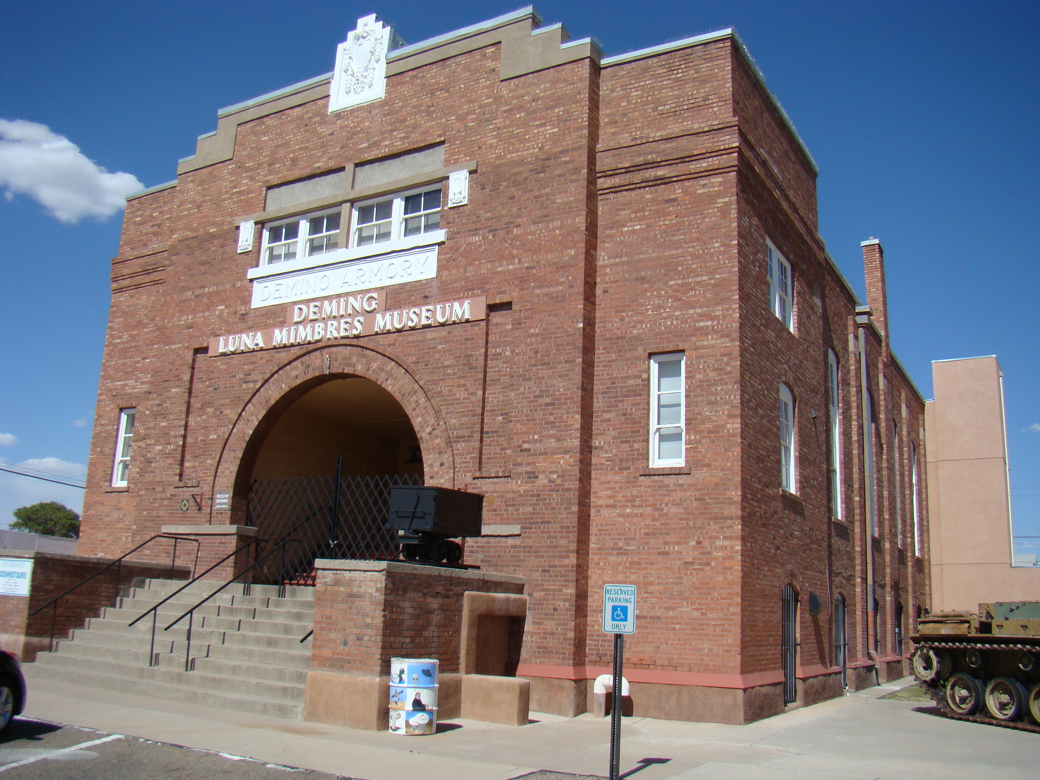
Deming Luna Mimbres Museum
Variety is the spice of life…and of museums. No matter what your interests, chances are you can find something to arouse your curiosity at the Deming Luna Mimbres Museum in Deming, New Mexico. Everything there is from the private collection of local residents, or former locals.
Housed in an old National Guard Armory, their unusual exhibits range from Mimbres pottery to Geodes and Gems to a Military Room. There is something that everyone can enjoy. Visiting the Deming Luna Mimbres Museum is a great chance to explore the history of Deming as well as the Mimbres heritage.
Since there is such a large variety of rooms to explore, only a few favorites will be visited here. This is one of those places where you could go back again and again to absorb the history that pours from its treasures.
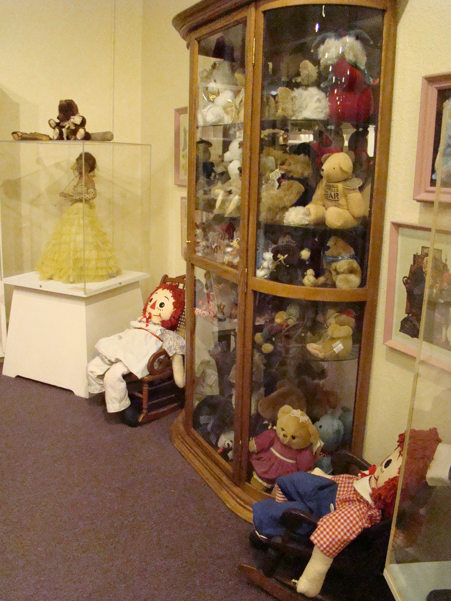
Doll Room Teddy Bear Collection
The Doll Room happens to be just inside the front door so is a natural place to begin your visit. This impressive collection contains about 1000 dolls, the oldest of which are those with China heads. Being a bear enthusiast, the teddy bear exhibit caught my eye. There is even a doll brought back by a sailor from the rubble at Hiroshima after the Atom Bomb exploded. But there is much more in this room than just dolls. Here you will find wonderful old books – the oldest I spotted was one by Louisa Mae Alcott, Jo’s Boys, dated 1866. Beautiful doll houses, antique toys and bears are scattered throughout the room.
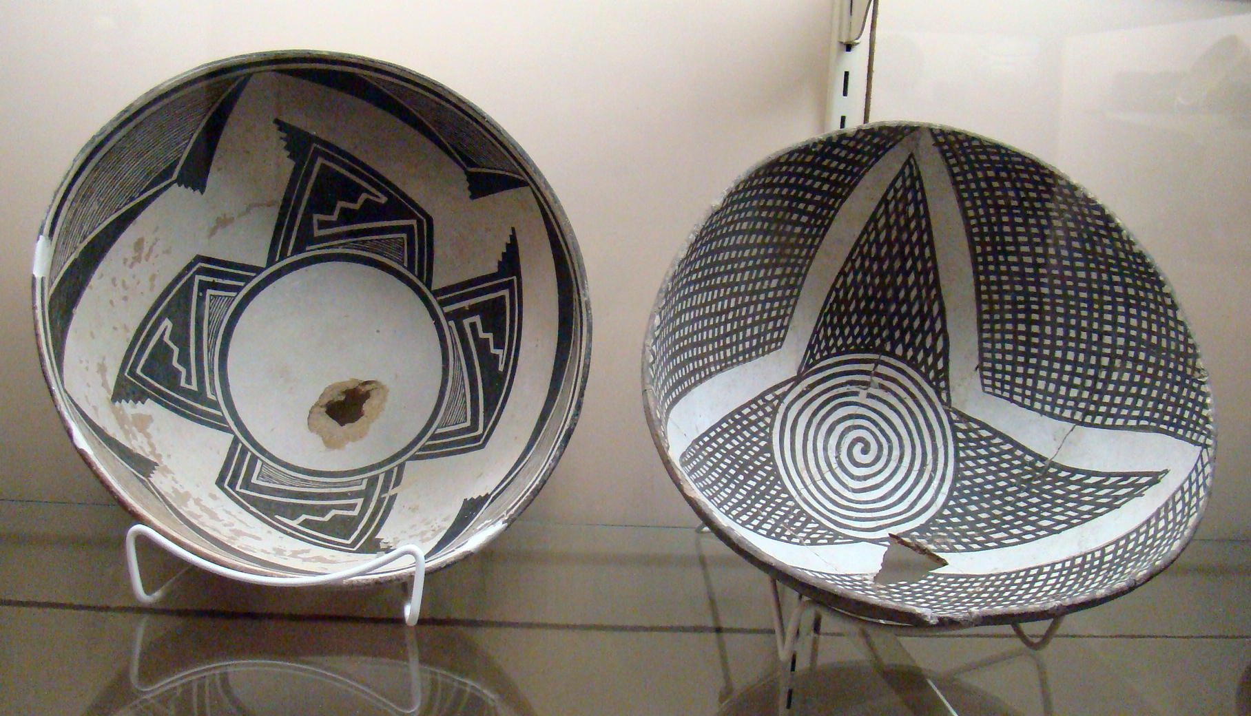
Mimbres Pottery
Another spot of high interest is one of the best collections of Mimbres Pottery in existence. The Mimbres Indians lived in this area in approximately 1000 A.D. Bits and pieces of pottery found in the area are displayed here with the black and white pieces being a favorite of Mimbres followers. Pictures of their burial method proved interesting as the deceased were placed in the ground, usually under their houses, in an upright sitting position. Then one of their beautiful bowls was placed on their head with a hole in the top so their spirit could go to another world.
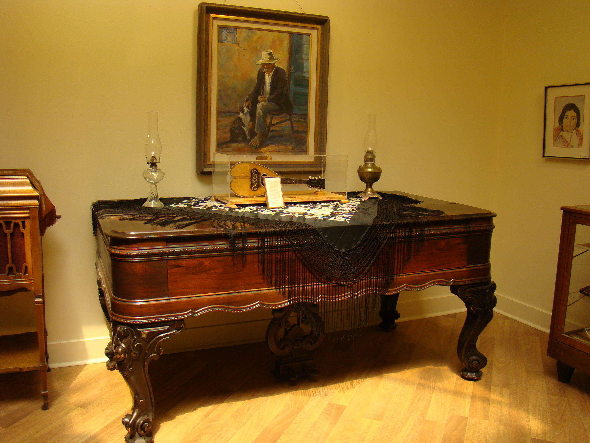
Square Grand Piano
A square grand piano caught my eye in the solarium of the Art Gallery. Made of Brazilian rosewood with two strings per key, this 1867 treasure was created by Hallet, David & Co in Boston. Grand pianos were often the centerpiece in Victorian parlors. Perhaps you might enjoy listening to a Brahms Waltz played on a Square Baby Grand.
An historic replica of the famous Silver Stake was on display in the Transportation Room. Back in 1881, Deming was the meeting place of the second transcontinental railroad in the United States where Southern Pacific and Atchison, Topeka & Santa Fe railroads joined together with the Silver Stake ceremony. Situated ten miles east of its present location, Deming at that time was a town of tents and shacks. Author James McKenna stated, “The great event in town was either the arrival of the stagecoach or the train.”
Admission to the museum is free but donations are accepted…after you have seen the exhibits. You can’t get much friendlier than that!
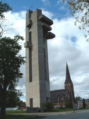
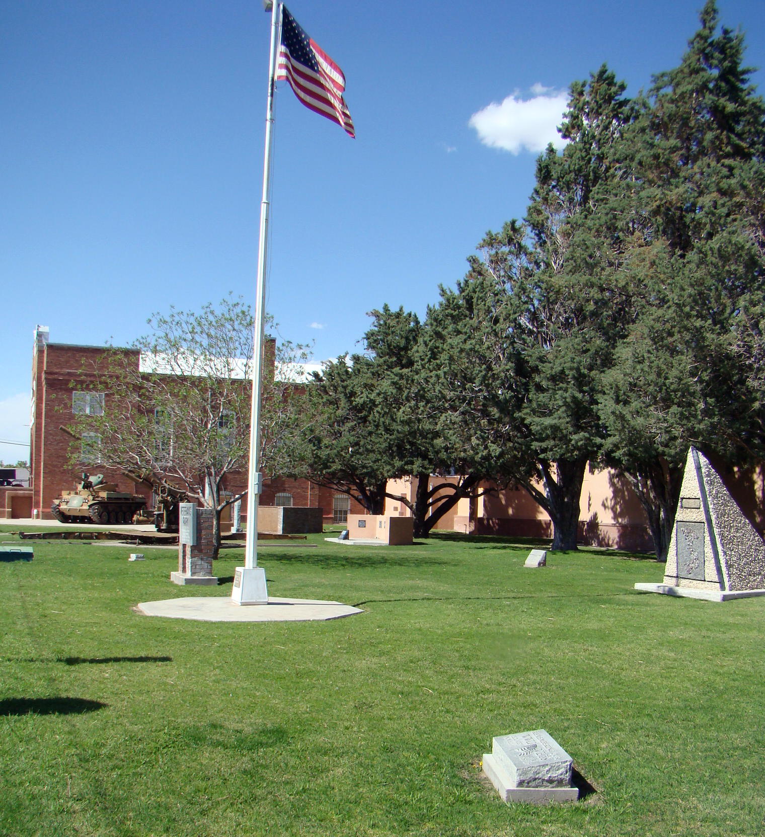 Outside a well-tended Veterans’ Park remembers wars, conflicts and attacks all around the world. The sign reads:
Do spread the word
Tell the passerby
That in this little world
Men knew how to die.
Deming Luna Mimbres Museum and Veterans Park can be found near downtown Deming, New Mexico just off I-10. From the east take Exit 82B and from the west take Exit 82A. This should exit left on Pine Street, which leads right downtown. Turn left again on South Silver Street, which leads to the courthouse. The museum and park are on the left side after two blocks.