Places to go and things to see by Gypsy Bev

Posts tagged ‘George Washington’

Sistersville West Virginia Oil Well History

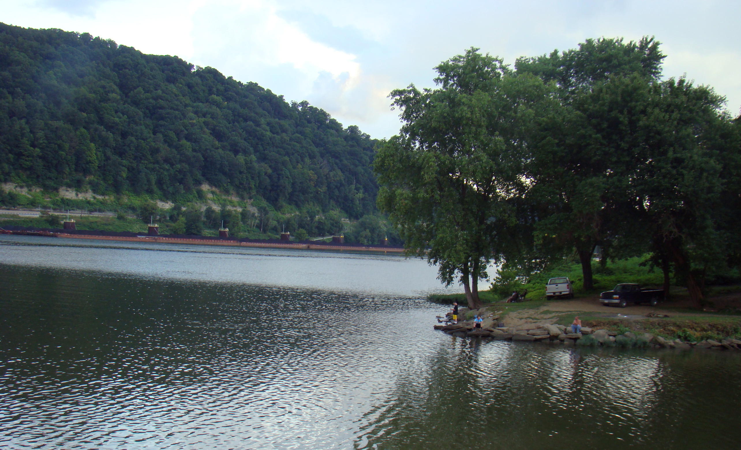
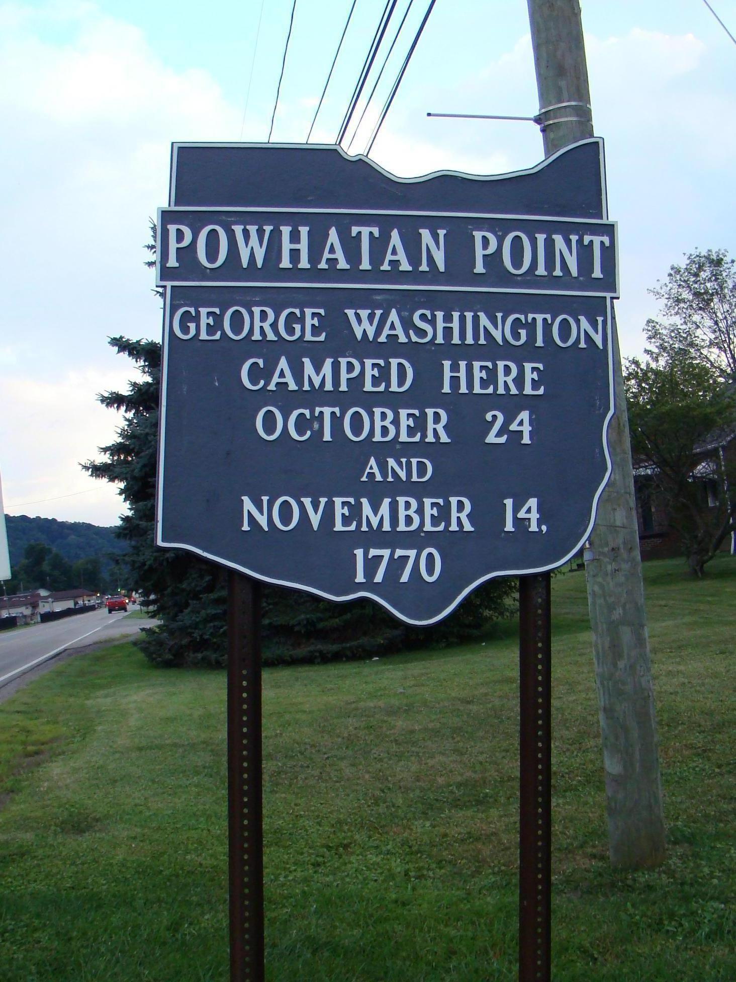
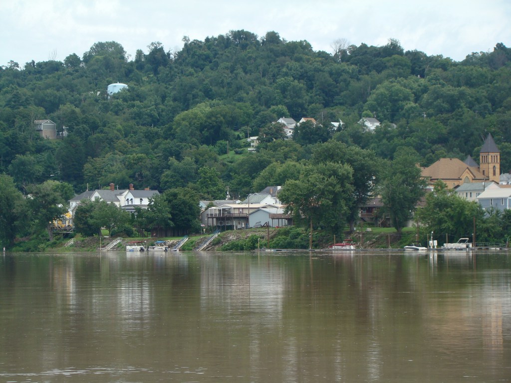
Sistersville’s rich history begins with George Washington really sleeping there in 1770 when he surveyed the Ohio Valley. In his journal, Washington called this stretch of the river “the Long Reach of the Ohio River.”  The river is broad and deep here with hills covered in trees for as far as the eye can see.

Charles Wells was the first to settle here permanently in 1802 naming his settlement Wells’ Landing. While Wells was primarily a farmer, he also served as a representative in the Virginia state legislature. He’s remembered for having fathered 22 children by two wives. Child 20 was named Twenty and 21 Enough. But Betsy came along as child 22.

When he died in 1815, Wells bequeathed the property that makes up much of the business district of the present town to two of his daughters, 17 and 18, named Sarah and Delilah. Each of the children received some property at this time.

The Wells sisters were good businesswomen and laid out the land into 96 lots with eight streets. The town is named for them, Sistersville.

The Sistersville / Fly Ferry still operates to this day across the Ohio River.

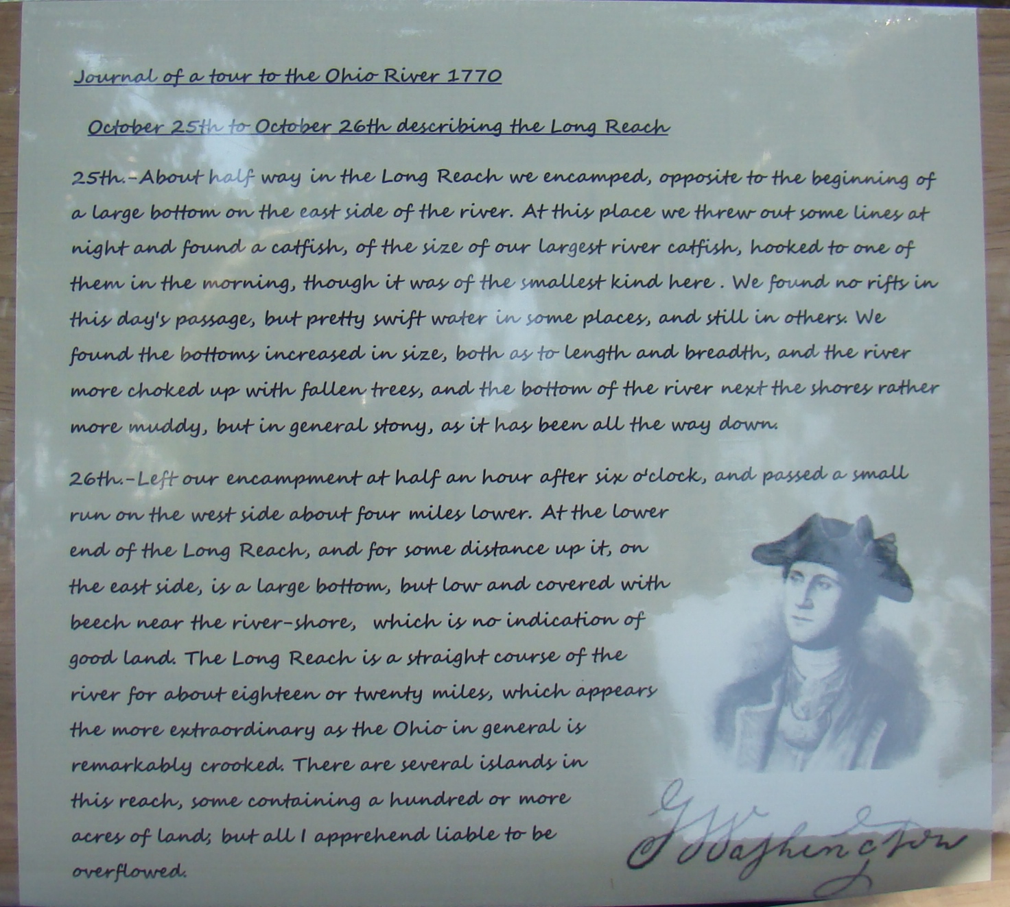
In 1817, the Sistersville Ferry was started to take passengers across the Ohio River to Fly, Ohio. It is the oldest ferry in West Virginia and continues to operate until this day.

Before the Civil War, a 51-man military unit, the Sisterville Blues was formed. However, when fighting began, some of these men joined the Confederate Army while others went to the Union Army.  The great-granddaughters of Charles Wells had to hide their Confederate flag behind the wallpaper in their dining room.

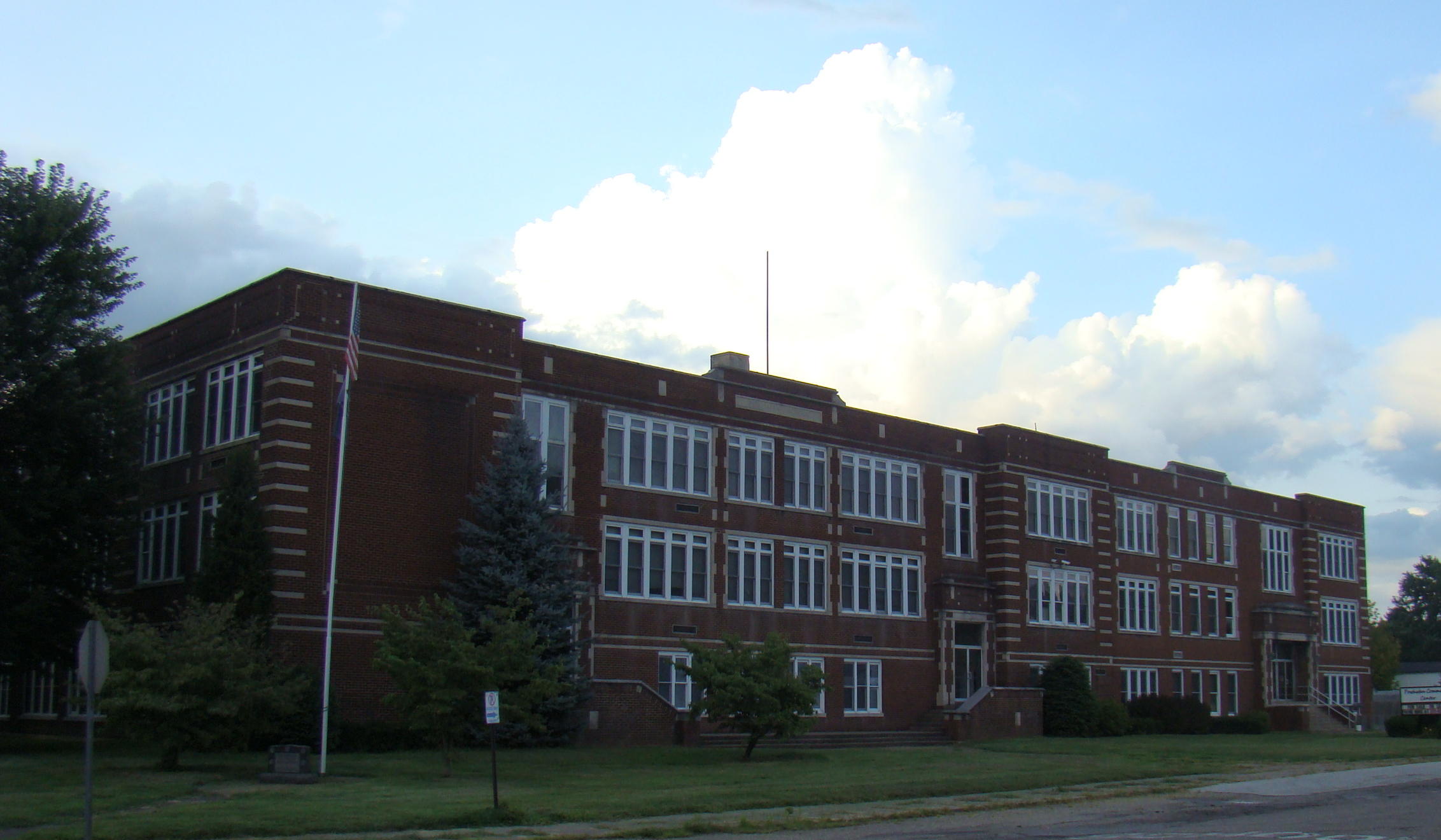
When the Civil War ended, Sistersville returned to its quiet farm community. Their first public school was built in 1869 at a cost of $4,000. School lasted only four months then with the teacher being paid  $30 a month.

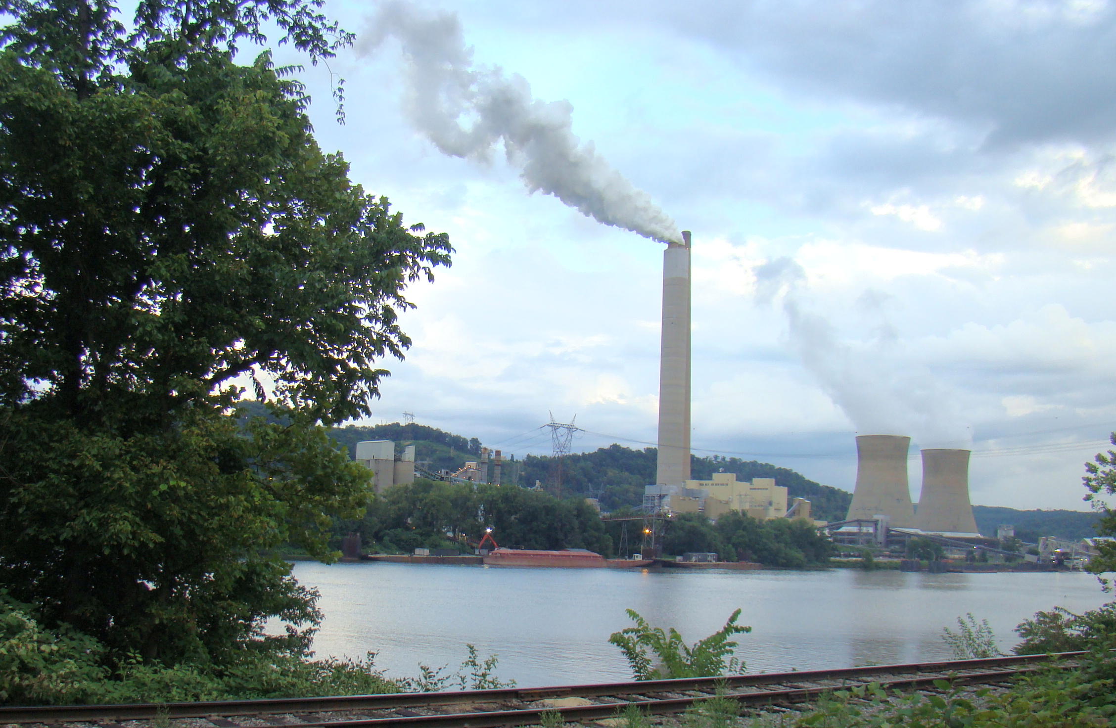
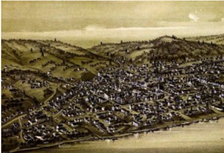
Peace and quiet came to an end in 1892 when oil was discovered in Pole Cat Hollow just up the river from Sistersville. Quickly, the Sistersville Oil Field began producing over 16,000 barrels of oil a day at 55 cents a barrel. This meant an increase in oil field workers and Sistersville boomed from a town of 600 to one of 12,000. Money flowed in that town as well as the oil wells.

The Big Moses Well is often said to be West Virginia’s greatest oil strike.

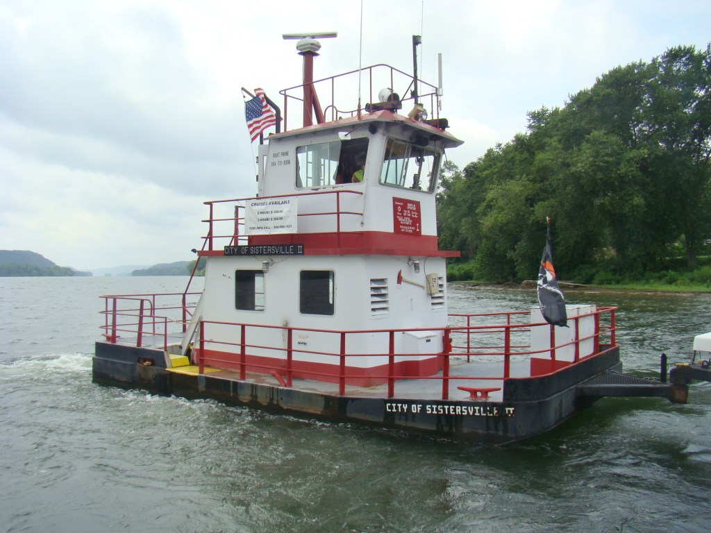
Twenty-two miles east of Sistersville, The Big Moses Well drilled on the farm of Moses Spencer is attributed as being the greatest oil well in W.V. Drilled in September 1894, it had a daily capacity of 100 million cu.ft. This well blew until December 1895.

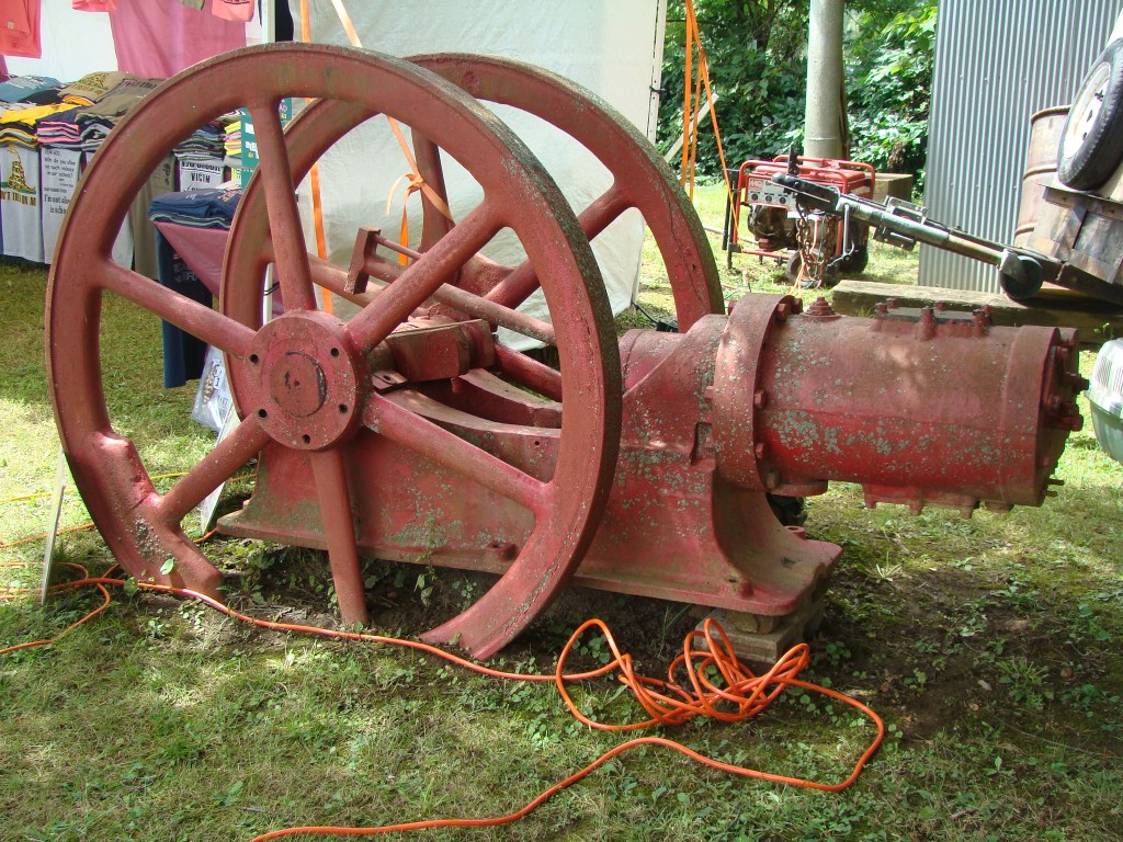
You can imagine all the businesses that opened for so many new residents. Banks, a newspaper, boarding houses and of course, saloons, gambling parlors and brothels, many of which were located on Sinner’s Boulevard. With this quick growth in population, many lived in houseboats called floating shanties along the riverbanks.  Others lived in oil field shacks, which cost about $500. The only inside plumbing was usually a cold water faucet in the kitchen with outdoor toilets on every property.

This is the Sistersville view from the other side of the Ohio River.

The well-to-do lived in beautiful homes and five of them are still in existence today in Sistersville on Main Street. As the city grew, new sections opened. Old Rough and Ready, Cow House, and Happy Hollow are a few of the descriptively named neighborhoods. A washerwoman’s house in Happy Hollow bore the sign “Men’s Working Clothes Laundered While You Wait.”

During the oil boom, Sistersville imposed heavy taxes on saloon keepers and gambling house owners. The city also offered bonds for sale to finance improvements. In 1890, water works and a sewer system were installed. All the streets and alleys were paved with brick. A trolley line was built to connect Sistersville with its neighbors, Paden City and New Martinsville to the north and Friendly to the south.

This shows the town of Sistersville during its boom days.

The boom days produced an interesting mix of residents. The original farmers, business people, oil field workers, hooligans, and prostitutes lived side by side among oil derricks and pumping wells. A city resident who was a child during these heady days reported that Madam Stoddard, proprietor of a “sporting house,” was loved by the town’s children. Every year when the circus came to town, Madam Stoddard had her butler round up all the neighborhood children and take them to see the show. The Madam also happened to be the sister of the chief of police.

More respectable forms of entertainment also grew. Private social clubs were formed such as the Americus Club, The Sistersville Music and Literary Club, and the “selective, exclusive” Sistersville Mandolin and Guitar Society.

In the 1890s, Sistersville had three thriving theaters: the Columbia, the Auditorium, and Olsen’s Opera House. The Columbia specialized in vaudeville, and the Auditorium could accommodate 1,000 patrons. For less than a dollar, a person could enjoy a performance by the Boston Lyric Opera Company. Silent film star Ben Turpin performed at the Comique, a nightclub.

The Wells Inn opened in 1895 to give food and lodging to the oil field workers.

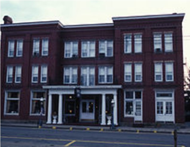
The Wells Inn was built in 1895 by Charles Wells’ grandson, Ephraim. It had 35 rooms, a bar, and a dining room. During boom days, when there were several hotels in Sistersville, the Wells Inn was considered the most elegant. Today it is the only hotel in town, and it has been nicely renovated.

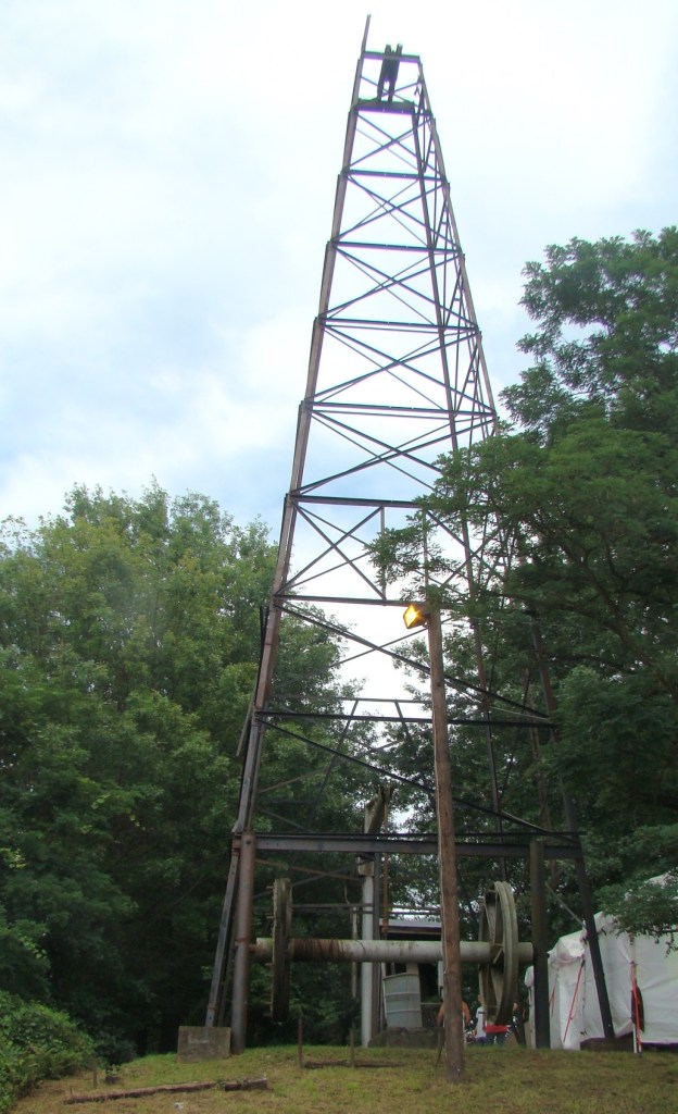
In 1911, the Little Sister well was drilled in the Big Injun Sand to a depth of 1481 feet and was in operation for many years. That derrick is being restored by Quaker State Oil Refining Corp. and The W.V. Oil and Gas Festival, Inc.

Today Sistersville has an excellent display of the Little Sister Well on the banks of the Ohio River. While visiting, you’ll want to be certain to take a ride on the Sistersville/Fly Ferry.

Advertisement

Fort Laurens – Only Revolutionary War Fort in Ohio Country

Fort Laurens Entrance

Fort Laurens is in Bolivar Ohio just minutes off I-77.

   Add a little history to your summer fun by visiting Fort Laurens near Bolivar. A Revolutionary War fort was built in Ohio back in 1778 by General Lachlan McIntosh on the banks of the Tuscarawas River. Fort Laurens was the only Revolutionary War fort built in the Ohio Country by the Continental Congress.

Fort Laurens Original Fort

This drawing captures the design of the original fort.

   Fort Laurens was named after Henry Laurens, the fifth president of the Continental Congress. The Americans built Fort Laurens with three purposes in mind.

Fort Laurens rifleman

Riflemen dressed in linen shirt and overalls helped build Fort Laurens.

   First, they hoped to use it as a base to attack the British garrison at Detroit Second, they hoped it would keep the American Indians, who were loyal to the British, from conducting raids against American settlers in eastern Ohio and western Pennsylvania. Finally, by offering protection to the neutral Christian Delawares, the Americans might convince them to forsake their neutrality and join the patriots’ cause.

Fort Laurens Men suffering in winter

That cold winter, men suffered at Fort Laurens in cold huts with little food.

   However, conditions were so cold during that first winter that most of the men were moved to Fort Pitt. Learning of the terrible conditions inside the fort, the British and a couple of hundred Indian warriors laid siege to the fort. The men inside the fort were reportedly reduced to making a soup broth of boiled moccasins. Two men snuck out and returned with a deer carcass. It is said that the men were so hungry they ate it raw.

   General Brodhead reported to General George Washington that the fort was too far from Detroit to stage an attack and not close enough to the Delaware Indians to offer protection. General Washington ordered the fort abandoned in August 1779.

Fort Laurens Picnic Shelters

Picnic shelters provide a great place for family gatherings.

   In July of 1887, Christian L Baatz visited the fort and became interested in preserving its history. Baazt with his friends Ed Pease and William Lowe became acquainted with landowner David Gibler. David and his brother had leveled the fort in 1853 for farming. 

   After much promotion on their part, in 1908 Ohio Archaeologists and Historical Society indicated they would like to purchase the land and create a state park. DAR and SAR also wanted to preserve the location for historical purposes.

Fort Laurens School Group

School groups participate in demonstrations to learn more about the history of our country.

   When nothing had been done for several years by these three organizations, Baazt, Pease, and Lowe drew up a petition to gather signatures to present to the Ohio State Legislature to create a proper memorial on the site. In 1915, legislation was passed to preserve the Fort Laurens site.

   It had only served as a fort for one year before it was abandoned in 1779. Part of the fort was destroyed during the building of the Ohio and Erie Canal. None of the original fort remains above ground, but the outline of the fort is still highly visible. The Ohio and Erie Canal Towpath Trail, an 80-mile long recreational trail, goes through the site today.

Fort Laurens Museum

The outline of the original fort can be seen in the vicinity of the museum.

   A museum tells the story of soldiers on the frontier. There is an informative video that you won’t want to miss telling the fort’s history. A display of archaeological items discovered during excavation is displayed in the museum.

Fort Laurens soldiers guarding tomb

Uniformed soldiers were present at the dedication of the Tomb of the Unknown Patriot.

   There is a Tomb of the Unknown Patriot of the American Revolution paying tribute to the unknown defenders of the fort. In 1976, the year of the bicentennial of the American Revolution, a special military ceremony was held to bury the remains of the first soldier excavated in 1973. Twenty-one men lost their lives there in the year it served as a fort and the remains of some of those men are in a crypt in the museum wall. 

Fort Laurens crypt

This crypt in the museum wall contains the remains of some of the men who lost their lives here.

   Events are held here throughout the year from February through December. Check their website for up-to-date events at www.fortlaurens.org . Almost every month they have an interesting speaker. In July, they will be talking about “Women of the Revolution” presented by Sharon Snowden of Ohio First Ladies Museum.

Fort Laurens Reenactment

Reenactments bring to life the conflict of Revolutionary War days.

   Revolution on the Tuscarawas: Revolutionary War Encampment and Reenactment takes place on July 18-19. Explore British and Continental camps to meet soldiers from both sides of the conflict. Children can enjoy musket drills, colonial America games and crafts throughout the day. Tickets must be purchased ahead of time for this event.

Fort Laurens Towpath Trail

This shady Towpath Trailhead leads to the Ohio & Erie Canal after a walk through an enclosed walkway over the interstate.

   Today Fort Laurens is managed by the Zoar Community Association and remains a special memorial to those who died during the Revolutionary War. While there, bring a picnic and enjoy a relaxing walk on The Ohio and Erie Canal Towpath Trail. The trail goes through a shady woods before crossing the interstate on an enclosed walkway. On the other side is part of that original Ohio and Erie Canal. You can walk the three miles to Zoar Village on the towpath trail if you have the time and energy.

   Add history to your summer adventures!

Fort Laurens is easy to reach off I-77 in Ohio. Take exit 93 for OH-212 W, then turn left on Mulberry Steet. Fort Laurens is on the left hand side. There is no admission fee to the grounds but a small fee for the museum.

Powhatan Point on the Ohio River

The Point on the Ohio River

The Point where the Captina Creek and the Ohio River meet

Chief Powhatan is memorialized here at the Point where the Captina Creek meets the Ohio River. The town laid out here in 1847 was named Powhatan Point in his honor. Captina Creek was the site of many Mingo, Powhatan, and Shawnee Indian camps in the late 1700’s, with exploration by famous white leaders such as Lewis Wetzel, George Washington and Ebenezer Zane.

Today the banks of the beautiful Ohio River provide a peaceful place to watch the barges float by, or relax with a fishing pole in hand in the cool of the evening.

Historical sign

Historical sign

When you enter town, an Ohio historical sign greets you. It states that George Washington camped at what is now known as Powhatan Point on October 24 and November 14, 1770. Some say that is the most important thing that ever happened in this small town, but there was more happening during the last visit.

Chief Powhatan was famous for his dealing with the Whites, but even before the Europeans came to this section of America, he had conquered 30 different Indian tribes. Later Chief Powhatan, with the chiefs from those 30 tribes, tried to recover their lands, which they felt had been stolen by the English and European immigrants.

Kandi's Chief Powhatan

Kandi’s Chief Powhatan

Since the town was named for Chief Powhatan, it seemed fitting for one West Virginia artist, Kandi Roche, to compose a modern day sculpture of the Chief for The Art Gallery at Powhatan Point Village.  The art gallery is situated at what they call “The Gateway to the Appalachias”. Kandi made an unusual Chief Powhatan statue, which was painted on plexi-glass, and left for the community to enjoy. This chief was the father of the famous Indian maiden, Pocahontas (1595-1617), who was a peacemaker to the first white settlers.

A beautiful fence covered with Native American tribal patterns greets you when you arrive at The Gallery here. Inside are paintings, pottery, glass and photography. Art classes have been available from time to time. Since this is a relaxed atmosphere, little is scheduled, but friends enjoy getting together along the river banks.

Community Center

Community Center and home to Christmas in the Village

Just down the street from the gallery is the abandoned Powhatan Point High School, which today has been turned into a community center. During the month of December, Christmas in the Village is held here. The 9th Annual celebration will be held in 2014 with crafts, food vendors, entertainment and of course, Santa. But if funds aren’t made available soon, this facility may be lost to the community.

Kammer-Mitchell Power Plang across the river from Powhatan Point.

Kammer-Mitchell Power Plant across the river from Powhatan Point.

Just south of Powhatan Point is the Kammer-Mitchell Power Plant providing electricity and employment for parts of Ohio and West Virginia. Today this American Electric Power (AEP) plant is partially shut down due to failure to meet EPA standards. They must convert their wet coal ash to a dry coal ash bed to return to full operation. This coal-fired plant has the sixth highest power plant chimney in the world.

Drive through our beautiful land and watch for pieces of history wherever you happen to visit. Every small town has its place in history, and Powhatan Point is no exception.

Drive along the beautiful Ohio River on Ohio Route 7 and you will come to the town of Powhatan Point, about fifteen miles south of  Bridgeport, Ohio.


A “Pleasant Point” Along the Ohio River

“A pleasant point” was the description given by surveyor, George Washington, when he arrived at the confluence of the Great Kanawha  and Ohio Rivers. Today the town that grew there is called Point Pleasant in West Virginia. The beautiful Riverfront Park is a pleasant surprise here and a wonderful place to take a leisurely stroll with the Ohio River on one side and large murals depicting the town’s history on the other.You can glimpse the Silver Memorial Bridge close to  the point where the Great Kanawha River joins the Ohio River near the end of the Riverwalk in the State Park, Tu-Endie-Wei, which adjoins.

The Ohio River peacefully flows carrying boats of various sizes for many purposes.  There are coal barges, speedboats, riverboats, and luckily this day the spectacular American Queen, the largest steamboat even built in the world. Built in 1995,  this beautiful riverboat is a  six-deck re-creation of a classic Mississippi Steamboat.  Its flat-bottomed style makes it possible to even continue if the waters become shallow.

Murals are painted on the floodwalls flanking the Ohio and Kanawha Rivers representing scenes from the Battle of Point Pleasant as well as other pieces of Point Pleasant history, including the Indian settlements of earlier days. Each large mural, measuring from 100-250 feet long, has one single monumental scene painted by artist Robert Dafford. His murals can be found in several cities along the Ohio River from here at Point Pleasant, West Virginia to Paducah, Kentucky.

One depicts the 19-year old George Washington surveying the wilderness where he met Benjamin Franklin and some land speculators, who were founders of the Great Ohio Company. This group intended to found a new colony called Vandalia that would have encompassed most of today’s West Virginia and Kentucky.  What a surprise to learn that on the eve of the American Revolution, there were thoughts of creating a fourteenth colony with Point Pleasant as its capital.

On the other side of the murals is the historic Lowe Hotel, the largest landmark in Point Pleasant. Built in 1901 of Cleveland Berea stone and red brick, this monument was originally called the Spencer Hotel in honor of J.S. Spencer, friend and financial backer of the Smith brothers who owned the hotel.  At that time, traffic on the Ohio River was heavy, so a place to spend the night became an important attraction at Point Pleasant.  Today that  hotel is said to be haunted by guests who decided not to check out, one of those being Captain Jim who is waiting for his steamboat.

Two unusual metal statues of Chief Cornstalk and Colonel Andrew Lewis caught my eye along the Riverwalk. These were the two combatants in what many say was the first battle of the Revolutionary War…the Battle of Point Pleasant. The Virginia Militia led by Andrew Lewis defeated Chief Cornstalk, the Shawnee leader, and his braves, thus preventing the Native Americans from forming an alliance with the British. This in turn had a major influence on the outcome of the War of Independence. Their statues are located in front of a mural depicting the Battle of Point Pleasant in 1774.

By late afternoon, the American Queen paddlewheels begin turning and the riverboat slowly, almost magically, floats away from the shore. Calliope music fills the air and seems to take one back in time to a happier, more peaceful way of life. This is a great spot to sit down in a swing and watch the river and your cares drift away.

The Riverwalk at Point Pleasant, West Virginia is located just a half block from Main Street and of course, along the Ohio River. Frequent festivals throughout the year are held here and it is often a stopping point for riverboats. 

American History Shall March Along That Skyline

Six Grandfathers Mountain, now known as Mount Rushmore, was spiritual home to the Lakota Sioux Indians. Many of the Sioux were insulted by the building of the Memorial on their sacred land. Add to that the fact that the monument celebrates the Europeans, who killed so many of their tribesmen as well as appropriating their land, and it is no wonder there is still controversy between the Sioux and the US government today.

As far back at 1923, the people of the Black Hills region of South Dakota were searching for an idea to bring tourists to their part of the country. After seeing samples of carvings done by Gutzon Borglum, he was invited by historian Doane Robinson, The Father of Mount Rushmore, to the Black Hills so they could find an acceptable place for a large carving.  After dismissing the idea of using the Needles range, they settled on the granite faced Mount Rushmore near Keystone, South Dakota. The granite was relatively free of fractures, and it also faced southeast for more sun exposure. When the selection was made, sixty year old Borglum remarked, “American history shall march along that skyline.”

For one hour each evening, Mount Rushmore, The Presidents’ Mountain, is illuminated with steadily increasing lights that make this carving glow in brilliant splendor. The four presidential faces shown on this 1989 postcard are from left to right: George Washington, the father of our country; Thomas Jefferson, principal author of the Constitution, and instrumental in the Louisiana Purchase; Theodore Roosevelt, champion of conservation; and Abraham Lincoln, leader during the Civil War.

Today we can see the results of Gutzon Borglum’s  guidance of approximately four hundred workers, including his son,  from 1927-1941.  The four sixty foot likenesses of the faces rest on 1,278 acres. Original plans were to sculpt them down to the waists, but that idea was cancelled due to insufficient funds. Upon his death, Gutzon’s son, Lincoln Borglum, was in charge of completing the project, but he basically left it as the monument appeared upon his father’s death.

Today you can visit the Lincoln Borglum Museum where a film provides an introduction to the memorial site plus historic exhibits.  Take a lunch break at Carvers’  Cafe where you might find on the menu tasty dishes such as Jeffersonian Gourmet Salad or Teddy’s Bison Chili. If you are lucky, you can sit at a table by the large wall of windows, which provides a great view of Mount Rushmore. The Sculptor’s Studio displays the unique plaster models used prior to sculpting on the mountain side, as well as the tools used while carving. A recent addition is the Native American Heritage Village devoted to Indian culture and the Indians’ place in local history.

For another close-up view of the mountain, take the scenic chairlift ride through the Ponderosa pines. Views are spectacular and there is a park at the summit as well as a small outdoor grille.  You must be careful getting on and off as the chairlift stops for no one.  You do get a unique view of the presidential faces as well as enjoying the feeling of flying up the mountainside on the chairlift. Coming down you can either return on the chairlift or descend on the Alpine Slide.  This new slide is 2000 feet long and you are able to control the speed downhill on a wheeled sled with brakes. So it is up to you!  Either take a slow and leisurely ride down, or get a rush of excitement.

On the side of the mountain behind the faces is an interesting tunnel called the Hall of Records. In 1998, they began construction of a vault there that would hold sixteen porcelain enamel panels.  On these panels are: text of The Declaration of Independence, Constitution, biographies of the four presidents, and a short history of the United States.  All this is being done to preserve our present history for future generations. At this time, the Hall of Records is not accessible to the public.

Here at Mount Rushmore, you and your family can have a great educational experience by learning about the Indian heritage as well as the significance of the four faces carved there. Leaving the park, there was an interesting view from the back road where it appeared that George Washington was keeping watch on everything with eyes eleven feet across. The pupils of each eye are made of granite so they appear to twinkle when the sun hits them.  Maybe that is the reason the eyes seem to follow you!  Join the nearly three million people who visit here each year to see the faces march along the skyline.

Mount Rushmore Memorial in western South Dakota can easily be reached off I-90 off Exit 57 to Highway 16, which goes to Keystone. At Keystone take Highway 244 to the Mount Rushmore entrance. 

Tag Cloud