Places to go and things to see by Gypsy Bev

Archive for the ‘Back Roads’ Category

School Is In The Air
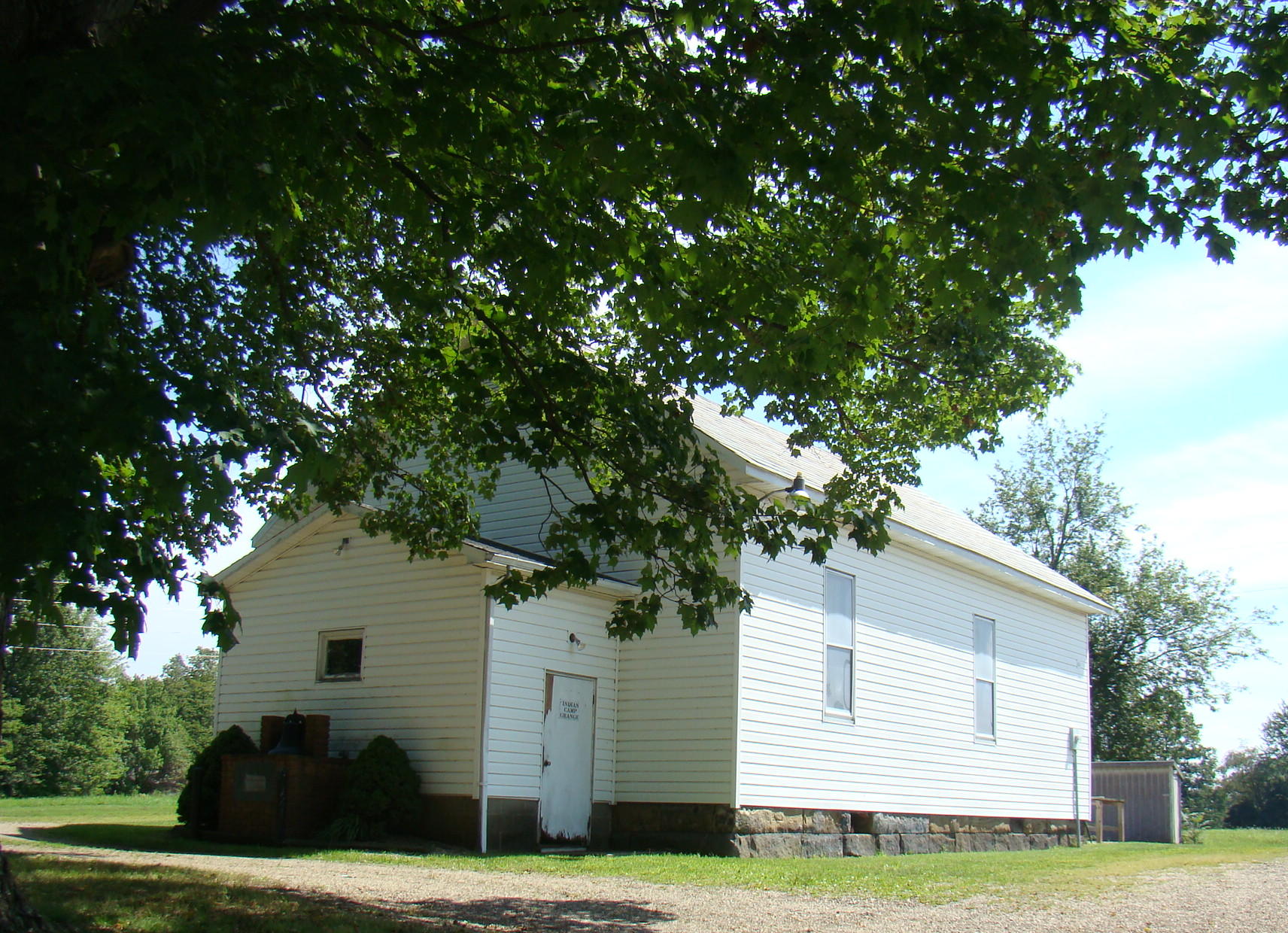
Hopewell One-Room School at Indian Camp

Hopewell One-Room School at Indian Camp

The cool morning air whispers Time for school. Memories flood back of days at a one-room school in Indian Camp. All eight grades were in one room so students helped each other climb the ladder of learning. Perhaps today is the perfect time to take a road trip leading back many years ago to Hopewell School. Chances are someone you know, or even you, yourself, have attended a similar school.

After driving the winding roller-coaster road of State Route 658 northwest of Cambridge, Ohio, the old school brings a smile. Those sturdy sandstone foundation blocks remain intact where so many students received building blocks for their lives from 1905-1955. Today the school is kept in repair while being used by the Indian Camp Grange, 4-H club, Hopewell Homemakers and once a year, the Hopewell One-Room-School Reunion.
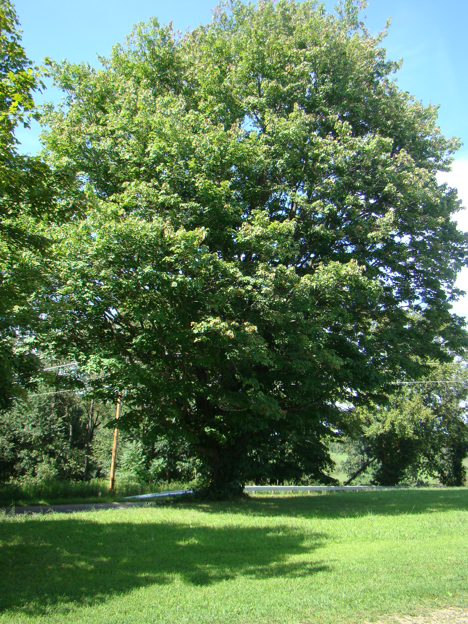
Favorite Recess Tree

Favorite Recess Tree

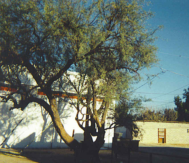
The trees have grown noticeably larger in front of the school.  Their branches provided the perfect places to sit while watching others play on the large surrounding field, or sharing secrets with your friends. In the absence of playground equipment, students played hopscotch at the top of the drive, baseball behind the school, or Annie Annie Over across the roof.

Children from miles around arrived at Hopewell School by bus, horseback, bicycle or walking. On the first day of school they proudly carried their yellow Big Chief tablet and a pencil or two. If they were lucky, they might have a box of eight new Crayola Crayons and Elmer’s School Paste.  Those scents still stir up memories.
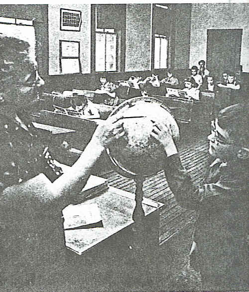
Teacher, Mrs. Mary Clark, uses the globe to explain geography.

Teacher, Mrs. Mary Clark, uses the globe to explain geography  during the 1950’s.

Inside the building, the pot bellied stove and the old desks are gone. The teacher or a student who lived close by came early in the morning to get the room warm for students. During the day, the boys took turns filling the coal bucket at the coal shed behind the school. Many boys volunteered for this chore and took their time, some even sneaking a smoke in the coal shed. But other things are still the same. An original blackboard still has initials carved in it, and the closets where coats and lunches were kept are exactly as they were years ago.

Lunches were brought in either a paper bag or a metal lunch box, which might last for several years. A personal favorite had a picture of Roy Rogers riding Trigger, and it even had a thermos. Lunch might include a bologna sandwich, boiled potato, dill pickle, and on special days, a thermos of homemade soup.

Since there was no water on the grounds, the boys carried water from a near-by house. After it was poured into a large keg at the back of the room, students would use a dipper to get a drink – everyone using the same dipper and no one getting sick!  No water also meant outdoor toilets with a rather unpleasant smell, flies, and even an occassional varmint.
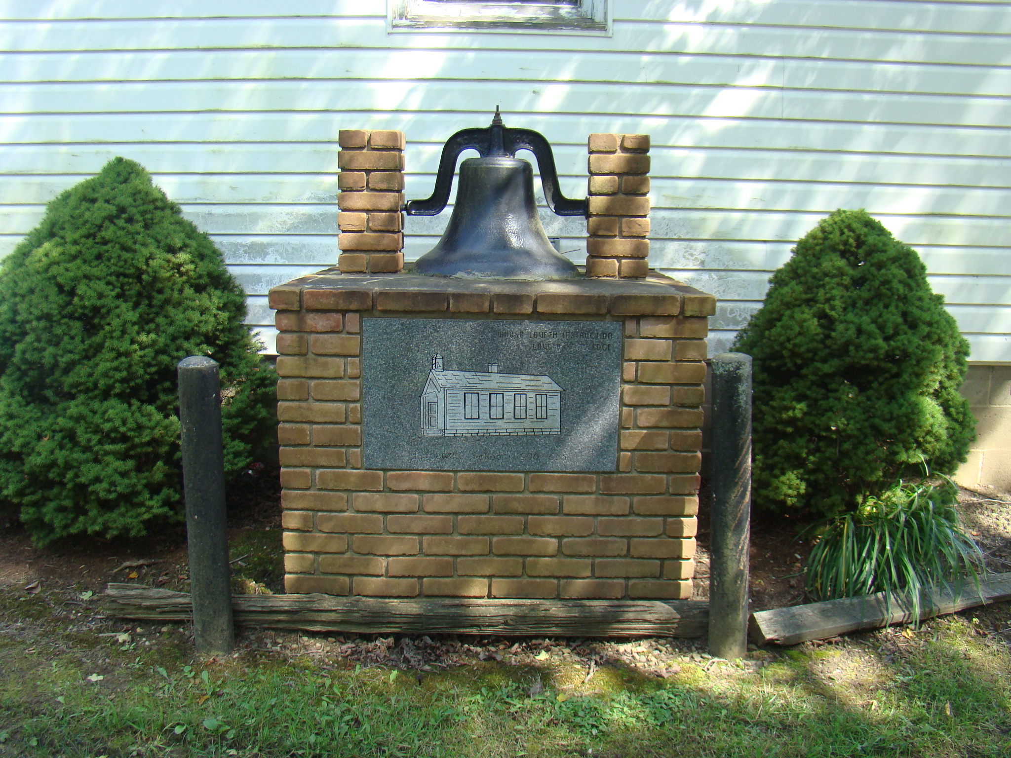
Original Bell at Hopewell School

Original Bell at Hopewell School with picture of school “Whoso Desireth Education, Desireth Knowledge”.

In 1994, former students constructed a brick base with a picture of old Hopewell School engraved on a plague and words that expressed the aim of the school: “Whoso Desireth Education, Desireth Knowledge”.  At the top of the base sets the school bell that called students to school in the morning, and reminded them that it was time to return to the classroom after recess. Students didn’t always stay on the grounds during recess as some went to Gerty’s Store just down the road, or in winter time might be sledding on the neighboring hills of the Cowden family farm. This bell is a beautiful heritage to the people that have received their education here, and also to their children for generations to come.

In spite of all the old-fashioned ways, lessons were learned and life-long friendships were developed. The one-room school was the perfect place to be taught the 4 R’s – Reading, ‘Riting, “Rithmetic…and Respect.

If you would enjoy a trip to the country to see Hopewell School, follow State Route 209 west from Cambridge, Ohio through Browns Heights. After a couple of miles, turn right on State Route 658 and continue until you reach the town of Indian Camp. At the north end of Indian Camp make another right hand turn on Mt. Herman Road. You are there!  
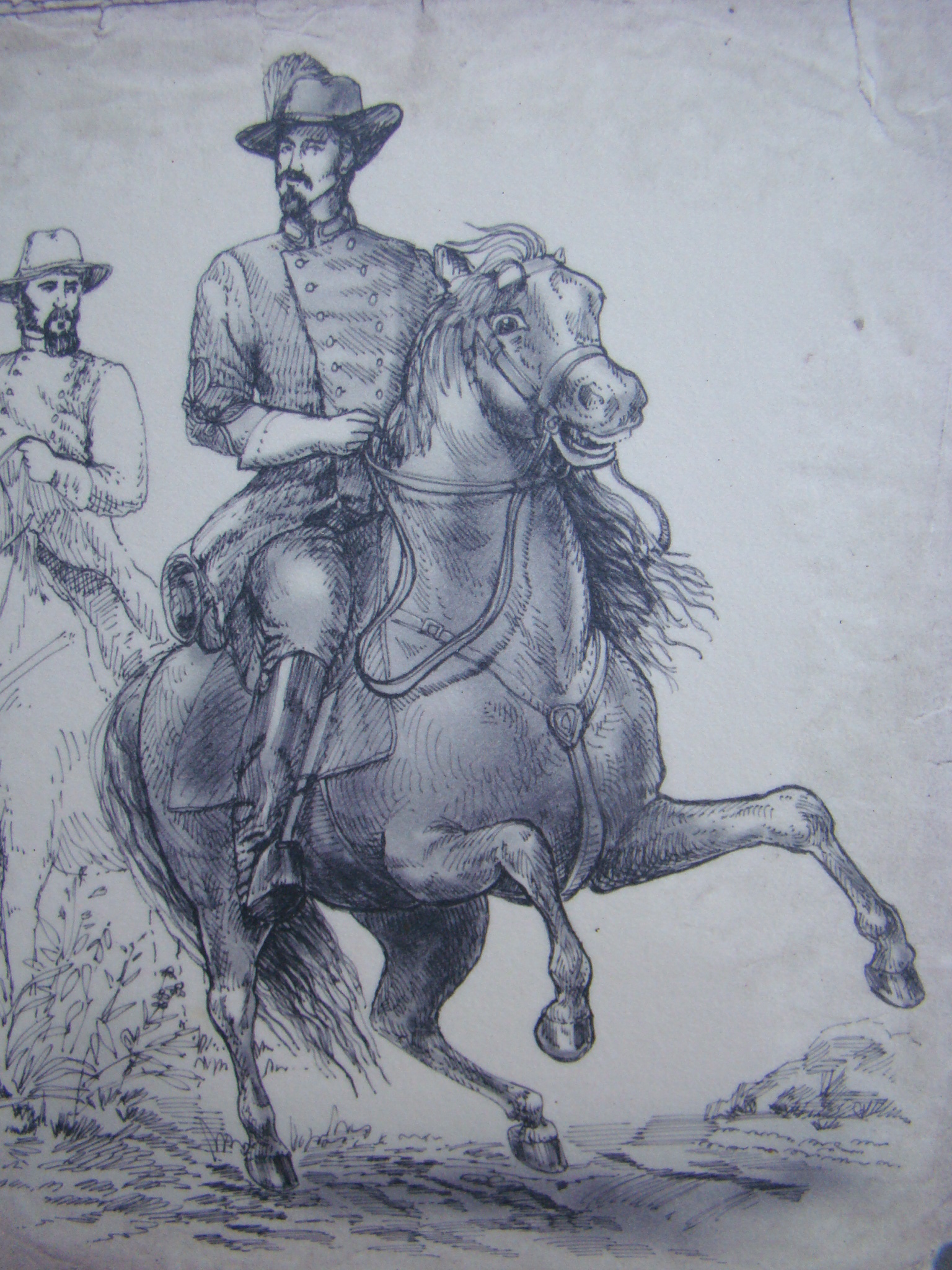
Following Morgan’s Raiders Trail 150 Years Later

Sketch of Brig Gen John Hunt Morgan

Sketch of Brig Gen John Hunt Morgan

During the Civil War, 150 years ago in July of 1863, Brigadier General John Hunt Morgan led a band of scoundrels, known as Morgan’s Raiders, through Ohio on a two week expedition consisting of many raids and robberies. Their purpose was to create terror and deviate the attention of the Union troops from Confederate forces.

The Ohio Historical Society has commemorated that John Hunt Morgan Heritage Trail with 56 interpretive signs from Cincinnati to West Point in northeastern Ohio. Official dedication took place at the entry point into Ohio at Harrison in July of 2013, although planning has taken several years.

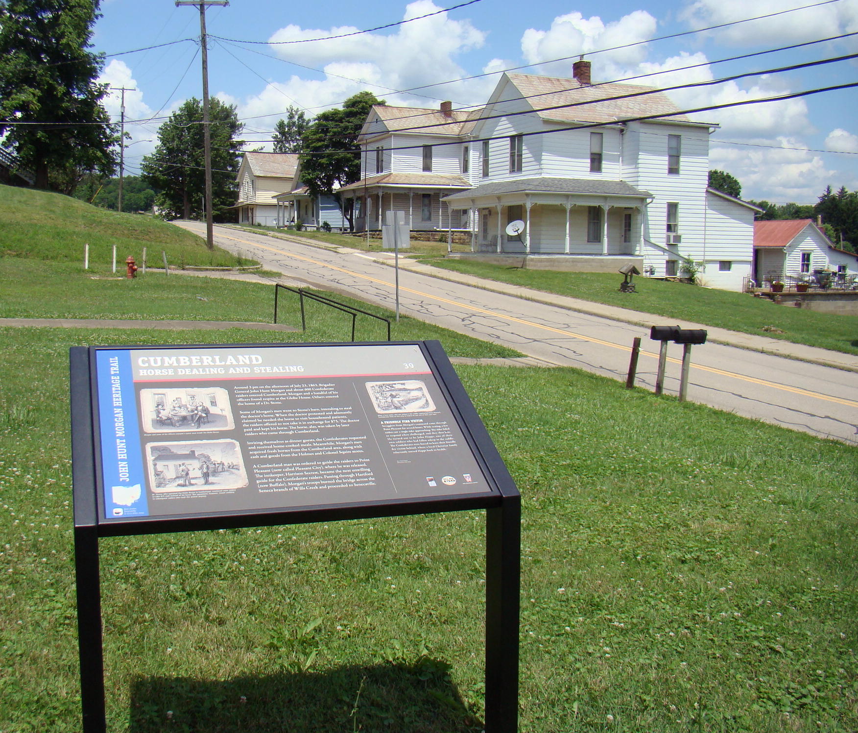
First Morgan's Trail sign in Guernsey County at Cumberland, Ohio

First Morgan’s Trail sign in Guernsey County at Cumberland, Ohio

Wanting to explore the local side of this route, my drive began in Cumberland, Ohio, which is the first place in Guernsey County, my home county, that Morgan’s Raiders appeared. Here in front of the old Cumberland High School is plaque #39, which begins the local trail of clever escapes by Morgan. Having invited themselves as dinner guests, Morgan’s men stole horses, cash, and even a guide before heading on to Point Pleasant (today’s Pleasant City).

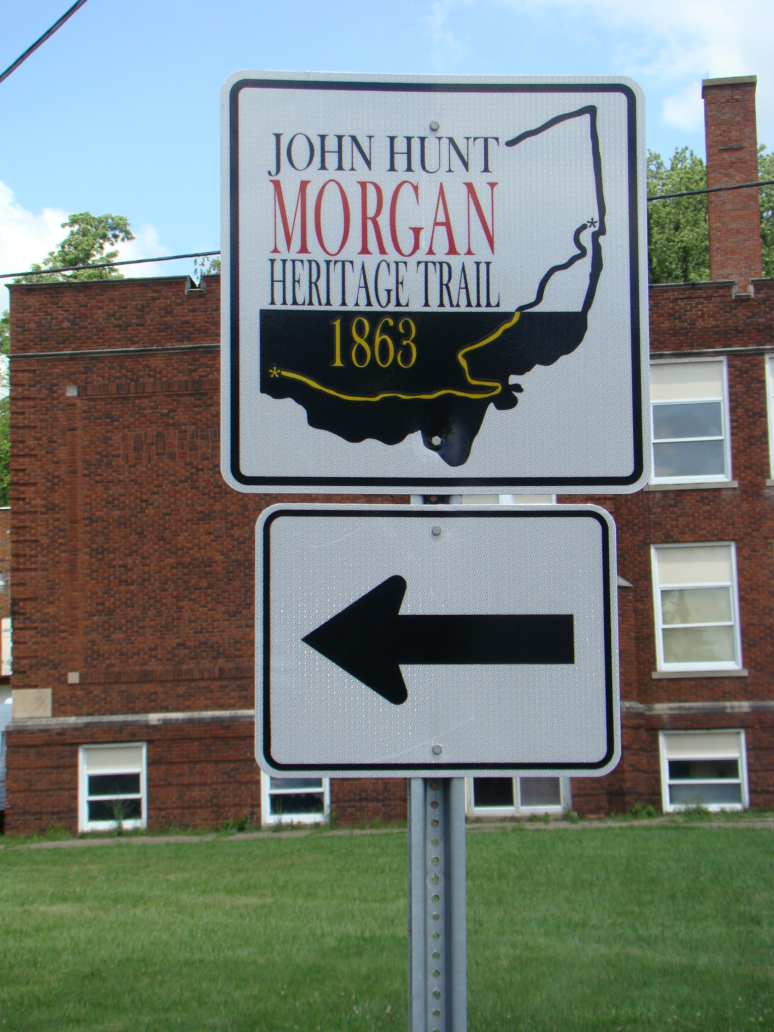
Watch for signs like this to follow the trail easily.

Watch for signs like this to follow the trail easily. Former Pleasant City High School sits in the background.

Morgan’s Trail is well-marked with signs at frequent intervals so you can rest assured you are still on the correct route. Stories on the plaques tell about real events that happened near each marker and all contain a couple beautiful old pictures from Civil War days. Each sign also explains, in the lower left hand corner, the location of the next commemorative stop

At the corner of State Routes 313 and 285 in Senecaville, followers will find plaque #40. On July 24 at 3 am, Morgan’s men rode into the village boldly knocking on doors to find out local road information. Lucky for Morgan, Colonel William Wallace of the Ohio Infantry had received an erroneous report and hours earlier had moved from that very crossroads. Ever since the battle at Buffington Island, Brig. Gen. James Shackelford had been in hot pursuit of the Raiders and seemed to be closing the gap.

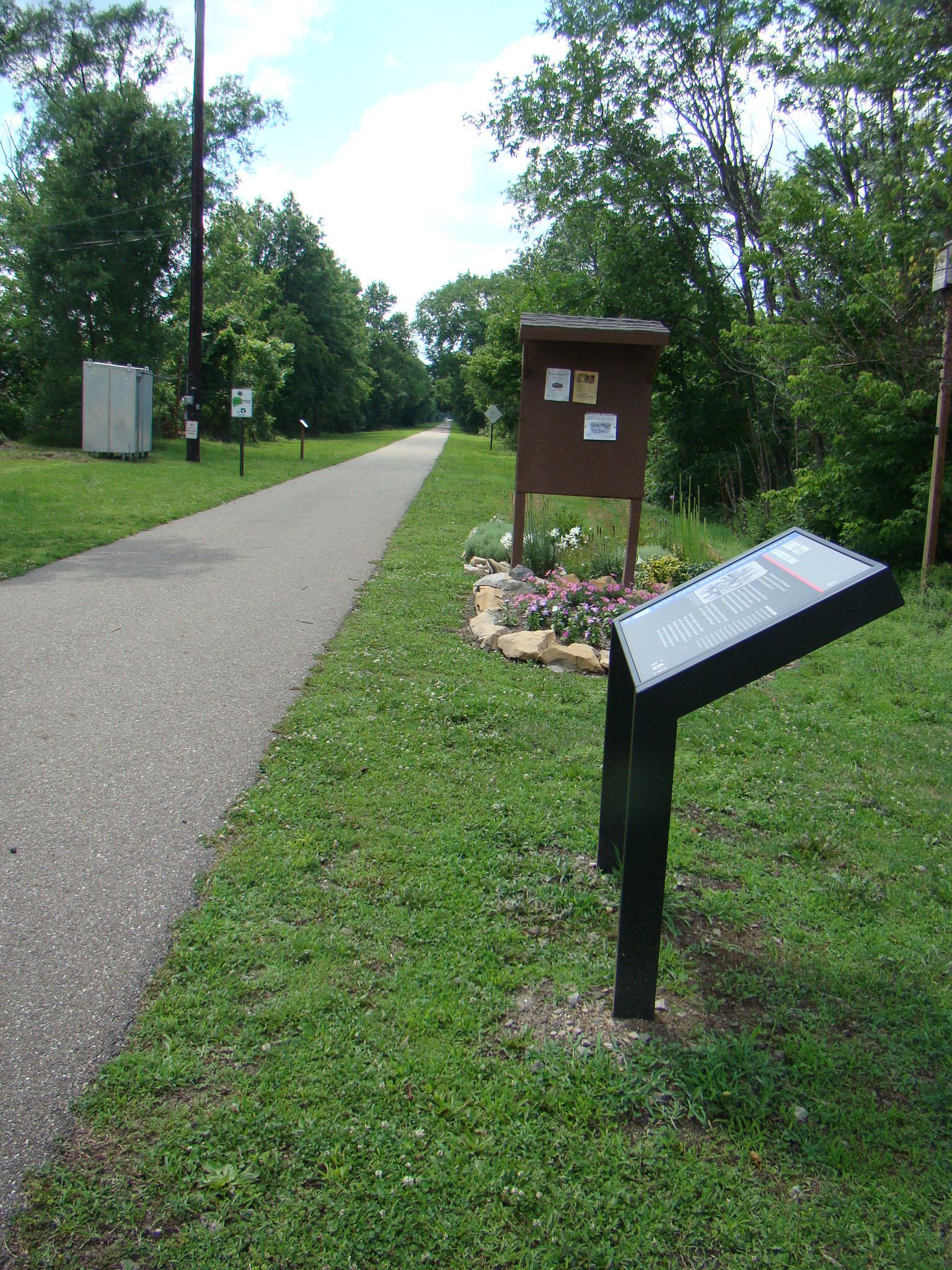
Interpretive sign #41 at Lore City trailhead.

Interpretive sign #41 at Lore City trailhead.

Campbell’s Station (today’s Lore City) had the most destruction of any place in Guernsey County with Shackelford being only seven miles behind. Located at the trailhead of the Guernsey Trail, #41 plaque area was the only one in Guernsey County that had been expanded with other information about the history of that area, as well as beautiful flowers.

At the edge of town on Old Mill Road, the battle at Washington (today’s Old Washington) is recognized. Sign #42 is near Cemetery Hill where Shackelford’s troops began firing on Morgan’s Raiders, who had spent the night in Washington. The officers had moved in, unwanted, to the American Hotel while others slept throughout the town, even in the streets. It came as a surprise that the plaque was not downtown with the 1927 monument to this skirmish.

Those four stops mark the route through Guernsey County, then the Trail guides you on toward Piedmont. By now you are beginning to get caught up in the thrill of the chase and to understand the lay of the territory they are crossing. Winding roads follow the Trail as best they possibly can, but Morgan’s Raiders attempted to travel through the woods quite often so the route is close, but can’t possibly be perfect.

Imagine the surprise and fear when up to 2000 Confederate soldiers arrived in one of these small towns along the way.  No wonder the unruly children were disciplined with the phrase: Morgan will get you!

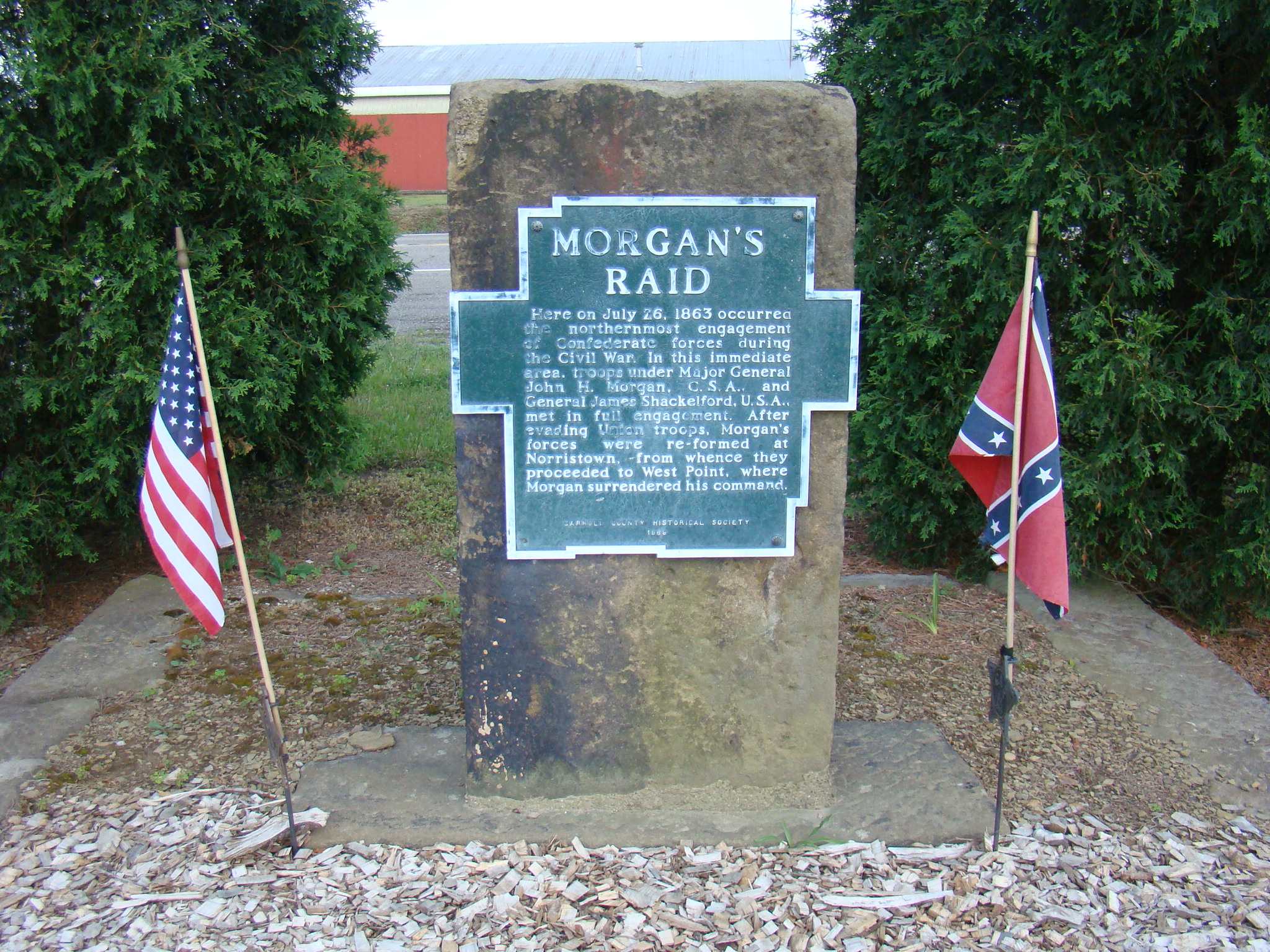
Monument to honor Morgan's Raid erected by Carroll County Historical Society in 1868.

Monument to honor Morgan’s Raid erected by Carroll County Historical Society in 1868.

My original plan had been to follow Morgan’s Trail just through Guernsey County, but once caught up in following Morgan’s Raiders, it was impossible to stop before reaching the spot where Morgan was captured. Being led through Harrison, Monroe, Jefferson and Carroll counties, the posted signs by the Ohio Historical Society were  easy to follow.

With troop numbers diminishing at each spot, Morgan continued to use clever escape tactics as long as he could.  The Raiders might pretend to be Union soldiers, stir up dust to hide themselves, or give promises they could never fulfill.

The last few marked encounters led through rugged, gravel roads. As you slowed down on these rutted and often muddy roads, you could almost feel the weariness of the troops.

End of Trail near West Point, Ohio

End of Trail near West Point, Ohio

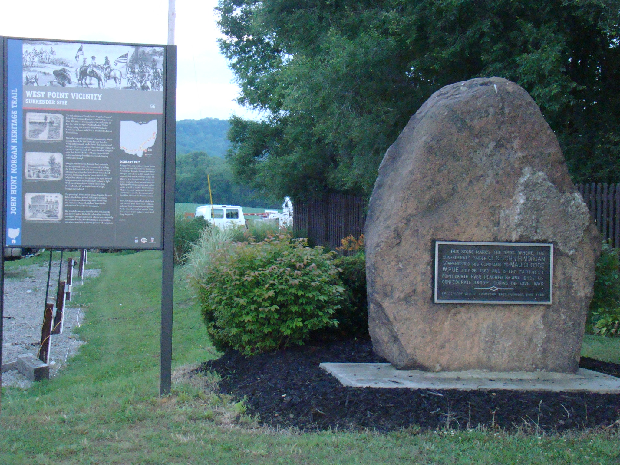
Finally, Morgan’s Trail, with plaque #56 entitled West End, came to an end in someone’s front yard where a monument had also been placed years ago. Morgan had tried his best to get back to cross the Ohio River and he was getting so close. Minutes later, I saw the beautiful Ohio River and felt a little sympathy for Morgan’s never reaching it.

The Heritage Trail from Cumberland to West End took Morgan’s Raiders four days from July 23 – July 26. By car, it took about eight and a half hours and I didn’t steal any horses, demand any dinners, or burn any buildings. They must have been worn out to have covered all that territory so quickly on horseback.

Even though he was captured for the moment, his cleverness helped him escape prison and travel unknowingly with a Union soldier on a train back home. Despite the chaos and destruction left behind, he taught the importance of never giving up in your quest to reach a goal.

Autumn Sunday Drive in Beautiful Ohio

“Want to take a ride?” Those were familiar words growing up, as my father always enjoyed a drive through the country, at any season of the year. While mom always went along, she never enjoyed them as much as father and daughter. Since we liked to explore all the back roads, mom came to calling us “gypsies”. The passion for exploring has never left, so now you know a little background for my blog, Gypsy Road Trip.

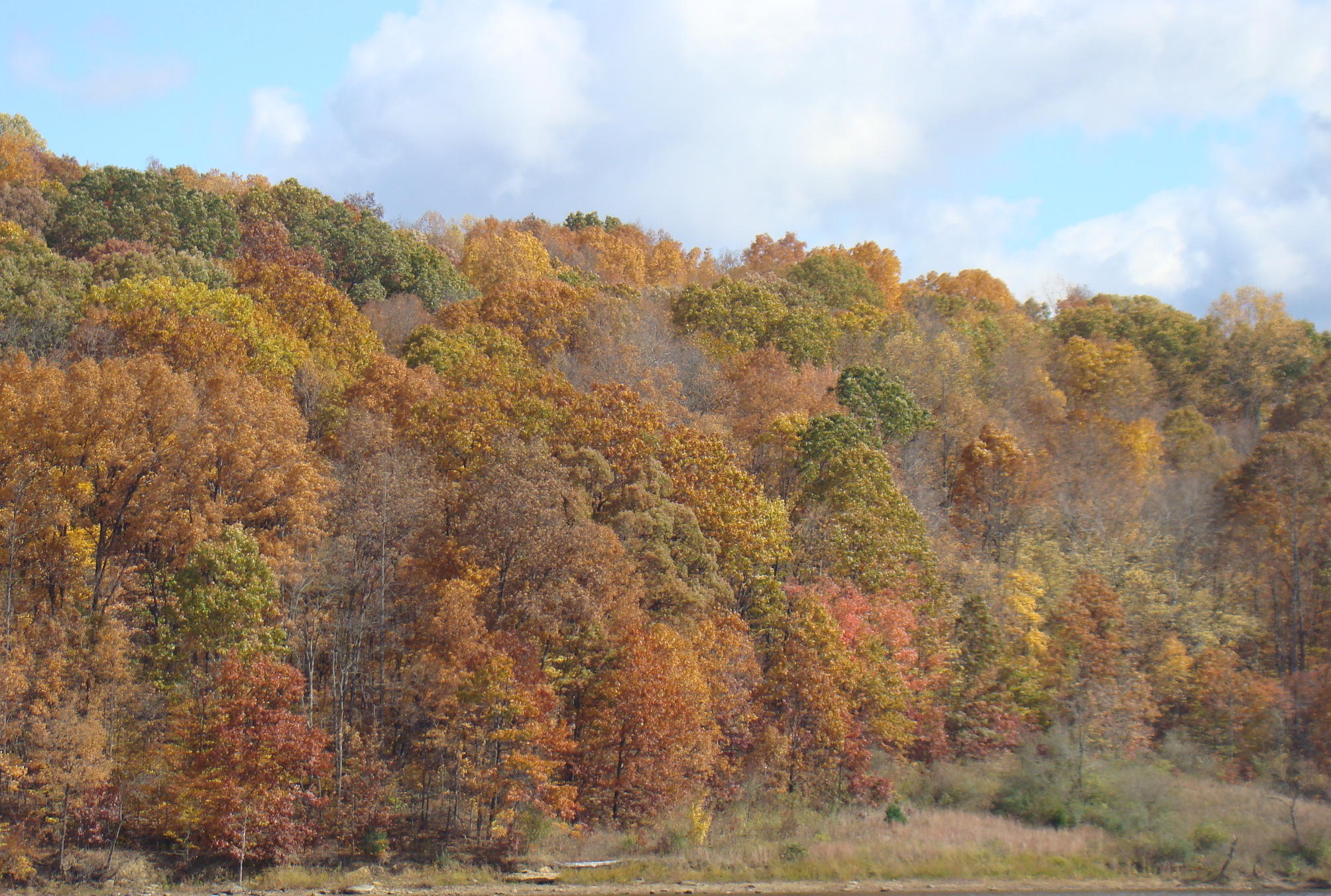
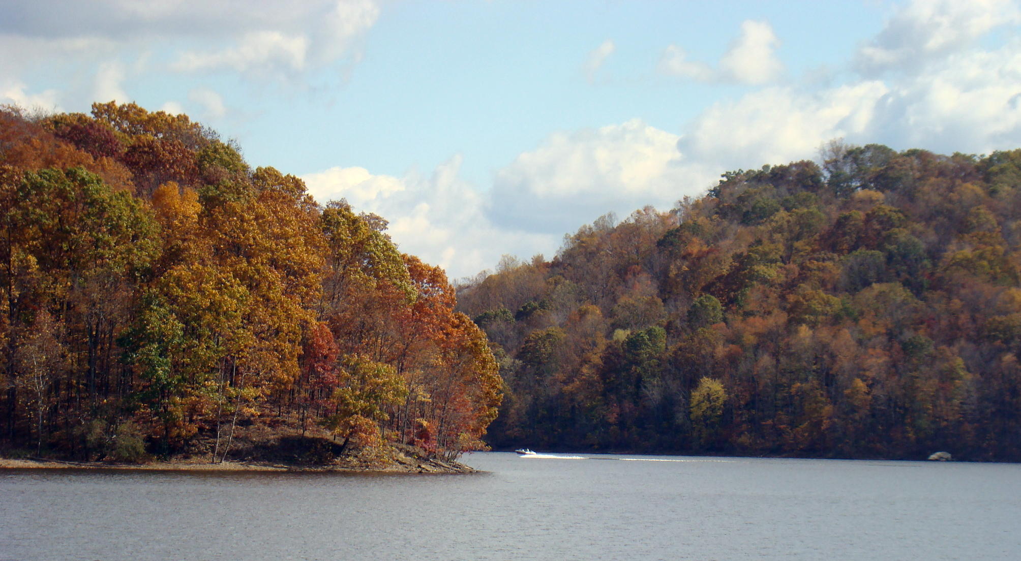
This beautiful autumn Sunday Drive in the hills of  Southeastern Ohio began at the dam of nearby Salt Fork Lake.  With fluffy clouds in a bright blue sky, the shades of autumn leaves were reflected off the calm lake. Tranquility surrounds you here interrupted only by the distant sound of a speedboat sliding through the waters. Sit and soak in the sun and grab some fresh ideas floating through the air.

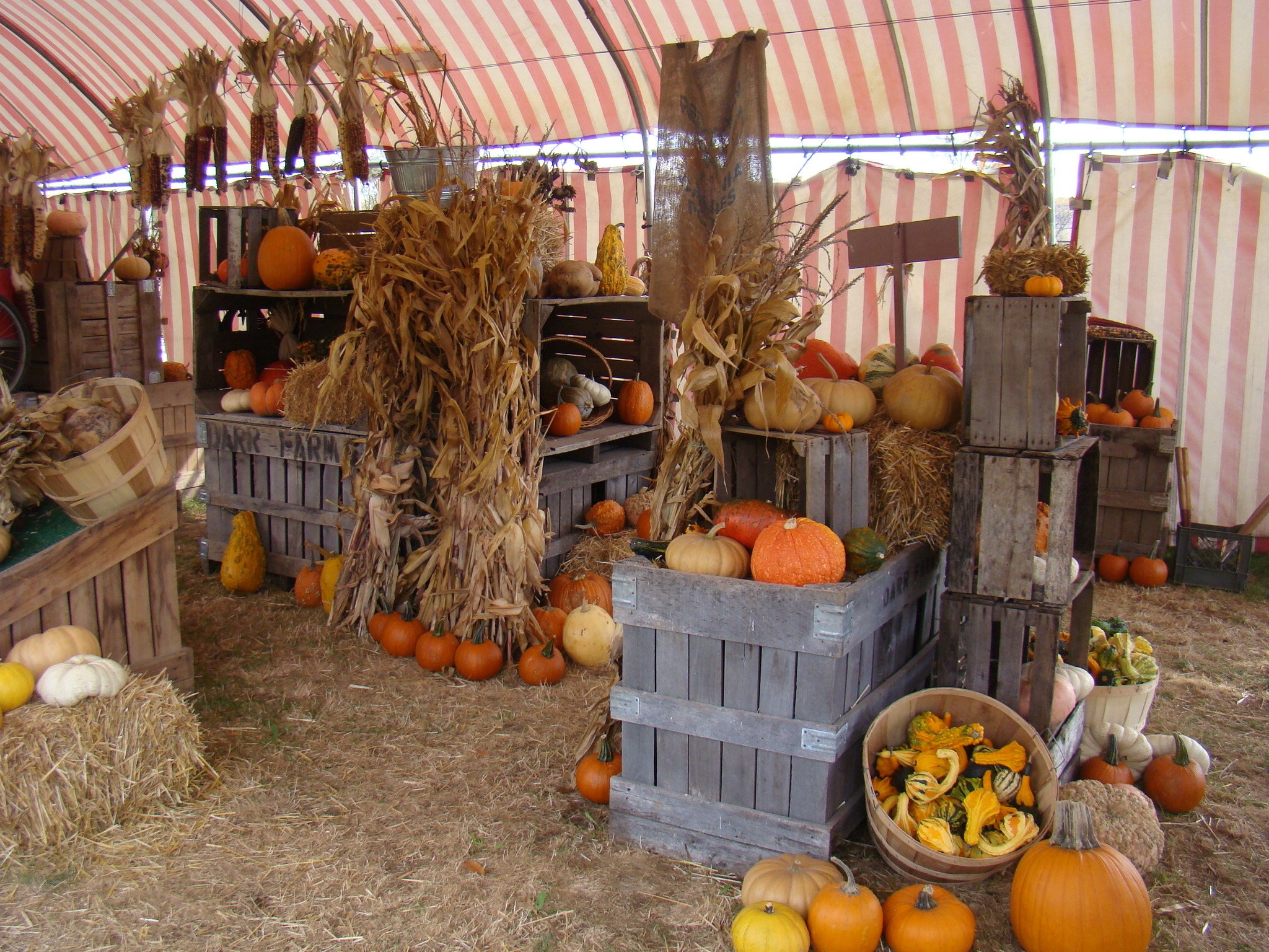
Sunday Drives are aimless ventures and who knows where the next random turn will lead. Along the side of the road the autumn colors catch your eye where a large red and white striped tent is fall home to Center Creek Farms. Here families  stop to let their children explore the scarecrows, pumpkins, and wagons that are all part of the fall scene. There is even a pick-your-own pumpkin patch so everyone can see pumpkins at their various stages from green to orange. No roadside stand at this time of year would be complete with out apple cider, preserves and honey. Bought a jar of local raw honey as it’s always good to ward off a cold when a sore throat first starts to develop.

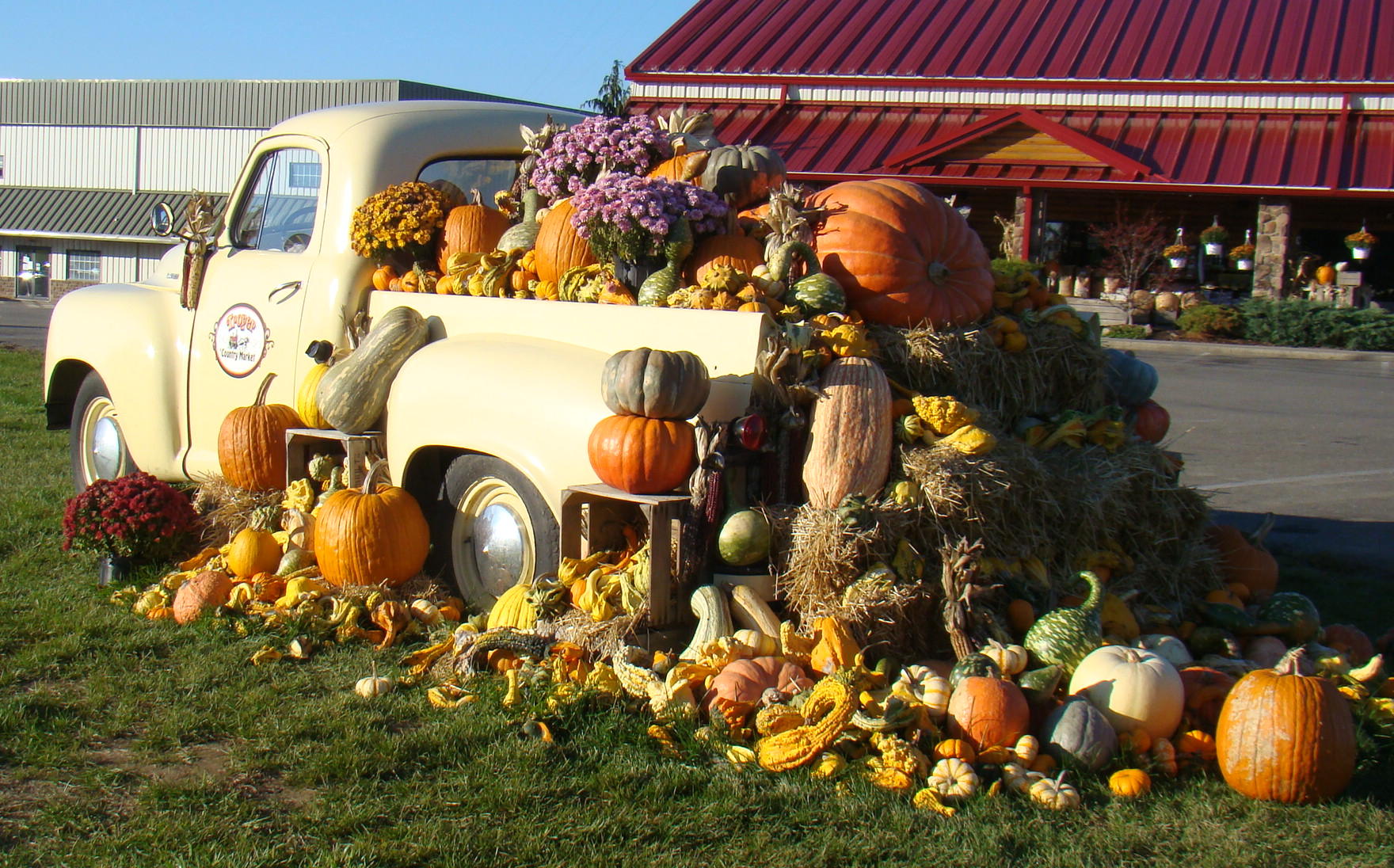
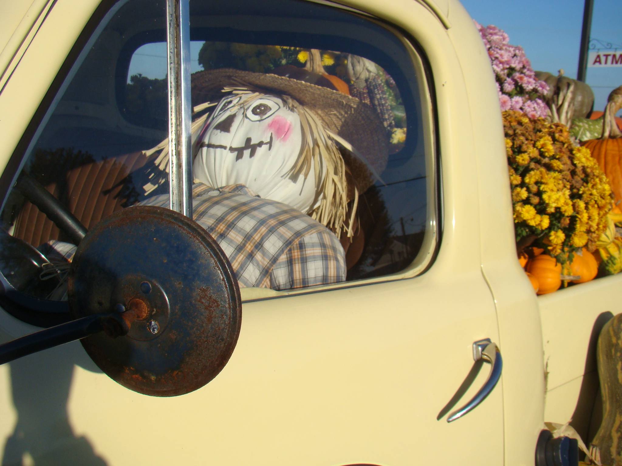
Farther down the road, an old Studebaker pickup is loaded down with autumn treasures at the Troyer’s Country Market. There’s a cute scarecrow driving this load of beautiful mums, pumpkins and other autumn decorations. Mums were brought to the United States back in colonial times and colors range from the traditional yellow shades to oranges, purples, and pinks.  Since they are  ‘short day plants’,  chrysanthemums bloom in the autumn when the nights are longer.  A pot of beautiful mums will brighten your life, or the life of a friend, for perhaps several months.

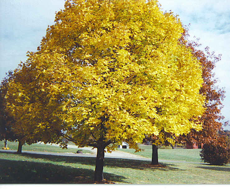
Sometimes a single tree can catch your eye as it glows like a ray of sunshine.  Here a golden maple tree is the center of attraction in someone’s beautiful yard. Temperature and moisture are the two elements that determine the amount and intensity of autumn colors. The most beautiful colors occur when there is a series of warm autumn days with cool, but not freezing nights…following a year of a warm, wet spring with normal summer rainfall. With those determining factors, every autumn brings about a new spectacular display.

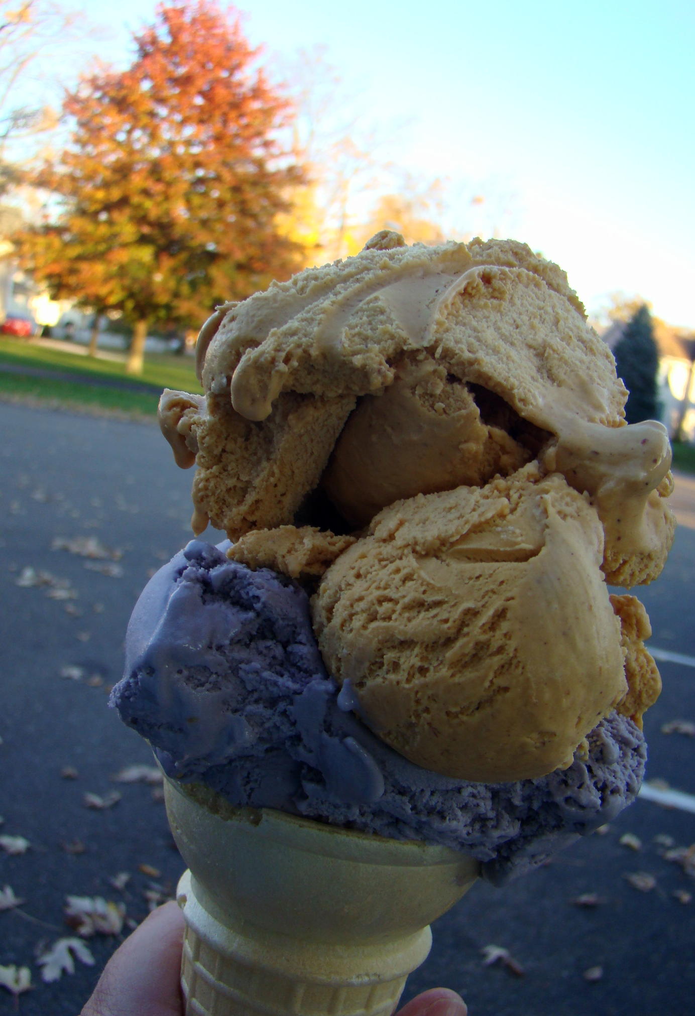
Had to top off the day with a stop in West Lafayette at a favorite ice cream stand. Noticed that keeping with the season they had pumpkin ice cream, so had to give it a lick. Wasn’t sure if the pumpkin would be something to my taste, so had them put a scoop of raspberry on the bottom so there would definitely be something deliciously satisfying. Both flavors hit the spot!

Any season of the year is a great time for a drive through the countryside wherever you happen to live.  If  for some reason you can’t take a drive, stop back and read another gypsy jaunt here on Gypsy Road Trip. Enjoy the adventure!

An “Old Soul” Explores Beautiful Red Rock Sedona

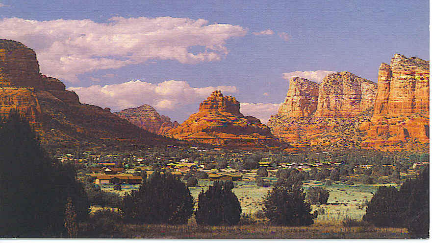
Sedona!  Just the word brings to mind beautiful red rock formations surrounded by a high level of spiritual awareness. For those interested in the metaphysical, Sedona, Arizona is the perfect place to explore. This New Age capital of America is nestled in the mouth of beautiful Oak Creek Canyon.

Spectacular views draw people from all over the world to this “red rock country” where they experience the majesty and peace of the natural wonders appearing around every corner of the road. The sandstone formations glow red and even orange, especially at sunrise and sunset here in Sedona.

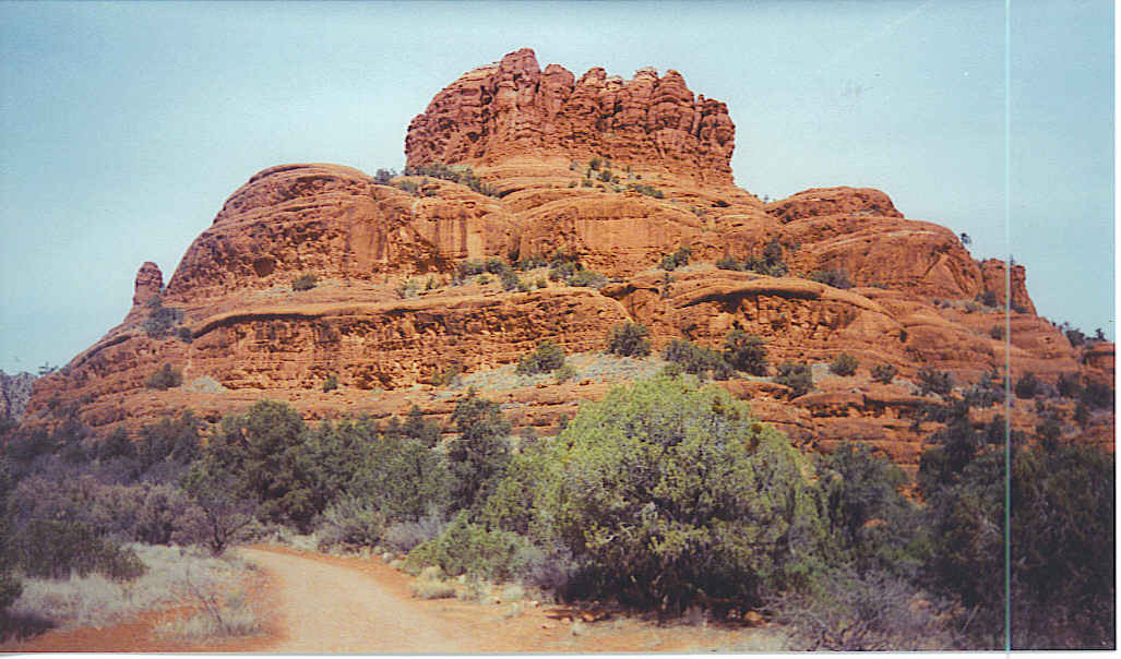
Bell Rock captures the eye and the heart as it emits an energy that can’t be explained. This is just one of several energy vortexes in and around Sedona. For those not familiar with vortexes, they are created from a spiraling motion around a rotating center, such as water going down the drain or a dust devil in the desert. But here in Sedona, the energy vortex is created by spiraling spiritual energy making it a great place for prayer, meditation and healing. There is no real explanation, it must be experienced…and that is just what I did.

While walking around Bell Rock, which is a two hour trip – at least for me- instead of getting tired, my feet moved faster at the end than they did at the beginning. Just had to keep a piece of the red rock with me -it fell at my feet- and still have it under my car seat today.  Maybe that is how I keep going and going on my Gypsy Road Trips… like the energizer bunny.

As you can imagine, Hollywood also noticed the beauty of this area and over sixty Hollywood productions, mostly Westerns,  have been filmed here. John Ford’s production of Stagecoach rolled into Sedona in 1938 beginning the bonanza of films and stars that would become familiar to the red rock area. Classic greats such as John Wayne, Elvis, Rock Hudson, and Art Carney have enjoyed hanging out in the red rocks while starring in scenes shot here.

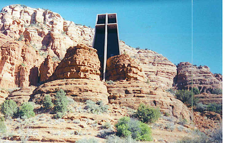
Just a short drive south of Sedona,  the Chapel of the Holy Cross provides a spiritual uplift to the trip as well as another gorgeous view of the surrounding area. Built back in 1956,  the chapel rises 250′ out of the red rock and its design was inspired by the Empire State Building. The front of the chapel faces sunset thus illuminating the interior naturally with sunlight.

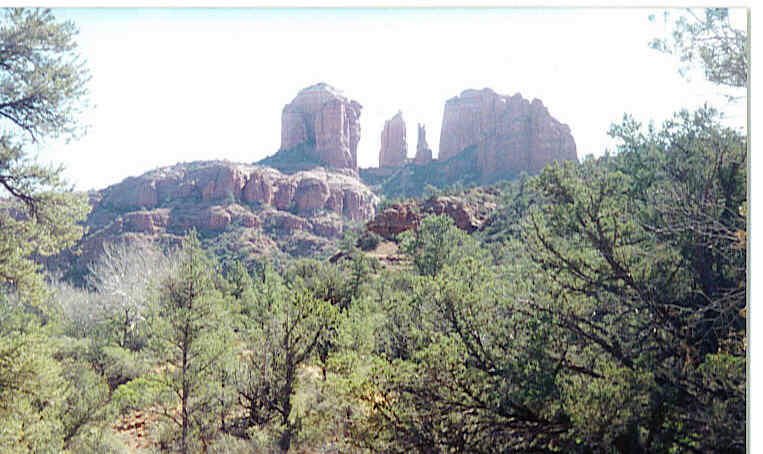
Cathedral Rock, the landmark of Sedona, provided another relaxing place to walk, but personally didn’t feel the energy surge experienced at Bell Rock. Trails lead to the “saddle points” or gaps in the beautiful red rock configuration. While the trail is exceptionally steep, a breeze is nearly always present due to the air movement through the saddle points.

Stayed on the edge of town in the red rocks at a rustic little place called quite naturally, Red Rock Lodge. Here the owner gave me a tour of her beautiful flower garden and explained a little about the flowers of the region. Arizona Poppy, Indian Paintbrush, and Desert Primrose add beauty and a pleasing aroma to the surrounding mountains. Rates were affordable at this small comfortable lodge while the views were extraordinary.

Couldn’t leave town without getting a psychic reading at a charming place with beads hanging from the doorway, a crystal ball on the table, and cards spread to tell me that I was indeed an “old soul” who had been around for a long, long time. This old-fashioned metaphysical community is the place to immerse yourself in Reiki, acupuncture, aromatherapy, UFOs,  and much more.

Sedona has grown since my last visit, but even today there are few streetlights, no buildings reach over two stories high, and every structure must match the primary colors of the rocks. No Golden Arches for McDonald’s here – arches in Sedona are turquoise! These awe-inspiring red rocks formed in beautiful buttes, spires and canyons capture your attention; however, there is a serenity here among the beauties of nature that draws one back again and again.

The Sedona area is located off I-17 at exit 298. Proceed on Highway 179 which after about 14 miles  will lead you to the Y in the road from which you will be guided to various area attractions.  Grand Canyon is a couple hours north of Sedona, while the intriguing Sonoran Desert lies south. Not many can resist the charm, so plan to spend a day or two in this breathtaking area.

A “Pleasant Point” Along the Ohio River

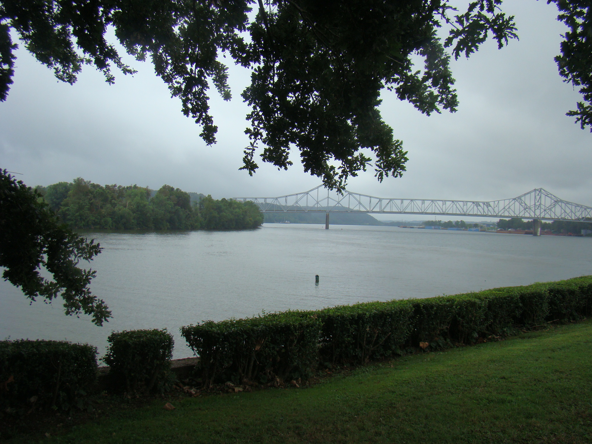
“A pleasant point” was the description given by surveyor, George Washington, when he arrived at the confluence of the Great Kanawha  and Ohio Rivers. Today the town that grew there is called Point Pleasant in West Virginia. The beautiful Riverfront Park is a pleasant surprise here and a wonderful place to take a leisurely stroll with the Ohio River on one side and large murals depicting the town’s history on the other.You can glimpse the Silver Memorial Bridge close to  the point where the Great Kanawha River joins the Ohio River near the end of the Riverwalk in the State Park, Tu-Endie-Wei, which adjoins.

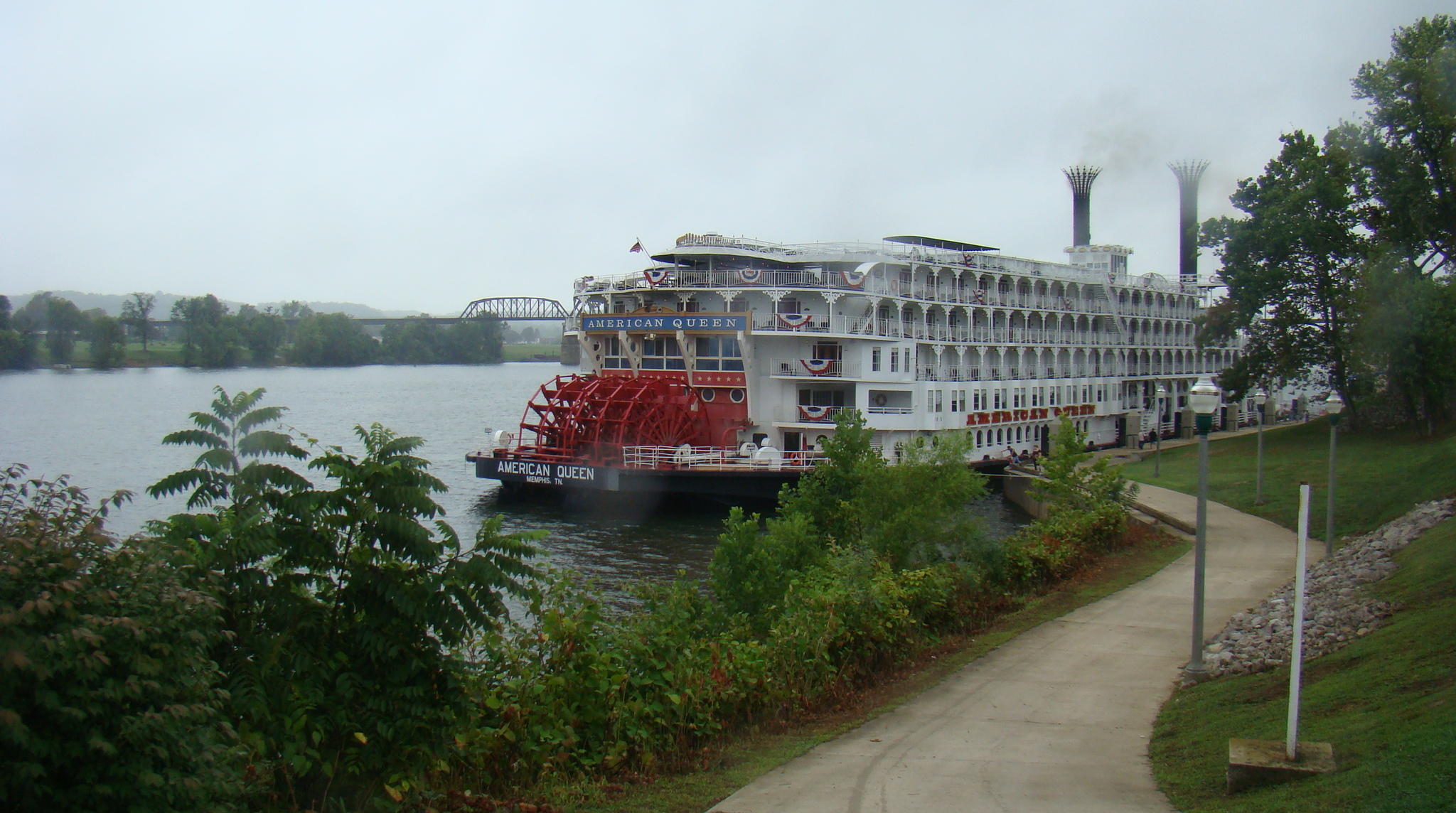
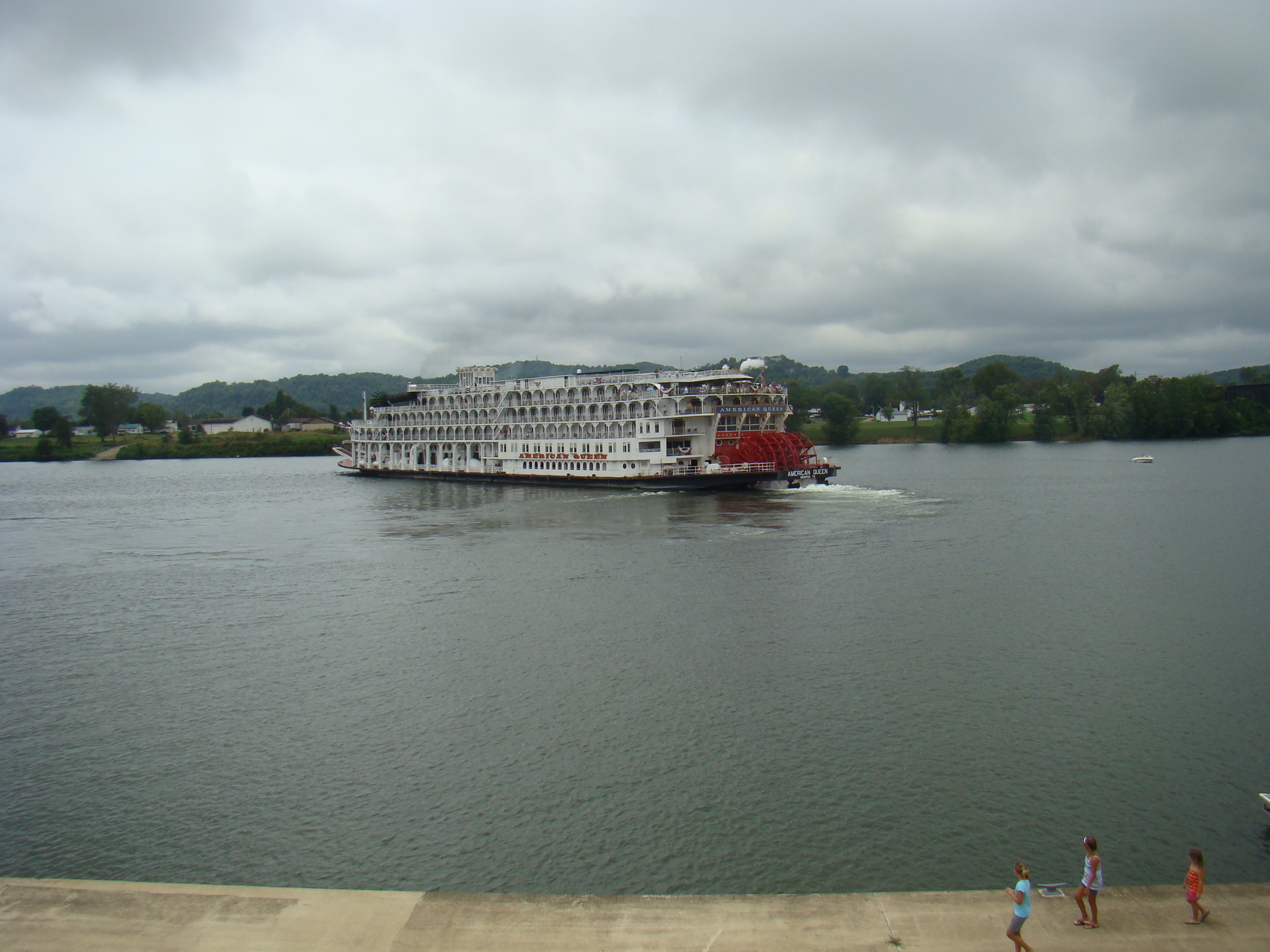
The Ohio River peacefully flows carrying boats of various sizes for many purposes.  There are coal barges, speedboats, riverboats, and luckily this day the spectacular American Queen, the largest steamboat even built in the world. Built in 1995,  this beautiful riverboat is a  six-deck re-creation of a classic Mississippi Steamboat.  Its flat-bottomed style makes it possible to even continue if the waters become shallow.

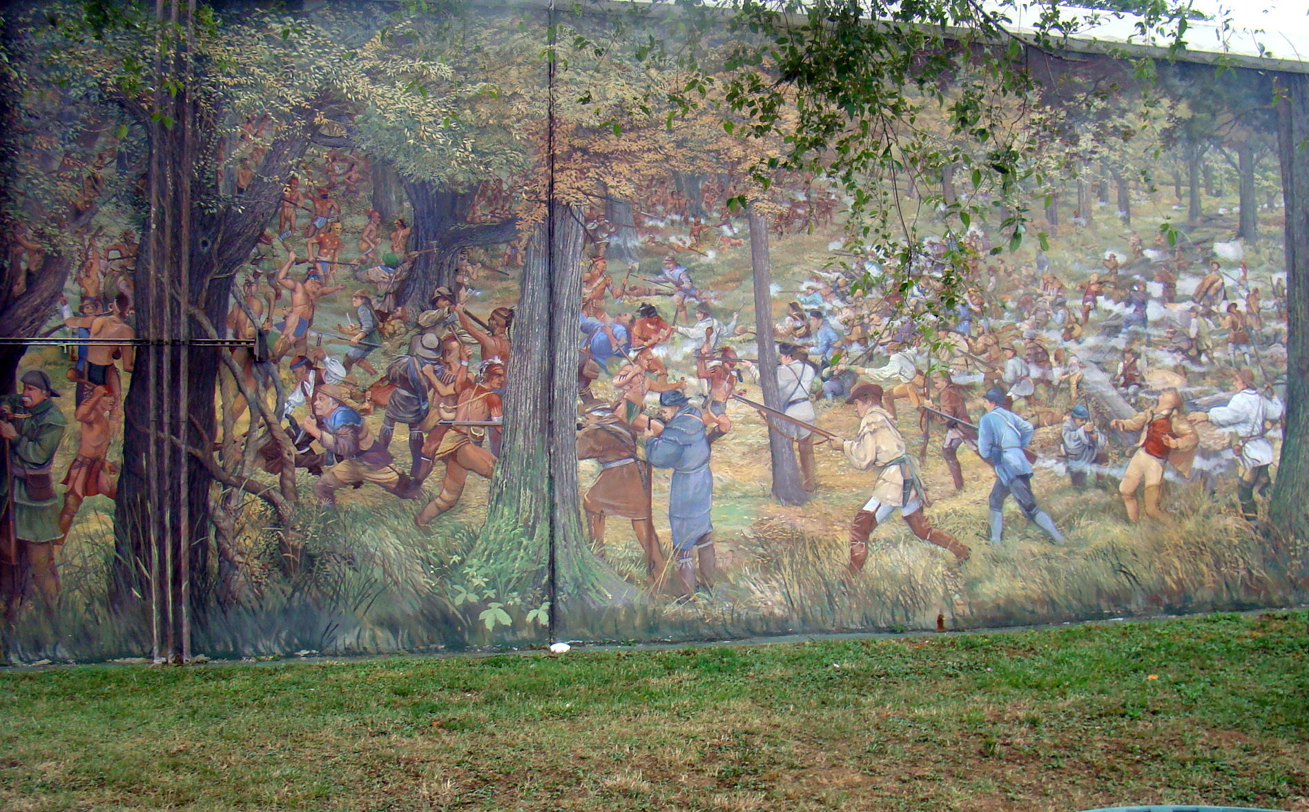
Murals are painted on the floodwalls flanking the Ohio and Kanawha Rivers representing scenes from the Battle of Point Pleasant as well as other pieces of Point Pleasant history, including the Indian settlements of earlier days. Each large mural, measuring from 100-250 feet long, has one single monumental scene painted by artist Robert Dafford. His murals can be found in several cities along the Ohio River from here at Point Pleasant, West Virginia to Paducah, Kentucky.

One depicts the 19-year old George Washington surveying the wilderness where he met Benjamin Franklin and some land speculators, who were founders of the Great Ohio Company. This group intended to found a new colony called Vandalia that would have encompassed most of today’s West Virginia and Kentucky.  What a surprise to learn that on the eve of the American Revolution, there were thoughts of creating a fourteenth colony with Point Pleasant as its capital.

On the other side of the murals is the historic Lowe Hotel, the largest landmark in Point Pleasant. Built in 1901 of Cleveland Berea stone and red brick, this monument was originally called the Spencer Hotel in honor of J.S. Spencer, friend and financial backer of the Smith brothers who owned the hotel.  At that time, traffic on the Ohio River was heavy, so a place to spend the night became an important attraction at Point Pleasant.  Today that  hotel is said to be haunted by guests who decided not to check out, one of those being Captain Jim who is waiting for his steamboat.

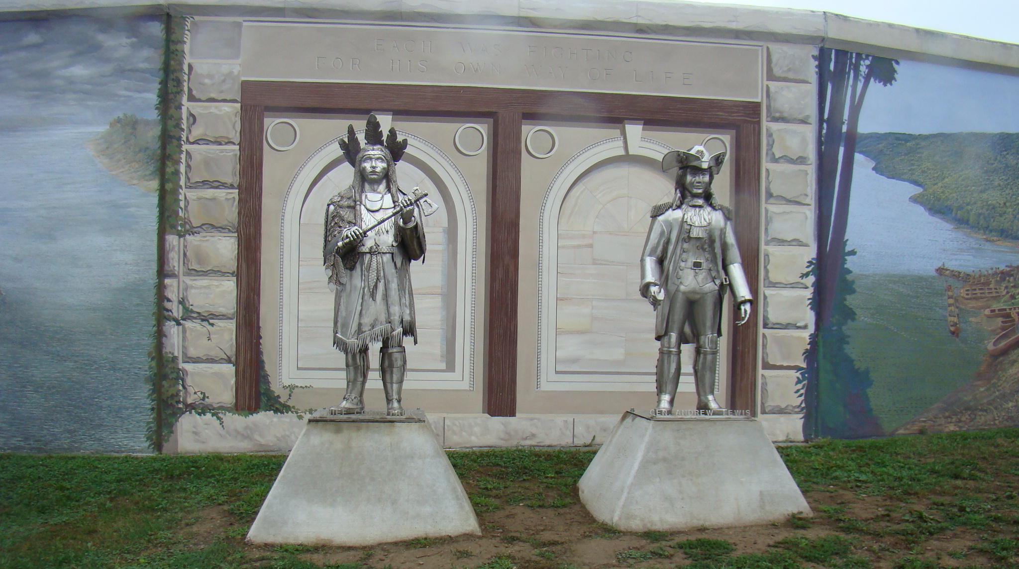
Two unusual metal statues of Chief Cornstalk and Colonel Andrew Lewis caught my eye along the Riverwalk. These were the two combatants in what many say was the first battle of the Revolutionary War…the Battle of Point Pleasant. The Virginia Militia led by Andrew Lewis defeated Chief Cornstalk, the Shawnee leader, and his braves, thus preventing the Native Americans from forming an alliance with the British. This in turn had a major influence on the outcome of the War of Independence. Their statues are located in front of a mural depicting the Battle of Point Pleasant in 1774.

By late afternoon, the American Queen paddlewheels begin turning and the riverboat slowly, almost magically, floats away from the shore. Calliope music fills the air and seems to take one back in time to a happier, more peaceful way of life. This is a great spot to sit down in a swing and watch the river and your cares drift away.

The Riverwalk at Point Pleasant, West Virginia is located just a half block from Main Street and of course, along the Ohio River. Frequent festivals throughout the year are held here and it is often a stopping point for riverboats. 

Buffalo Hills Resort Welcomes Native American Pow Wow

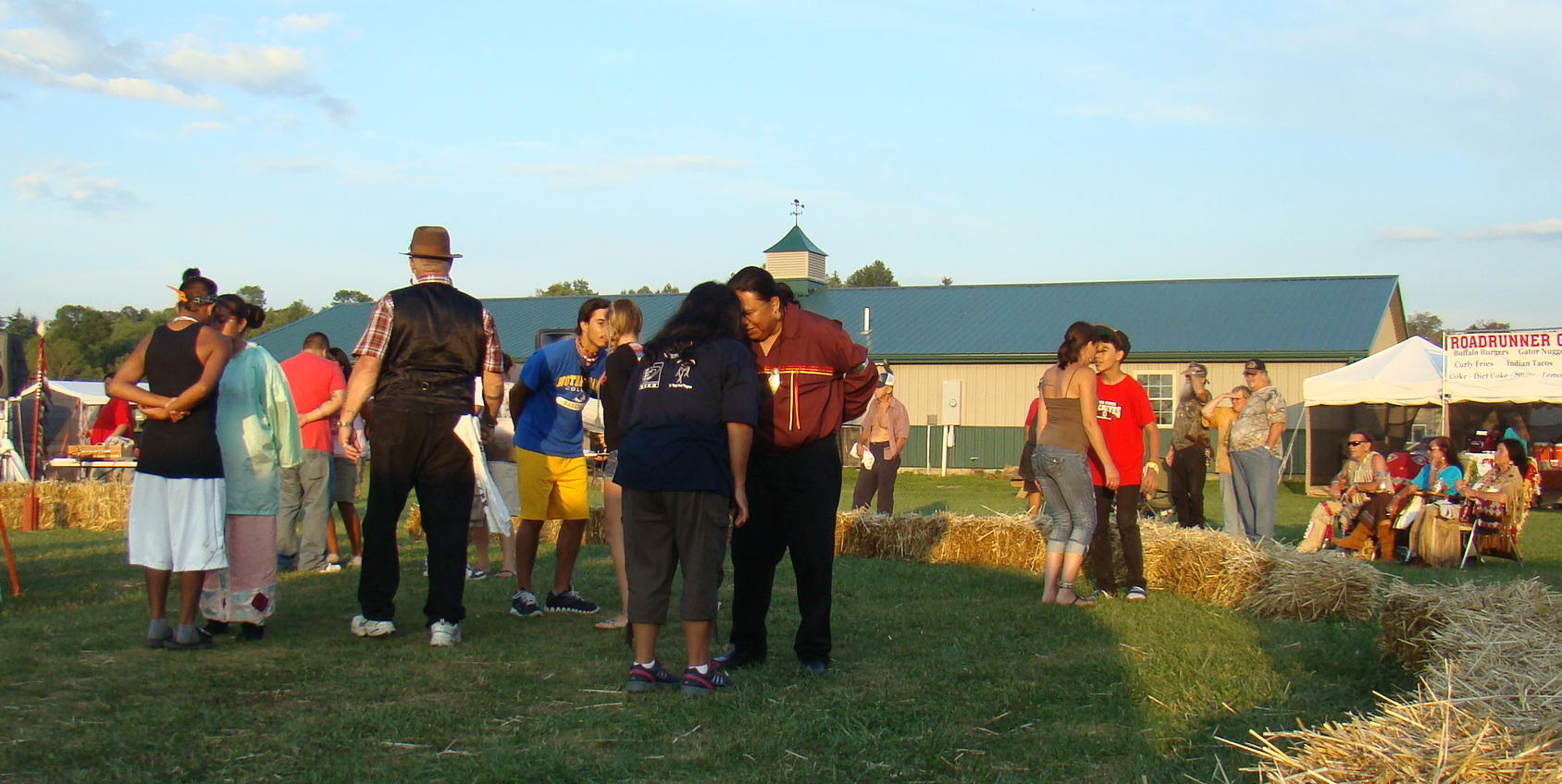
Native Americans are proud of their heritage as was witnessed at the gathering of tribes near Senecaville, Ohio at Buffalo Hills Resort.  Indian Pow Wows join together tribe members  for dancing, singing, socializing, and most of all, honoring their Indian culture. This seemed like the “real thing” as Native Americans congregated for their own enjoyment, not just entertainment. Any lessons learned by White Man were considered a bonus.

Did you ever taste Frybread? Native Americans will often remark, “Frybread is the story of our survival.”  Over a hundred years ago when the US forced Indians to take “The Long Walk” from Arizona to New Mexico, they nearly starved in their new landscape. To keep them from starving, the US government gave them flour, sugar, and lard – the makings of frybread, which later led to various health problems. At the Pow Wow, authentic Indian food was served by concessions and Frybread was delicious either served as the base for an Indian Taco, or covered with sugar and cinnamon. Also on the menu were Buffalo Burgers and Gator Nuggets on a Stick, with Snowballs for dessert.

Native costumes caught the eye of visitors as Indian maidens seemed to float over the ground with their smooth movements.  Delicate woodland flowers and vines added beauty to the deerskin dresses, as did the unusual jewelry made with the help of Mother Nature. Necklaces and bracelets were designed from acorns, spices, dried corn and seeds. This beautiful maiden was called Gentle Dove and said to be a Messenger for Love and Peace.

A circle of baled hay made a comfortable place to observe the Indians’ presentations. In the afternoon an entertaining storyteller told traditional Indian legends, most of which centered around animals.  All their stories have special meaning, and hopefully an effect on the listeners. The story of a Snake taught children to beware of wild animals, while the adventures of Bear and Rabbit with Buzzard described why Buzzard has a deep mark on his face to this day.

John Red Deer filled the spot of medicine man for the day with his extensive knowledge of herbs for healing. While there were many interesting items in his display, the popular 7 Grandfathers All Purpose Salve topped the list. As you can see from the sign, it can be used for many different ailments as well as a detox. John Red Deer feels inspired to make this in cream, liquid for detox, and even in stick form to carry with you for cuts and bites.

Peppermint and Spearmint form the base of this magical salve plus seven other herbs, which he feels he will reveal soon so others can carry on his work. Plants are harvested as he is guided by the voice of Spirit, and later the herb combination is brewed during the Summer Solstice.  This time of solar and lunar infusion gives the perfect blending of the herbs. A severe storm this year, while he was making the salve, produced two hours of intense energy, which John Red Deer felt increased the strength and effectiveness of that salve. His plans are to make a medicinal soap in the near future.

With the drums and flutes of Southern Pine in the center of the circle, the evening dance was a pleasure to watch.  Leading the procession of dancers were Native Americans carrying the USA flag, an MIA flag, as well as their traditional eagle staff with an eagle head on the top. The opening prayer was given first in Choctaw language, followed by English.

Songs were sung to relatives who had passed on to another world and veterans were honored with the blowing of the eagle whistle. Beautiful dresses filled the center and individual dances were performed.  The Jingle Dress glistened in the sunlight and jingled to the beat of the drums.

To close the evening, couples did a Potato Dance with a potato held between their foreheads as they constantly moved to the music. The last couple to keep the potato from dropping to the ground was the winner of a small monetary prize.

Find an Indian Pow Wow in your area to attend so you, too, can learn of the American Indian traditions. While sometimes stories are heard about the Indian attacks long ago, they basically wanted to be peaceful people and enjoy their style of life in the quiet of their homes.  Imagine sitting in the woods with the drums beating, chants filling the air, and the Spirit surrounding you. That’s the way life is meant to be!

Buffalo Hills Resort encompasses over 300 acres in southeastern Ohio making it one of Ohio’s largest campgrounds. Campers have their choice of primitive camping, parking for their RV, as well as cabin or perhaps teepee rental.  While it isn’t far from the interstate, it is definitely peaceful country and near Seneca Lake. Leaving I-77, take exit 37 to the East  (State Route 313) until you come to the four-way stop at Senecaville.  Make a right hand turn on State Route 285  then shortly a left at the fork on State Route 566, also called Opossum Run Road. After a couple miles, campers will find Buffalo Hills Resort on the left hand side.  

The International Peace Garden May Peace Prevail on Earth

Opened on July 14, 1932 the International Peace Garden on the border of Canada and the USA near Dunseith, North Dakota is the world’s largest unfortified border, “Like No Other Place On Earth”. It encompasses 2,300 acres of botanical gardens and on a stone caim on the border are inscribed these words:

TO GOD IN HIS GLORY,
we two nations
dedicate this garden
and pledge ourselves
that as long as men
shall live, we will
not take up arms
against one another.

What a great thought all those years ago as a symbol of friendship between the two nations.

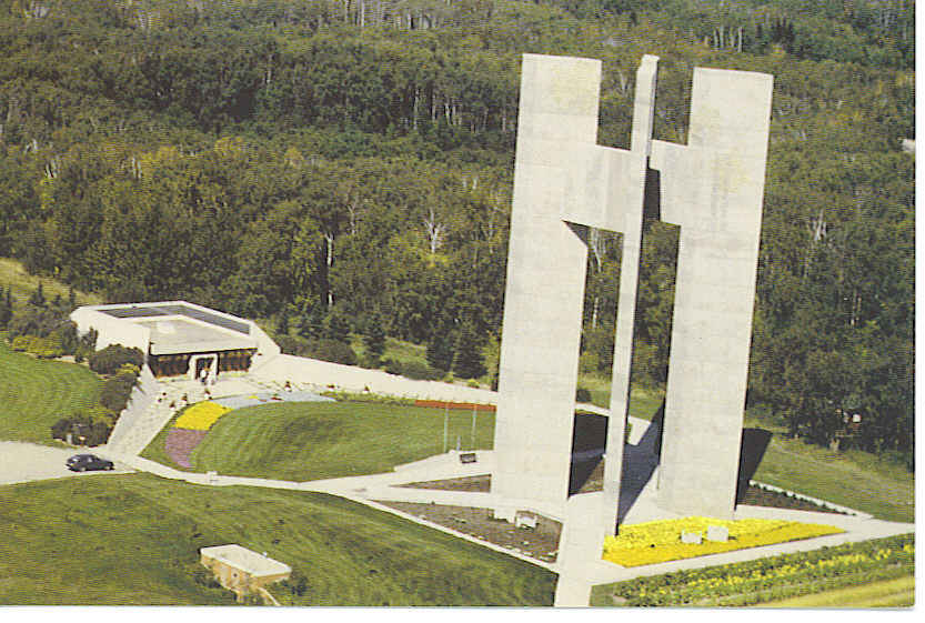
The sounds of bell chimes faintly echo every fifteen minutes from the Veterans Memorial Bell Tower.  The nearby 120′ concrete Peace Tower has four columns symbolizing the four corners of the world from which thousands of immigrants arrived in Canada and the United States to make better lives for themselves. Two of the columns are in Manitoba, Canada while the other two columns are in North Dakota.  The foundation symbolizes one solid base of democratic beliefs between the two countries.

The Peace Chapel provides the perfect place to sit down and relax, meditate, or read the positive thoughts written on the walls. The Peace Chapel has been a long time project of area members of the Order of the Eastern Star and is the only building which straddles the United States and Canadian border. While the chapel is a simple building, the addition of amber glass windows from France gives it a soft, golden, peaceful glow.

The three encircling walls into which quotations have been engraved were one of the special features that grabbed my attention. All quotations were either spoken or written by great men of peace throughout history. Some of the limestone walls still have embedded fossils of strange marine life, which had been molded into the bed of a tropical sea in the Manitoba region millions of years ago.

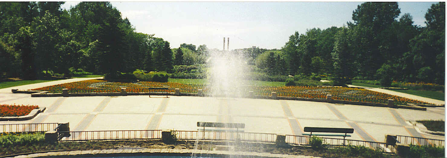
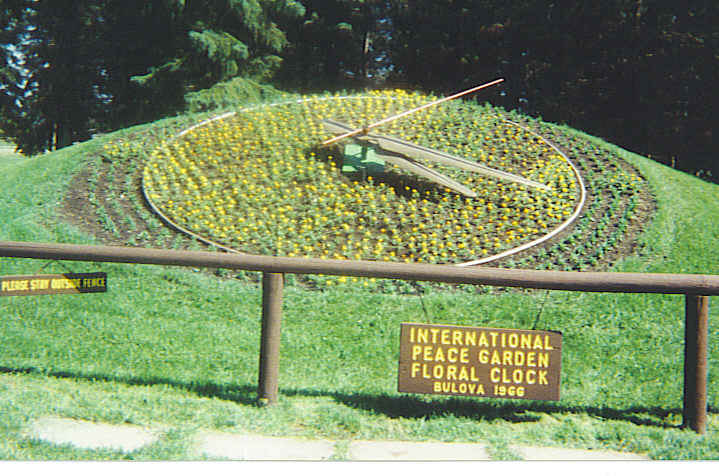
Flower beds are around every corner here, but two displays that have been constant from the beginning are beds forming the United States and Canadian flags.  A beautiful International Peace Garden Floral Clock actually works and was originally donated by Bulova in 1966. This original was designed as a replica of the famous Bulova Floral Clock in Berne, Switzerland, but inner workings were replaced in recent years by a clock from St Louis, Missouri.  The clock contains over 2,000 flowers with the design changing yearly, and reminds visitors to take time for the peaceful feeling surrounding the gardens.

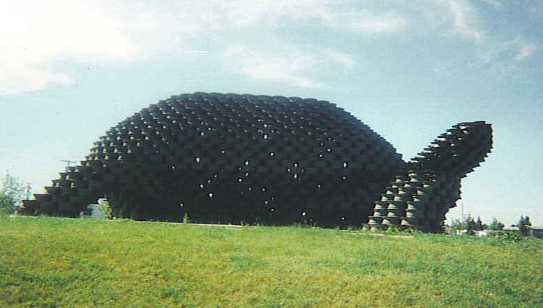
Just down the road in the Turtle Mountains near Dunseith, North Dakota is the largest man-made turtle in the world. Constructed of nearly 2,000 wheel rims, this “W’eel Turtle made from Wheels” has a head that actually bobs up and down. While the turtle is nearly forty feet long, its head alone weighs almost a ton! Stop and visit this tire rim sculpture at Dale’s Thrifty Barn – a gas-station, cafe, and motel in Dunseith, North Dakota. Little extras like this always bring a smile.

Turtle Mountains seem to be a perfect location for the International Garden of Peace as the slow movement of the turtle gives a relaxed and peaceful feeling just like the gardens. May peace prevail in your world as well. We should all attempt to be more like the turtle… at ease in our own shell.

The International Peace Garden in North Dakota can be reached by taking I-29 North in North Dakota to Exit 203.  Take Route 81/281 West to Dunseith where 281 bends North to the Canadian border.  This is a beautiful back-road drive away from the crowds.

The Town Too Tough To Die Tombstone, AZ

“The only rock you will find out there will be your own tombstone,” was the advice given to Ed Schieffelin when he headed to the mountains of Arizona to hunt for ore samples.  When Schieffelin filed his first claim after discovering silver, he suitably named his first mine Tombstone, and organized the Tombstone Mining and Milling Company.

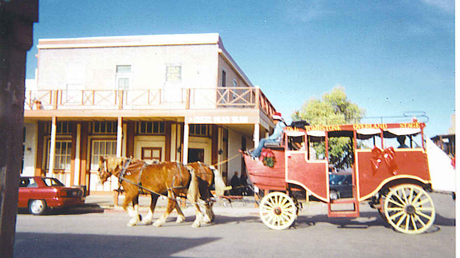
If you want an informative trip through Tombstone, Arizona, hop on the guided horse-drawn stagecoach tour. Here you will hear the basic history of the town with lots of humorous stories thrown in. Don’t be surprised if you see a gunfight or stagecoach robbery along the way. Then you can walk or ride to your favorite places throughout the town for a closer look.

The stagecoach is pictured in front of the Crystal Palace Saloon, which was originally built in 1882 but restored in 1963.  Prominent citizens of Tombstone liked to congregate here as the saloon was know for its “Good Whiskey, Tolerable Water, and Best Food in Town” as well as an honest gambling room. Add to that the fact that upstairs were located offices that furnished all the latest news, and you can see why it was such a popular spot. The second floor contained offices of Marshall Virgil Earp – in the front, Dr George Goodfellow, leading surgeon, and Atty George Berry.

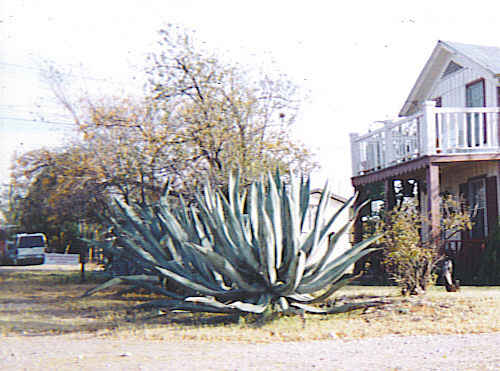
Since plants are one of my pleasures, couldn’t help noticing this huge century plant located in a resident’s yard. This plant’s name is derived from the fact that they only bloom once in a long, long time, but not quite a century. Usually they grow for around twenty five years before the plant puts forth its tall wooden seed stalk filled with blooms.  This blooming spike grows so fast that it takes all the nutrients out of the plant causing it to die.  But the seed lives on!  These plants are used for their medicinal properties, fiber, food, and even needles.

As you can imagine this was rough territory with tough, lawless characters calling it home. Being only twenty miles from the Mexican border, a group of bandits called The Cowboys, led by Billy Clanton and the McLaury brothers, began rustling cattle from Sonora, Mexico to the fields near Tombstone. That brought lawmen onto the scene in the form of the Earp brothers. The Cowboys were welcome in town since they spent a lot of money there, but shootings often occured. Here you will also find The Hanging Tree, which was used for executions when the gun just wasn’t enough punishment.

Early in 1881 however, one story reports that The Cowboys attempted to rob a stagecoach of $26,000 worth of  silver, and killed two passengers. The events that ensued culminated in the now famous Gunfight at the O K Corral where US Federal Marshall Virgil Earp, his brothers, Wyatt and Morgan, and Doc Holliday shot and killed three of The Cowboys.  They are buried today on Boothill, one of the city’s most popular tourist attractions.

Boothill reportedly received its name because so many died violent deaths in that area and were buried with their boots on. Wording on the tombstones tells a lot about the life of those times. Some simply say: MURDERED or HANGED. The tombstone of Lester Moore is one of the most often viewed and remembered on Boothill as it has the epitaph:

HERE LIES LESTER MOORE, 4 SLUGS FROM A 44, NO LES NO MORE

The world’s largest rosebush is also in Tombstone so growing conditions must be exceptional. Planted in 1885, this Lady Banksia Rose covers the roof of an inn as well as this terrace. The trunk of the rose bush is twelve feet wide, which you may be able to spot in the shadows. That rose bush must also have been Too Tough To Die.

Since 1880 until the present day, the local publication, The Tombstone Epitaph…The Old West’s most famous newspaper, has kept locals and visitors informed regarding what’s happening in Tombstone. There are now actually two editions: a monthly historical national and a bi-monthly local.  Check out some of their historical issues at The Tombstone Epitaph online.

Even though this two-fisted, trigger-happy boomtown has settled down quite a bit, Tombstone is proud of its Wild West history.  This is a real town with real inhabitants today and in the past.  That is why they are pleased to call it: The Town Too Tough To Die.

Tombstone is located in the southeastern corner of Arizona, just 70 miles from Tucson. Follow I-10 to exit  303 and head southeast on route 80 for about 23 miles. If time permits, head on down to relaxing Bisbee and tour their Queens Copper Mine, one of the richest copper mines in history.

Mysterious Bigfoot Legend – Skeptic or Believer?

“Absence of evidence is not evidence of absence.” This quote from distinguished astronomer, Dr Carl Sagan, is popular with Bigfoot investigators. They are still searching for more clues that will prove their Bigfoot theory.

Guernsey County, Ohio is one of those “hot spots” for Bigfoot investigators.  Annually, the Ohio Bigfoot Conference gathers informative speakers to share their adventures with the gathering crowd.  The 2012 conference was held at Pritchard Laughlin Civic Center near Cambridge, Ohio after previously being held at Newcomerstown and then Salt Fork Lodge. The move was partially made to accommodate the growing attendance as last year at Salt Fork they overflowed the conference room and many were  forced to watch the program on big screen TVs in the lobby.  The Bigfoot enthusiasts have increased from less than a hundred in 1989 to over seven hundred at present.

The goal of the Ohio Bigfoot Organization is to find, recognize, and protect what many believe to be an unclassified primate, commonly known as Bigfoot, and residing in North America.

A highlight of the meeting this year was the appearance of legendary Bigfoot seeker, Peter Byrne, who fascinated visitors in the lobby with his Bigfoot stories. Peter, the star of the show, has led professional expeditions in search of Yeti and Bigfoot.  His book, The Search for Bigfoot, tells of his fascinating life exploring since 1946 in the Himalayas for Yeti, the Himalayan version of Bigfoot.  Even though he is 86 years old, Peter still has a curious mind and continues his search for Bigfoot on the Oregon Coast.

Before the scheduled speakers, curious visitors checked out tables in the lobby with lots of unusual items. Of course, there were videos of possible sightings as well as plaster casts of large footprints left behind by something or someone. Lengths of these footprints average about 16″ long, but some range up to 22″, and are much wider than a human footprint.

Soaps and lotions carried the name Sasquatch, the Canadian Bigfoot rendition. One popular soap made in Canada bore the title Sasquatch Sweat Soap – Guaranteed not to grow hair. Sasquatch Sweat Cream was also available. Not certain if their purpose was to repel or attract Bigfoot.   There were even cookies for sale shaped like…yes, you guessed it, Bigfoot.

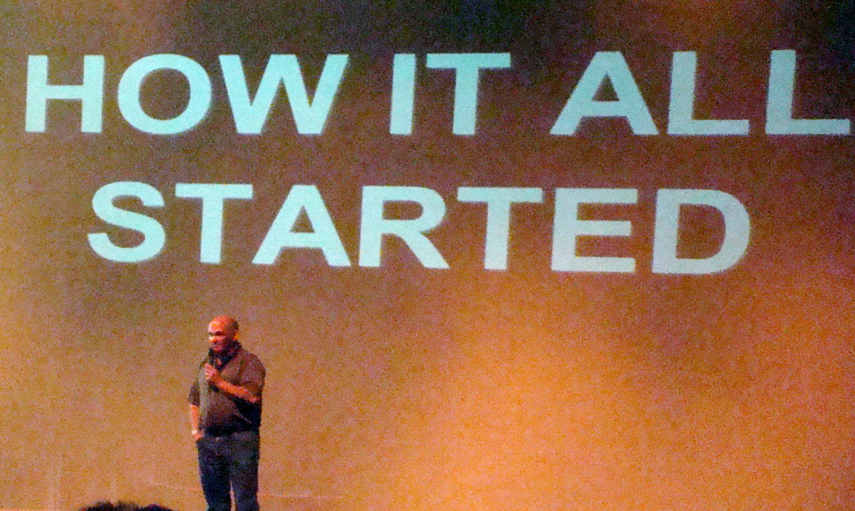
The first speaker of the day was past president, Don Keating, who led this conference for 23 years. He first heard of Bigfoot in 1984 from a story in the Newcomerstown News that told of strange sightings of a large, hairy creature in and around the Newcomerstown area. Later Don began investigating some of the unusual sightings he heard from neighboring Guernsey County as well – glowing red eyes, large footprints, and very tall creatures.

Salt Fork Lake area became one of those places where frequent strange events seemed to occur. Often something eerie seemed to be happening at Hosak’s Cave in the late evening hours, especially when there was a full moon.  For their safety, people were even strongly advised to leave the area by park rangers.

When Don Keating said he was leaving his president’s position to devote more time to his weather research, someone in the audience asked an interesting question: “Do you find predicting the weather a lot like investigating Bigfoot?” To which Don answered, “With both, you put your neck on the line.”

Grabbed a Bigfoot cookie to munch while listening to additional speakers which included: Dr John Bindernagel, wildlife biologist; Bill Draginis, surveillance and security expert; and Mike Esordi, crypto zoologist with artistic abilities. All are active in Bigfoot research and frequently share their knowledge through lectures around the world.

Whether you believe in the existence of Bigfoot or not, you could hear some interesting adventures at the conference. Maybe some evening you will want to spend the night at Salt Fork State Park. If you listen carefully, you might hear strange calls, branches breaking in the woods, or rocks being thrown into the lake. Could these sounds be made by Bigfoot?  Keep your eyes and ears open!

Salt Fork State Park is located just five miles north of Cambridge, Ohio just off Route 22. I-70 and I-77 intersect close by so you will have easy access to the area.  While in town, stop at Mr. Lee’s or Theo’s Restaurant as both have delicious home cooked meals at reasonable prices.

Amazing Scenery Along the Pacific Coast Highway

The surprises kept coming on the beautiful Pacific Coast Highway, which began in Washington and continued along the edge of the Pacific Ocean through Oregon and California, stopping at San Diego. Meandering roads kept driving speeds at 15-20 mph, or perhaps it was partly due to the spectacular views. When driving and watching the scenery at the same time, slower speeds were definitely required especially with many steep cliffs at the ocean’s edge.

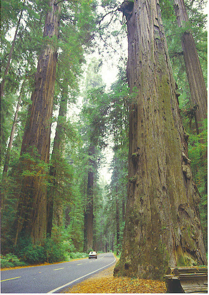
With beaches galore and piers aplenty, Pacific Coast Highway, also known as America’s Most Beautiful Drive, renewed your spirit and your senses, as you encountered many unusual scenes along the way. This curving highway passed right  through the awesome giant redwoods on a stretch called Avenue of the Giants.This was the place where trees were large enough for a car to drive through or even have a gift shop inside. Words can not describe the wonder of these giants as you attempted  to look skyward  to see their highest branches. These towering trees, rock formations and ocean waves made you realize the power of Mother Nature and the role she plays in our beautiful world.

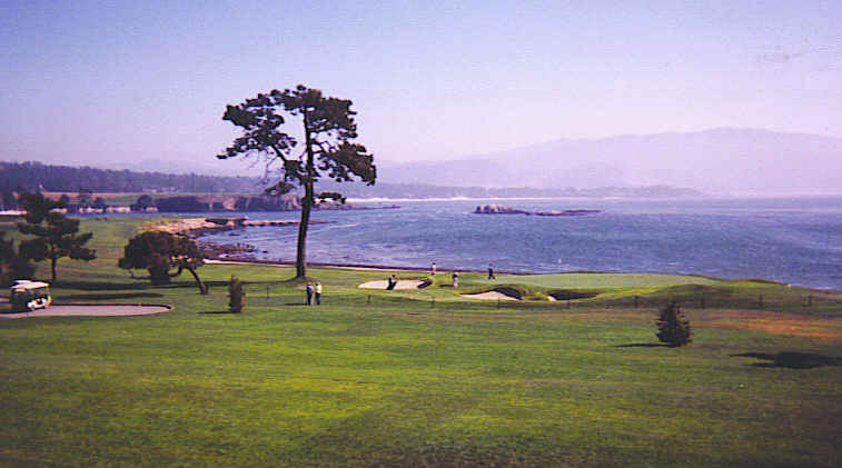
Even on a foggy morning, the picturesque combination of mountainous cliffs  on one side, and the waves crashing against the rocks on the other, made your heart beat just a little faster. After spotting a sign that said Pebble Beach Golf Links, thought the golfers in my family would be happy to know I stopped for a visit, as this is home to some of the world’s most prestigious golf tournaments.  Evidently it was a day without a tournament scheduled, as admission was granted to drive up to the luxurious lodge and even to walk on the course. My camera definitely wanted to snap a picture of the famous 18th green to prove my story wasn’t fiction.

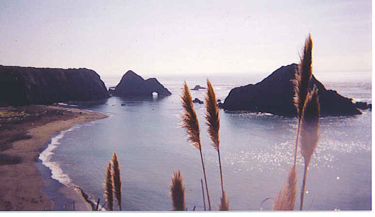
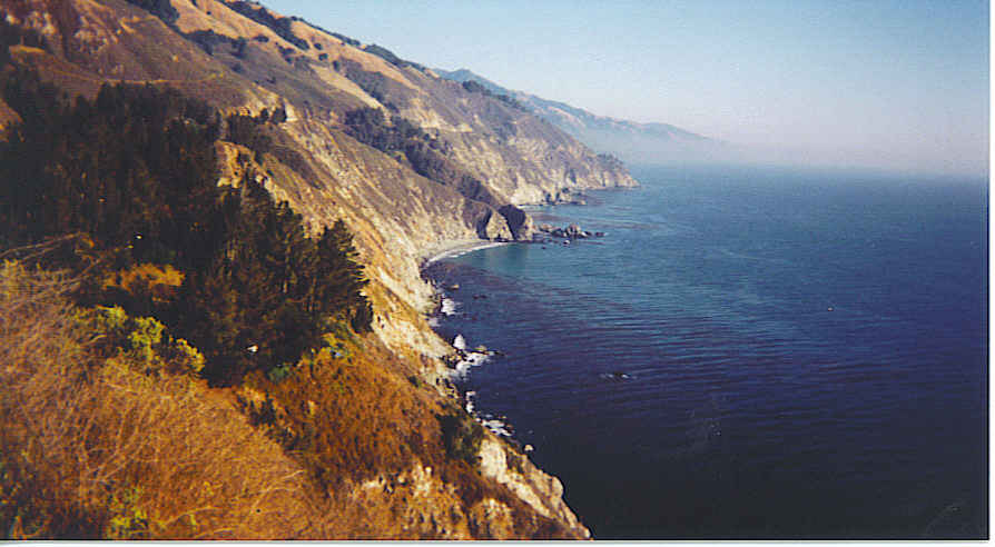
Near Big Sur the mountains seemed to plunge into the Pacific. Unusual black rock formations rose out of the water to create amazing and different views around each bend of the road.  . These towering black rocks made a sharp contrast against the constant waves of the Pacific and the blue sky. Surfers in their wetsuits rode the waves and kayaks bounced across the ocean. A couple young men enjoyed hang gliding and the winds must have been perfect that day as they were airborne  for a very long time.  Might have to try that on another trip to experience the sensation of flying! Everywhere you felt the happiness of people relaxing from the cares of the day.

There was no resisting the temptation to find a place to pull off the road and walk on the beaches. Leave your shoes behind so you can feel the power of the waves wash over your feet. Two golden labs approached with a frisbee in their mouth so ended up the day playing catch with the labs.  Memories of the ocean will live on, long after the footprints in the sand are gone.

The Pacific Coast Highway, Highway 1, begins in Oxnard, Washington and continues along the coast through Oregon into California all the way to San Diego. Sometimes Highway 101 bends inland so watch carefully if you want to enjoy the scenic journey along the coastal region.