Places to go and things to see by Gypsy Bev

Posts tagged ‘West Virginia’

SMART Centre Features Dinosaurs, Space, and Ice Cream

SMART Centre

SMART Centre Market opened its doors in 2010 to encourage students’ interest in science.

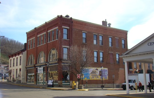
A delightful Science Centre Market exists in downtown Wheeling, WV – right next door to their historic Centre Market District. This is no ordinary shop as it combines elements of hands-on experience, museum-like pieces, as well as a place to find some unusual gift ideas for those interested in science.

SMART owners 2

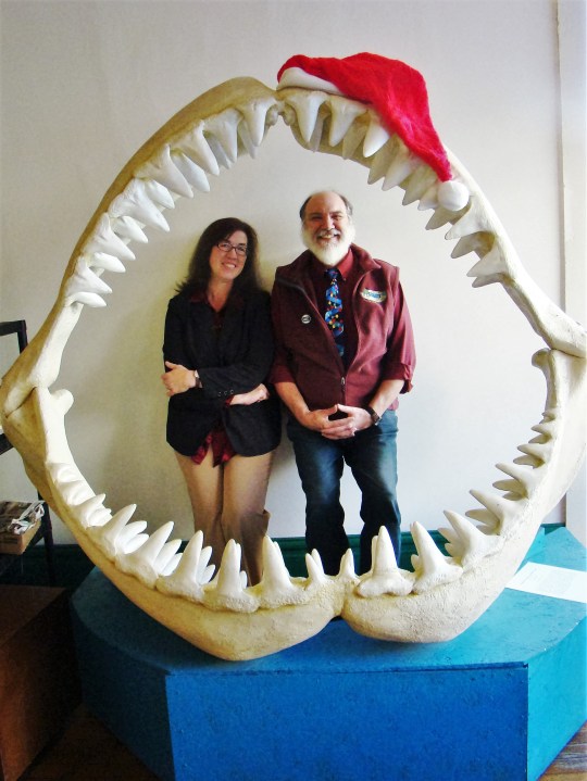
Libby and Robert Strong enjoy having fun as well as teaching.

Robert and Libby Strong, two former science teachers, created this special place several years ago. SMART stands for:

  • Science

  • Math

  • Art

  • Research

  • Technology

It seemed the natural thing to do for a physicist and a biologist!

SMART Fish Fossil

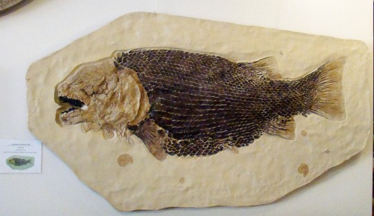
This cast shows the armored skeleton of a German fish with teeth sharp enough to bite through the shells of squid.

A fossil is a snapshot in time, so they feel it important to have original fossils throughout the center. Since originals are hard to come by, some of the larger displays are casts of original fossils, so children can see their size and detail. It is important to keep past science discoveries alive.

SMART singing coin

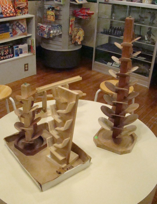
This wooden singing tree produced a beautiful song as a marble, made at near-by Marble King, dropped from leaf to leaf.

Around every bend, there’s a spot for hands-on discovery. Robert pointed out that there are two kinds of people who enjoy their place: little kids and tall kids. Even adults need to keep their curiosity alive, and learn something new each day.

SMART Gravity Machine

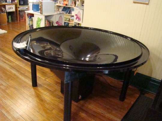
This Gravity Well lets children watch a coin go around at high speeds as the coins descend to the vortex tunnel.

This is the place to learn while you play. Children find interesting a line up of scales where they can discover their weight on earth, the moon, Mars, Jupiter, and Pluto. On Pluto, they would weigh the least, and on Jupiter the most – due to gravitational pull. A Gravity Well lets you watch different size coins make their way down the well at different speeds.

SMART books

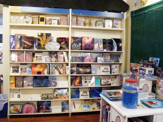
Books on every scientific subject fill the shelves along with science kits to ignite their imagination.

Besides all the activities in the center, the Strongs hold field trips, camps, workshops, and have special open evenings for star gazing. Their main desire is to create a place where kids can have fun learning about science. Robert and Libby bubble over with enthusiasm.

SMART Wooly Willy

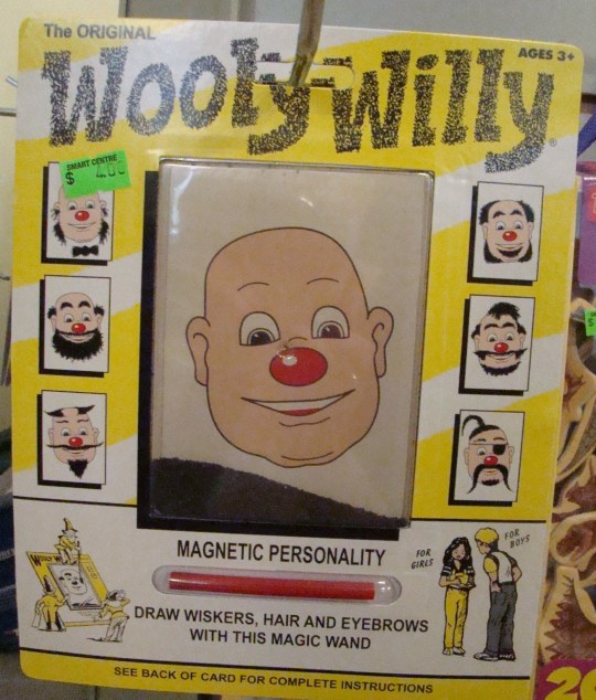
This 1955 game of Wooly Willy shows the magic of magnets as it creates “Magnetic Personalities”.

Everything in the center has an unusual quality. No matter where they sat or stood, the Strongs could point out unusual items such as dinosaur teeth, leaf fossils depicting global plate shifting, or pieces of k-t most likely from a million-year-old asteroid, which coincided with the extinction period of the dinosaurs. All this from one spot!

When Robert was asked about his favorite part of the center, he said, “When the door opens and people begin conversations about science, you are going to learn something.” Those people, who enter through the front door, teach him something from their questions and contributions. “It’s fabulous! It’s a perk being here – people and ice cream.”


Ice Cream Flavors

The day had to be finished with an ice cream cone, which Robert handed to me upside down…and it didn’t fall out!.That’s the first time a physicist ever made me an ice cream cone and it only cost a dollar. This ice cream comes from Kirke’s Homemade Ice Cream at near-by St. Clairsville.

With a visit to the SMART Centre Market, kids of any age can catch enthusiasm for the world of science. Robert and Libby are prepared to help you light the fire of exploration. Don’t forget the ice cream cone!

Hours for the SMART Centre are Tuesday – Saturday from 10:00 – 6:00. Check out their special events at http://www.smartcentremarket.com

Advertisement

History Speaks Through Fairfax Stone

A scenic gravel road through wild, wonderful West Virginia in the fall of the year

A scenic gravel road through wild, wonderful West Virginia in the fall of the year

Often a gravel country road leads to places that give us a better understanding of our country’s history. Sometimes the things we find along the way don’t look as important as they really are.

Such is the case with one of the most significant landmarks in West Virginia, the Fairfax Stone located at Fairfax Stone Historical Monument Park near Thomas, WV. This stone marks the North headwaters of the Potomac River, which flows all the way to Virginia. Today the original stone is gone, but a replacement stone marks the spot so future generations will not forget how the states’ boundaries were determined.

Fairfax Stone National Historical Park

Fairfax Stone Historical Monument Park

The reason for the search for the headwaters of the Potomac River came about because the King of England gave Thomas Fairfax all the land from the Potomac River to the Rappahannock River. Naturally, Lord Fairfax wanted to know where the boundaries of his land actually were.

This was part of the Northern Neck Land Grant. The surveying for this western boundary of Maryland was done by Colonel Peter Jefferson, Thomas Jefferson’s father, and Thomas Lewis. Many historians say that George Washington perhaps set the original stone himself as a young surveyor.

Two Fairfax Stones - 1910 and 1985

Two Fairfax Stones – 1910 and 1957

Way back in 1746, the original stone was placed there  to honor a boundary dispute between Thomas Fairfax, 6th Lord Fairfield of Cameron and the English Privy Council.. Later it became the spot to mark the state boundary of West Virginia and Maryland. The dispute over the boundary between Maryland and Virginia, later West Virginia, was so severe that it ended by being solved by the Supreme Court. Now it is easy to see its importance.

Fairfax Stone plaque describes its purpose.

Fairfax Stone plaque describes its history.

The original stone was a small pyramid of sandstone and had the letters “F.X.” scratched into the stone. Now an engraved six ton rock with a flat surface displaying an engraved metal plague sets over the site of the actual spring, the beginning of the North Branch of the Potomac River in West Virginia. An inscription on the plaque tells the historical significance of the stone. The marker from 1910 rests close by.

Nearby Mountaineer Wind Energy Center generates electricity.

Nearby Mountaineer Wind Energy Center generates electricity.

Even though this park contains only four acres, the Fairfax Stone Historical Monument Park attracts many historians, who want to walk where their forefathers trod. Then take a ride just south of here and view some modern history in the making – the Mountaineer Wind Energy Center, the largest wind farm east of the Mississippi that provides electricity to many of the mid-Atlantic states.

Next time you take a drive, perhaps you will want to explore some of those dirt roads along the way. You may be surprised at what you find.

Fairfax Stone Historical Monument Park can be found off U.S. Route 219 near Thomas, WV. Turn onto county Route 9 and travel .5 miles. Turn right at Fairfax Stone Monument sign and travel 1.5 miles to Fairfax Stone. Great signs help make this easier to find.

Coopers Rock Beckons Nature Lovers

Cooper Rock Picnic Shelter

Coopers Rock Picnic Shelter

“The Rock with a View” describes a visit to Coopers Rock between Morgantown and Bruceton Mills in West Virginia, bordering Pennsylvania. The crowded park grounds gave a festival like appearance with beautiful American chestnut and stone picnic shelters welcoming families and groups to spend the day. Fifty miles of hiking trails provide an outlet for exercise surrounded by nature. During the winter months, these trails are used for cross-country skiing.

But the picnic area and hiking trails weren’t the attraction here. After walking down a short scenic path, you arrived at an immense rock, which serves as a scenic overlook for miles around. Caution must be used on this very steep and slippery rock.

Climb cautiously on Cooper Rock.

Climb cautiously on Coopers Rock.

Legend has it that Coopers Rock received its name from a barrel maker, also called a cooper. The story goes that a fugitive hid away from the law for several years under the shelter of the rocks in this vicinity. In his new mountain hideaway, the cooper made barrels, which he sold to people in the nearby communities.

The early history of the area centers around the iron ore industry, with many iron furnaces located nearby as early as 1798. With the discovery of iron ore and limestone, the abundance of hardwood trees for fuel made this the perfect spot for Henry Clay Iron Furnace, which produced pig iron.

View from Cooper Rock

View of Cheat River Gorge from Coopers Rock

Standing on the Main Overlook, Cheat River Gorge appears in panoramic view. Fall is the perfect time to enjoy the scenic gorge and river surrounded by autumn colors. Enormous boulders and cliffs encourage rock climbers and hikers to explore.

Cooper Rock Overlook

Stone Bridge to Coopers Rock Overlook

An astounding piece of work is the stone bridge which connects the overlook to the main ridge. The steps were carved out of the mountain during the Great Depression by the Civilian Conservation Corps. The view from the bridge is quite spectacular as well.

Eco Turtle

Eco-sculpture of Coopers Rock Turtle by Gazsi

During the last few years on Earth Day, Benjamin Gazsi of West Virginia University made eco-sculptures near the parking lot of Coopers Rock to create another reason for people to visit. The Sleeping Giant, Standing Bear and Coopers Rock Turtle are the first three structures to be completed using products of the forest. These characters made of tree branches, mud, grass, leaves, and moss will be enjoyed by visitors until nature returns them to the forest floor.

Access to the park is closed during December until March 31 for motor vehicles, but you can still park at the first lot and walk in. There is no charge for visiting and hiking this fantastic forest. Being in a peaceful spot surrounded by nature clears the mind and relaxes the body.

 Coopers Rock State Forest has easy access just east of Morgantown, WV from I-68 off Exit 15. I-68 actually bisects the State Forest into two areas.


Blackwater Falls – A Powerful Experience

The roaring falls of Blackwater River can be heard for miles around. Located near Davis, West Virgnia, these falls have become one of the most photographed sites in the state.

Steps at Blackwater Falls

Steps to Blackwater Falls

When you arrive at the Blackwater Falls sign, you notice that it says 214 steps to the falls. As you start down the first steps, it seems like an endless adventure as group after group of steps appear. Youngsters step gingerly down the steps, counting as they go to see if that number is actually correct. Several viewing platforms have been placed for enjoyable viewing, as well as a spot to rest.

mountain laurel

Mountain Laurel already produces blossoms for next spring.

Along the way, the forest flourishes with mountain laurel plants, already forming blossoms for next season. In the fall, autumn leaves add color to the greenery of the pines.

Posted signs give interesting, helpful information regarding the falls. One sign points out that the walls of the falls are composed of “Salt Sand” used by drillers. This Conoquenessing sandstone strongly resists forces of nature, and forms the canyon walls and Blackwater Falls. This special sand assists in the production of oil and natural gas in West Virginia.

Sandstone began to form here over 230 million years ago as deposits of sediment were deposited in large basins that covered present day West Virginia. Over millions of years, most sediment deposits squeezed and changed the underlying sediment to rock. The large boulders at the base of the falls were once part of the cap rock.

Blackwater Falls

Beautiful Blackwater Falls

The first glimpse of the falls even from afar takes your breath away. When you get closer, you can actually feel the spray from the water on your face. As it descends the falls, the water appears amber, or tea colored as it plunges straight down about sixty feet before it twists and turns down the eight mile long gorge. Since the color appears darker than most waterfalls, it received the label of “black” water. The color results from tannic acid emitted by fallen hemlock and red spruce needles.

Blackwater River flows on.

Blackwater River flows on.

As you watch the bubbling mountain stream at the top of the falls, it suddenly picks up life as it tumbles over the edge, swirling as it goes.But it’s pure pleasure to sit on the deck of the overlook and listen to the powerful sound of the falls with its unending flow. Sometimes during the year, the falls either slow down to a trickle, speed up to a torrent, or even partially freeze over.

Everytime you visit will be a new experience!

Blackwater Falls can be found in northeastern West Virginia near Davis. Natural treasures like this remain off the beaten path so directions vary greatly depending on your direction of travel. Definitely worth the trip!

The Smallest Church in 48 States Our Lady of the Pines

Listed as smallest church in 48 states, but that is debatable.

Listed as smallest church in 48 states, but that is debatable.

On the backroads of West Virginia, a sign points to Our Lady of the Pines. Established in 1968 near Thomas, WV, this church claims to be the smallest church in 48 states. Blessings from your visit will bring peace of mind as you travel on down the mountain highway.

Statue outside the church

Statue outside the church

The community received its name from Silver Lake, a small man-made lake built in 1928 at the headwaters of the Youghiogheny River. Previously this town was known as Breedlove, the southern terminal at that time of the Preston Railroad.

This tiny memorial Roman Catholic church was constructed in 1958 by Mr. and Mrs. P.L. Milkint in honor of their parents. This small piece of beauty was built completely out of love. The delightful stone church contains stained glass windows and an historic bell in the tower.

Topped by a cross on its steeple, a second cross appears in the cement work of the sidewalk just outside the front door. On their well kept lawn, beautiful flowers surround a memorial statue in front of the church.

The altar inside the smallest church

The altar inside the smallest church

Mission priests come from time to time and hold mass in this little gem in the mountains. Many young couples have been married here as well. Often on a Sunday five to six hundred visitors leave here with a peaceful feeling.

Inside six pews can seat 12 worshippers. Outside measurements are 24′ X 12′, while inside measurements are 16′ X 11′. Even though the church claims to be the smallest church in the states, there are many other smallest churches listed around the country. If you know of a smaller church, please let me know.

The beautiful altar area, cross above the altar, candleholders, and old rugged cross at the foot of the altar were all handmade with love. The infant of Prague with its red velvet garment was donated by a dear friend of the family. Their Lithuanian grandmother actually wove the altar cloth over ninety years ago in her home country.

Smallest mailing office with its own Zip Code

Smallest mailing office with its own Zip Code

Unusual postal hours on sign

Unusual postal hours on sign

The church’s next door neighbor is the smallest mailing office – a post office serving the small rural community of Silver Lake, West Virginia 26716. A sign inside tells that there is outgoing mail daily, but window service is only available on Friday 13th. Parcel post service is available on Feb 29th. It’s always a pleasure to see the Stars and Stripes flying, surrounded by more beautiful flowers. It seems they have planted flowers  that bloom from spring through fall.

Here in the pines, take time for reflection and relaxation as you visit the smallest church in the forty-eight states. The wind in the pines whispers blessings of peace and goodwill to those who stop by for a visit

This tiny church can be found just south of Deep Creek, MD along route 219 at Silver Lake, West Virginia on County Road 24/8. Enjoy the beautiful mountain roads along the way.


Desolate Dolly Sods Wilderness in Allegheny Mountains

Desolate Dolly Sods - a perfect escape from civilization!

Desolate Dolly Sods – a perfect escape from civilization!

Desolate! That seems the perfect description for the Dolly Sods Wilderness. This vast, rugged back country can be found in the Allegheny Mountains of West Virginia in the Monongahela National Forest.

Narrow dirt road to Dolly Sods

Narrow dirt road to Dolly Sods with twists and turns just ahead

Named for a German family, the Dahles, locals added “sods”, because that is their term for an open mountaintop meadow where cattle grazed.  Over the years, the entire name has been localized to Dolly Sods.

The road to the top contains narrow, twisting, dirt roads. You just hope you don’t meet anyone coming around the bend. Add a little fog to the adventure and the trip becomes even more exciting. As you enter the wilderness area, you might feel civilization is being left behind. No guardrails line the sides of this mountain road, but hopefully the trees would catch you if you had to get close to the edge.

Flexible weather can change several times in a day. Within an hour, sun, rain, snow, and fog might all make an appearance. Cool weather prevails  and frost can occur on any time of the year. But that doesn’t deter the campers, who camp out year round.

Windy Dolly Sods

Windy Dolly Sods

Winds blow fiercely here as witnessed by the red spruce trees, whose branches grow on one side, the side away from the wind. 

During the early 1900’s this mountain top was a great source of timber for the United States. At that time, some of the trees measured 13′ in diameter – quite the giants! Those early settlers cleared the field completely of all growth and brush. Sparks from the locomotives, saw mills, and logger’s warming fires set fire to the field to burn everything off; the peat burned for years as it was seven to nine feet deep.

One Surviving Daisy

One Surviving Daisy

Today, little growth remains on the top of the Dolly Sods, but a new crop of trees is growing at lower levels. Right now this high plateau can best be described as a vast “nothingness”, but low growing blueberry and huckleberry bushes, wild strawberry plants and even a daisy can be found struggling for existence.

Many trails exist to explore the wilderness and you don’t have to worry about reptiles as they don’t want to hang around in the cold. When you finally get to the top, rocks and low growth cover the open areas. Over 17,000 acres compose this arctic-like, wilderness area, which runs about 49 miles across the top.

View from Dolly Sods Plateau

View from Dolly Sods Plateau

Dolly Sods sets on the Eastern Continental Divide with waters flowing to the east continuing to the Potomac River, while those flowing to the west help form the Ohio River and eventually the Mississippi. In 1852, an article in Harper’s Monthly Magazine described the area as:

…so savage and inaccessible that it has rarely been penetrated even by the most adventurous. The settlers on its borders speak of it with a sort of dread, and regard it as an ill-omened region, filled with bears, panthers, impassable laurel-brakes, and dangerous precipices.

A challenging rocky trail back to the parking lot

A challenging rocky trail back to the parking lot

At one point in time, a glacier covered the top of Dolly Sods. Walking the trail to Bear Rock, water lays on top of the ground since it can’t be absorbed by the rocks just below the surface.  The trail required careful steps to avoid too much water, and it became very narrow between the low growth of wild blueberry bushes. But in just a little while, the trail turned into one made of rocks and it was a game of hopping from rock to rock to reach the edge.

An interesting sidenote was the fact that the US Army used this area as an artillery training ground before troops were sent to Europe in World War II. Hard to tell what might be found in the rocks and brush.

Many seem to enjoy escaping to the world of nature.

Many seem to enjoy escaping to the world of nature.

Starting back to the parking lot, it was surprising to see how many people were out walking the Dolly Sods on a weekday at a temperature of 49. Had to wonder how they found it!

From Canaan Valley follow WV 32 south to the Laneville Road (WV 45). Turn left and go approximately 6 miles to the Red Creek Bridge, where the road changes from pavement to gravel and is now Forest Road 19. 


Beautiful Autumn Leaves HIghlight Lindy Point

A roadside peek on a cloudy day

A roadside peek on a cloudy day

Every little corner of West Virginia seems to have a beautiful mountain view, and nobody does Autumn better than West Virginia. Lindy Point near Davis, West Virginia, provides a dynamic view in several directions.

Lindy Point Overlook sign

Lindy Point Overlook sign

Heading back a narrow curving road only wide enough for one vehicle, it seems obvious that this is not a heavily traveled area even for tourists. There are only four parking places at the entrance to Lindy Point so it would appear they don’t expect many visitors, but surprisingly several people were met on the trail.

Rough path to Lindy Point

Rough path to Lindy Point

Traveling down a long, secluded path, each step needs to be taken carefully. Many tree branches, briers, and rocks appear on the path, which is basically a black dirt trail, but rather level. There are interesting plants along the way as the trail leads through dense rhododendron bushes. While eyes were open for animals, especially bears, none were spotted.

At places the road was muddy from rains of the past few days, and the black dirt trail turned into a boggy black adventure. There were places where there was no way around due to the heavy brush, so the only way to proceed was to walk right over the murky black bog. This was accomplished by placing the foot flat on top of the mud, one step at a time, and you didn’t sink in…well, at least not too much. A walking stick on this trail was particularly useful and welcome.

Looking over the edge at Lindy Point

Looking over the edge at Lindy Point

Finally we reached the end of the trail to a magnificent view from the overlook. Here you can see 48 acres of the Blackwater Canyon, one of those picture postcard views in all directions, as the valley is ignited with the colors of Autumn leaves. The Blackwater River runs through the bottom, while at the top are unusual, free-standing, rock “chimneys”, which add to the spectacular view. These enormous rocks were pushed up during the formation of the mountains many years ago.

Zoomed View of the river below Lindy Point

Zoomed View of the river below Lindy Point

A young man and his family appeared at the summit and told of his teenage adventures there for frequent picnics.  He remembered the time they were having a party out on the rocks before the platforms were built. One of his friends had too much to drink and fell to his death off the rock into the canyon below. The area was closed for a couple years and then the platform was put in place as a safety measure.

The walk back seemed much shorter and faster, but at the end it was necessary to clean the boggy mud off our shoes before moving on. 

Autumn is a great time to catch the view from Lindy Point. Anytime is beautiful, but the colors of the leaves highlighted its beauty.

Directions to Blackwater State Park travel many scenic routes along the way. These are the clearest directions I have found: Take I-7o E to I-79 S. Stay on I-79 S to Morgantown, WV. At Morgantown, follow I-68 E to Rt. 42 S, Friendsville, MD. Follow to Rt. 219 S through Oakland, MD, to Thomas, WV. At Thomas, take Rt. 32 S to Davis, WV. See what I mean?


Visit Henderson Hall Plantation 19th Century Hoarders

Henderson Hall

Henderson Hall

Look for a hidden treasure across the river from Marietta, Ohio along the banks of the Ohio River. Here a Victorian plantation mansion from nearly two hundred years ago seems to watch over the river between Williamstown and Parkersburg, WV.

Even before Henderson Hall came into being, the Henderson family played a vital role in the Ohio River Valley. Vice-President Aaron Burr and Harman Blennerhassett thought that perhaps the Henderson brothers would help in their attempt to set up a separate nation west of the Alleghenies. Hendersons would not be coerced, called their father’s friend President Thomas Jefferson, and testified in the Burr-Blennerhassett trail in 1807.

Henderson Hall was built shortly thereafter in 1835 by George Washington Henderson and Elizabeth Ann Tomlinson Henderson, grand-daughter of original claimant of Williamstown. This merger of estates encompassed 2600 acres on the eastern bank of the Ohio River. It seemed that everything they touched turned to gold, from the land they purchased, to breeding fine horses, to owners of an oil field boom.

Henderson Indian Mound

Adena Indian Mound

Walking to the house, one of the three Indian mounds on the property is clearly visible. Dating back 2,000 years, Adena mounds appear in several places in the Ohio Valley. Inside the mounds were found skeletal remains and artifacts.

Even though the Henderson family supported the efforts of the Union during the Civil War, they did themselves keep thirty slaves. Some of those slaves actually left through the Underground Railroad, which the Henderson family supported, in Marietta, Ohio.

This well preserved Victorian plantation propels visitors into the past with twenty-nine rooms to explore. All the rooms overflow with memorabilia from the 18th century to the present. It seems the Hendersons kept everything. 250 years of letters and diaries were found in the home – what treasures! Even more impressive is the trail of famous historic figures, who visited frequently.

Front Parlor

Front Parlor

In the front parlor with its gold leaf wallpaper, pictures of Elizabeth and George hang over the mantle of the fireplace. In the picture she wore a hair broach, which was considered mourning jewelry. Having twelve children during their lifetime, six of them died before the age of ten. Elizabeth took a lock of hair from each of those six children to weave into an intricate pattern for her broach, which she always wore. The broach remains on display today in their small museum.

Collections from these 19th century hoarders give visitors a chance to see the changes made in many areas of life. The overwhelming amount of treasures saved, ranges from toys to wedding gowns to beautiful dining room settings. A winding staircase curves up to the third floor ballroom, making the mind wonder how those ladies managed these steep stairs in their flowing gowns.

The original kitchen

The original kitchen

The 1836 kitchen holds household cooking utensils and crockery dating back a couple centuries. This was part of the original smaller house before the 1859 impressive addition. Many of the rusted kitchen utensils can be found stored in the basement today.

When the last family member died in 2007, the historic house was deeded to the Board of West Virginia Oil & Gas Museum. Today they keep the place in repair and have great guides to share the Henderson story.

First school houe in West Virginia

First school houe in West Virginia

The earliest school in the area was here behind Henderson Hall in 1836. Note the teacher’s desk with candle and switch – for pointing and for correcting. Several old books from that time period have been placed on the students’ desk along with slates to practice writing and mathematics. Original equipment includes:  slates, blackboards, and seats. What a thrill to gently touch the slates, which were used by youngsters from the 1800’s.

The Carriage House contains different buggies. Among them is the actual buggy used by the original founders, George and Elizabeth, on their honeymoon to Niagara Falls.

Henderson Hall overflows with treasures too numerous to mention. Hopefully you have now received a taste of history that will whet your appetite for more. Johnny Chapman, John James Audubon, and Stephen Foster always enjoyed their visits here.  Shouldn’t you?

Henderson Hall Plantation is just a few miles off I-77 at the Williamstown, WV exit. Follow Route 14 South, then turn right on Old River Road. Summer hours are noon- 5 p.m. daily.


West Virginia Penitentiary Visit: A Chilling Experience

Former West Virginia Penitentiary

Former West Virginia Penitentiary

Feel the chill of the prison walls.  Hear the stories of former prisoners. Walk the halls of the former West Virginia Penitentiary in Moundsville, West Virginia, as cold sensations permeate the skin. Some say this happens because the spirits of many former prisoners still hang out at the prison. Or perhaps it is that feeling of being locked away from the world that causes the chilling sensations.

The prison began back in 1866 when the government of West Virginia made a major decision. Eleven acres of land became available for govenment use in Moundsville, West Virginia. The choice was between building West Virginia University there, or a State Penitentiary. Those in charge concluded that a penitentiary would bring more jobs into the area and give them an economic boost.

Wagon Gate and nearby Bull Pen

Wagon Gate and nearby Bull Pen

The prison originally occupied the Wagon Gate, a prison used for confederate prisoners during the Civil War. One hundred prisoners could be held there in two stories. These prisoners were taken daily to the stone quarry where they cut stones to expand the prison – now three city blocks long.

It was here inside the Wagon Gate that they also had a Hanging Gate. 85 prisoners were hung either at the gate or on the courthouse square. Since people had no television to watch back then, in the early 1900’s thousands would gather on the courthouse lawn to watch the hangings while eating their picnic lunches.

The Bull Pen, with stainless steel razor wire around its top, served as an exercise place for maximum security prisoners. They most likely appreciated their one hour outside each day.

One of many paintings by the prisoners

One of many paintings by the prisoners

West Virginia Penitentiary was a self-sufficient prison. The only things they had to purchase were salt and sugar! Besides quarrying rock to build their own prison, the prisoners produced many valuable items that were used in the prison and sold to local residents – some of them through the Mound Museum Gift Shop located across the street. Hand tooled leather purses, brooms, whips, soap, signs and beautiful paintings and drawings were products of prisoner endeavors. Since they had lots of time on their hands, they often became very creative.

One noteworthy prisoner was Charles Manson’s mother, in prison for armed robbery. Charles Manson himself wrote a letter to the warden asking to be transferred to the West Virginia Penitentiary so he could be closer to his mother. Everyone knew the reputation of Charles Manson, so the warden immediately answered with just four words: “When Hell freezes over.”

Exercise Yard

Exercise Yard

Prisoners had inside freedoms according to the crime for which they were imprisoned. The worst were kept in Maximum Security, which will be more fully described in a future blog. Most however were in the “Main Street”, where they actually were able to get out of their cells for most of the day if they desired.

Many of these passed the day with their crafts as well as participating in sports in the yard. Basketball, softball, boxing, weight lifting, and table games were all possible activities to keep them occupied. There was a beautiful chapel in “The Yard” in case they desired to worship.

Cells were not very comfortable spots so spending as much time as possible outdoors was a goal. Most cells were very small with usually two cots for prisoners, who shared a small sink and toilet. At a time when there were 2400 prisoners at the penitentiary, it became necessary to have three men to a cell. That was rough as the third person had a mat on the floor. This made his head located right at the base of the toilet bowl. They always slept with their feet toward the bars as otherwise someone might bash in their head as they passed by.

Revolving Door to Freedom

Revolving Door of Justice

The front door is a locking, revolving door where prisoners either entered or were freed from the prison. Imagine the thrill of seeing that door after years of imprisonment, knowing that through the glass was a free world waiting. Today some say they still see that door slowly spinning on its own – maybe from the energy of some of the inmates who walked through it.

West Virginia Penitentiary is located in Moundsville, West Virginia just ten miles south of Wheeling along the east bank of the beautiful Ohio River. From Wheeling, follow Route 2 into Moundsville. Turn left on 8th Street and after two blocks turn right onto Jefferson Ave. The penitentiary is on the left side of the street. You can’t miss it!

Fort Henry Days Celebrated Oglebay Park, West Virginia

For Henry Days Encampment at Oglebay Park

Fort Henry Days Encampment at Oglebay Park

After driving the scenic, winding, mountain roads of Oglebay Park, the scene changed to one resembling a Revolutionary War Camp. We had arrived at Fort Henry Days celebrating life as it was on the frontier in the late 1700’s. Fort Henry was built as protection from the Indians during Dunmore’s War and also used during the Revolutionary War. Originally it was called Fort Fincastle in honor of Viscount Fincastle, Lord Dunmore, Royal Governor of Virginia. Later the name was changed to Fort Henry, to honor Patrick Henry, the Revolutionary Governor of Virginia.

Young settler makes a stem for his pipe.

Young settler makes a stem for his pipe.

A stroll through the grounds indicated there would be a variety of ideas to explore with people who were very knowledgeable regarding the war as well as life during that time. Everyone was camped in tents using only supplies and equpment that would have been available during the late 1700’s.  One family told of seeing deer grazing nearby and even having a red fox and her cub come into their tent.

Near the center of the encampment, benches had been placed to face a platform made of bales of straw covered with sheets of plywood. This was the spot for today’s presentations. Dan Cutler, dressed in Indian garb with a headdress made of antlers, portrayed Chief John Logan. This mild-mannered chief extended a wampum belt of friendship to the white man. His kindness shone through when he made a pair of beaded deerskin moccasins for a barefoot, little girl of the settlers.

Chief Logan displays a Christian peace offering.

Chief Logan displays a Christian peace offering.

Chief Logan told of the Indians’ struggles with the settlers at Yellow Creek after they had killed his brother and other female relatives.  Chief Logan, who by Indian custom had the right to retaliate for their murders, then raised a hatchet that had long been buried. His hatchet handle contained fourscore notches – one for each scalp taken in their subsequent attacks on settlers.

Later in the afternoon, Dan Cutler also portrayed Chief Cornstalk and told tales of the chief’s adventures at Fort Randolph on the Scioto River, where they floated quietly on rafts of driftwood to surprise the settlers. Having the standing of warrior was very important, but some felt it important for the young men to get an education. When the educated returned to their tribe, they were considered “good for nothing” …no longer warriors.

Chief Cornstalk told of the Ohio Company promising the land to the Indians, but then supporting the British and pushing the Indians off their promised land. He vividly remembered the first surveyor of the Ohio Company, George Washington, who didn’t even know how to read and write…according to Chief Cornstalk..

Alan Fitzpatrick, author of Indian legends

Alan Fitzpatrick, author of Indian legends

The grounds at Oglebay Park were filled with battle re-enactors, people depicting life of the times, and vendors selling wares. Under the pavilion were located Sons of the American Revolution, Daughters of the American Revolution, Wheeling Area Historical Society, and authors selling their books. One of these authors was Alan Fitzpatrick, author of Wilderness War on the Ohio and In Their Own Words. His tales of life at that time are based on written records he has found. Anyone in that era who could read and write was very highly sought after with quill, ink, and tablet. There was also beautiful handmade Native American jewelry for sale…my Fort Henry Days’ remembrance – a thunderbird necklace!

Gallowglass musical entertainment

Gallowglass provides musical entertainment.

Member of the Wayward Companions plays a jawbone.

Member of the Wayward Companions plays a jawbon

Musical entertainment was provided by Gallowglass, a lively group playing and singing period music as well as old Irish tunes. There seemed to be a lot of drinking ballads in the mix.This group has been performing at Fort Henry Days for several years and their performance contained not only songs but humorous stories as well. Included in their performance were: Welcome Home, Nancy Whiskey, and several reels. A member of the Wayward Companions joined in on many of their songs by playing a bovine jawbone with a period bone toothbrush that he had brought from Gettysburg.

Dr. Jessica Fisher, dentist

Dr. Jessica Fisher, dentist

An interesting frontier dentist informed those gathered at her office about dental practices of that time.  Arsenic was one favorite remedy for a toothache. Their favorite mouthwash was a combination of mint or rosemary in orange water or rose water mixed with alcohol, of course. When someone died or was killed, their teeth were removed to replace those lost by the living. ..an early concept of “tooth implants”?

Indian Village for Reenactment

Indian Village for Reenactment

The culmination of the day was a Battle Re-enactment, unlike any I had ever seen before. This recreation told a true story, which was narrated over a loudspeaker. This event occurred back in 1782 at Sandusky, Ohio where the frontiersmen were attacking an Indian village. The natives were doing their normal chores with children playing in the cornfields. An Indian warning call was the sign for everyone to run for cover. They even set the cornfield on fire! Many were captured but some fled to freedom.

Fort Henry Memorial Wall

Fort Henry Memorial Wall

Not much is left of the old Fort Henry, but locals are trying to keep alive the memories. There is a granite Fort Henry marker in the parking lot on the right hand side just past Capitol Theater. A list has been started, but not complete by any means, of those who were in Wheeling at the time of the American Revolution. All these names have been placed on a wall, which is being displayed throughout the Ohio Valley. Should your family name be there?

Fort Henry Days are held the first weekend of September annually. Celebration is held in Oglebay Park at Wheeling, WV. Once you get to the park, signs will direct you to the activities. If you know of any names that need to be added to the wall or wish to display the Fort Henry Wall, contact the Fort Henry Living History board by email at don@feenerty.com.

Tag Cloud